Estimated Value: $244,000 - $271,000
3
Beds
2
Baths
1,655
Sq Ft
$155/Sq Ft
Est. Value
About This Home
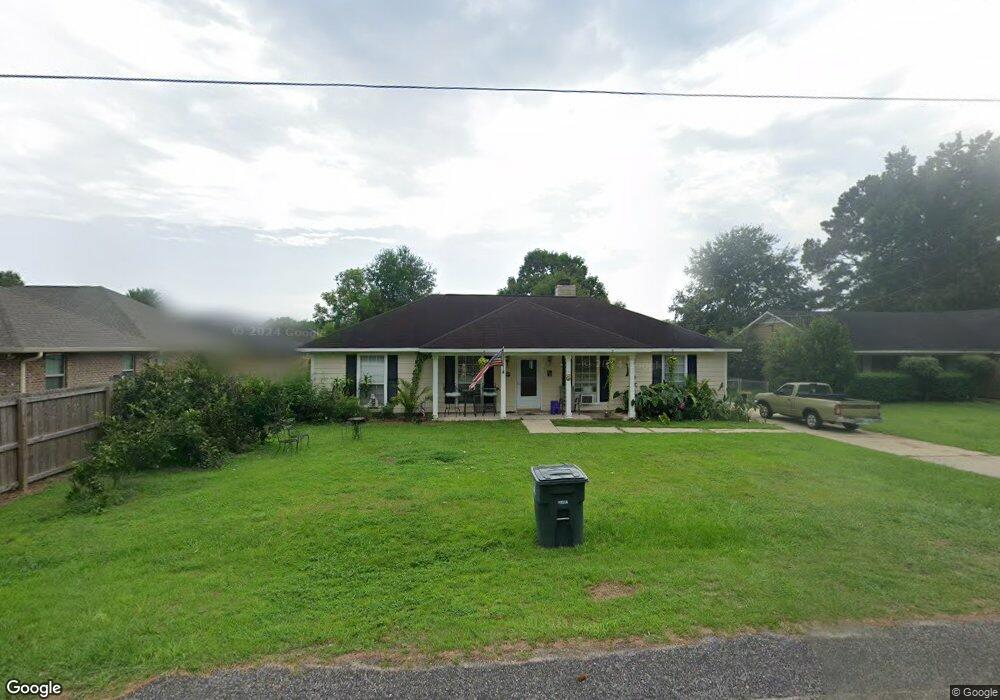
This home is located at 412 E Lawson Ave Unit 1, Foley, AL 36535 and is currently estimated at $255,971, approximately $154 per square foot. 412 E Lawson Ave Unit 1 is a home located in Baldwin County with nearby schools including Florence Mathis Elementary School, Foley Middle School, and Foley High School.
Ownership History
Date
Name
Owned For
Owner Type
Purchase Details
Closed on
Sep 16, 2011
Sold by
Regions Bank
Bought by
Kirchharr Johnie T and Kirchharr Janie E
Current Estimated Value
Home Financials for this Owner
Home Financials are based on the most recent Mortgage that was taken out on this home.
Original Mortgage
$68,124
Interest Rate
3.87%
Mortgage Type
FHA
Purchase Details
Closed on
May 27, 2011
Sold by
Federal Home Loan Mortgage Corporation
Bought by
Regions Bank
Create a Home Valuation Report for This Property
The Home Valuation Report is an in-depth analysis detailing your home's value as well as a comparison with similar homes in the area
Home Values in the Area
Average Home Value in this Area
Purchase History
| Date | Buyer | Sale Price | Title Company |
|---|---|---|---|
| Kirchharr Johnie T | $69,900 | None Available | |
| Regions Bank | -- | None Available |
Source: Public Records
Mortgage History
| Date | Status | Borrower | Loan Amount |
|---|---|---|---|
| Previous Owner | Kirchharr Johnie T | $68,124 |
Source: Public Records
Tax History
| Year | Tax Paid | Tax Assessment Tax Assessment Total Assessment is a certain percentage of the fair market value that is determined by local assessors to be the total taxable value of land and additions on the property. | Land | Improvement |
|---|---|---|---|---|
| 2024 | -- | $18,160 | $3,900 | $14,260 |
| 2023 | $0 | $18,640 | $4,600 | $14,040 |
| 2022 | $0 | $15,880 | $0 | $0 |
| 2021 | $349 | $13,880 | $0 | $0 |
| 2020 | $308 | $12,340 | $0 | $0 |
| 2019 | $300 | $12,040 | $0 | $0 |
| 2018 | $355 | $10,760 | $0 | $0 |
| 2017 | $680 | $20,620 | $0 | $0 |
| 2016 | $623 | $18,880 | $0 | $0 |
| 2015 | $619 | $18,760 | $0 | $0 |
| 2014 | $562 | $17,020 | $0 | $0 |
| 2013 | -- | $16,320 | $0 | $0 |
Source: Public Records
Map
Nearby Homes
- 0 S Poplar St Unit 340047
- 1510 S Juniper St
- 1432 Plymouth Dr
- 1096 Pheasant Cir
- 1093 Pheasant Cir
- 627 Mayflower Dr
- 628 Mayflower Dr
- 639 Mayflower Dr
- 1709 Grouse St
- 1123 Pheasant Cir
- 645 Beignet Dr
- 644 Mayflower Dr
- 637 Revere St
- 7747 Sable Dr
- 17910 Hens Ave
- 7785 Courant Cir
- 7589 Courant Cir
- 652 Mayflower Dr
- 1867 Arcadia Dr
- 0- 4A Highway 59 Unit A & B
- 410 E East Lawson Ave
- 410 E Lawson Ave
- 1705 Firefly Ln
- 1701 Firefly Ln
- 1709 Firefly Ln
- 0 Canterberry Cir
- 3 Windgate Ct
- 408 E Lawson Ave
- 0 S Poplar St Unit 181914
- 0 S Poplar St Unit 181901
- 0 S Poplar St Unit 185948
- 0 S Poplar St Unit 239122
- 0 S Poplar St Unit 339282
- 0 S Poplar St Unit 238004
- 0 S Poplar St Unit 304267
- 0 S Poplar St Unit 289556
- 0 S Poplar St Unit 289237
- 0 S Poplar St Unit 280907
- 0 S Poplar St Unit 280906
- 1713 Firefly Ln
Your Personal Tour Guide
Ask me questions while you tour the home.