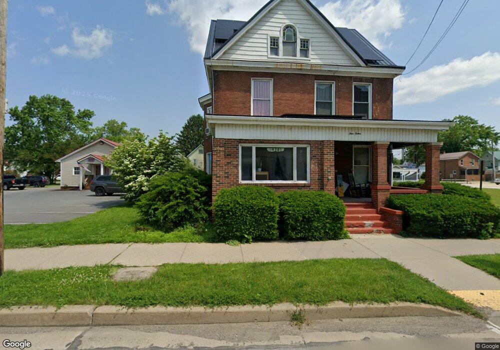
412 E Mahoning St Punxsutawney, PA 15767
Estimated Value: $113,148 - $150,000
--
Bed
--
Bath
1,100
Sq Ft
$121/Sq Ft
Est. Value
About This Home
This home is located at 412 E Mahoning St, Punxsutawney, PA 15767 and is currently estimated at $133,287, approximately $121 per square foot. 412 E Mahoning St is a home located in Jefferson County with nearby schools including Punxsutawney Area High School, Punxsutawney Christian School, and Sunset View Amish School.
Ownership History
Date
Name
Owned For
Owner Type
Purchase Details
Closed on
Oct 29, 2019
Sold by
Finley Nancy A
Bought by
Brooks Jade M
Current Estimated Value
Home Financials for this Owner
Home Financials are based on the most recent Mortgage that was taken out on this home.
Original Mortgage
$83,075
Outstanding Balance
$73,230
Interest Rate
3.7%
Mortgage Type
New Conventional
Estimated Equity
$60,057
Purchase Details
Closed on
Jul 7, 2006
Sold by
Winter H Buhl
Bought by
Finley Nancy A
Create a Home Valuation Report for This Property
The Home Valuation Report is an in-depth analysis detailing your home's value as well as a comparison with similar homes in the area
Home Values in the Area
Average Home Value in this Area
Purchase History
| Date | Buyer | Sale Price | Title Company |
|---|---|---|---|
| Brooks Jade M | $83,500 | Colonial Title Llc | |
| Finley Nancy A | $55,000 | None Available |
Source: Public Records
Mortgage History
| Date | Status | Borrower | Loan Amount |
|---|---|---|---|
| Open | Brooks Jade M | $83,075 |
Source: Public Records
Tax History Compared to Growth
Tax History
| Year | Tax Paid | Tax Assessment Tax Assessment Total Assessment is a certain percentage of the fair market value that is determined by local assessors to be the total taxable value of land and additions on the property. | Land | Improvement |
|---|---|---|---|---|
| 2025 | $1,644 | $29,760 | $4,770 | $24,990 |
| 2024 | $1,616 | $29,760 | $4,770 | $24,990 |
| 2023 | $1,584 | $29,760 | $4,770 | $24,990 |
| 2022 | $1,589 | $29,760 | $4,770 | $24,990 |
| 2021 | $1,587 | $29,760 | $4,770 | $24,990 |
| 2020 | $1,591 | $29,760 | $4,770 | $24,990 |
| 2019 | $1,558 | $29,760 | $4,770 | $24,990 |
| 2018 | $1,534 | $29,760 | $4,770 | $24,990 |
| 2017 | $1,530 | $29,760 | $4,770 | $24,990 |
| 2016 | $1,519 | $29,760 | $4,770 | $24,990 |
| 2015 | -- | $29,760 | $4,770 | $24,990 |
| 2012 | -- | $29,760 | $4,770 | $24,990 |
Source: Public Records
Map
Nearby Homes
- 501 E Mahoning St
- 321 E Union St
- 116 Clark St
- 231 Lane Ave
- 402 S Penn St
- 501 Woodland Ave
- 313 Greenwood Ave
- 409 Greenwood Ave
- 114 Ellsmore Ave
- 308 W Mahoning St
- 113 Church St
- 512 Woodland Ave
- 600 Rockland Ave
- 125 Hall St
- 409 &411 W Mahoning St
- 5 Starlite Ln
- 399 Harmony Rd
- 607 Sutton St
- 116 & 116 1/2 Clark St
- 000 G and Rd S
- 410 E Mahoning St
- 203 Dunlap Ave
- 203 Dunlap Ave
- 22 Ivy Ln
- 00 Kelsey Rd
- 000 Bair Rd
- 000 Martha St
- 106 Dunlap Ave
- 104 Dunlap Ave
- 12 Ivy Ln
- 110 Dunlap Ave Unit 110 1/2
- 108 Dunlap Ave Unit 108 1/2
- 108 1/2 Dunlap Ave Unit 110 1/2
- 422 E Mahoning St
- 404 E Mahoning St Unit 404 1/2
- 104 Independent Ave
- 101 Independent Ave
- 101 Independent Ave
- 424 E Mahoning St
- 208 Dunlap Ave