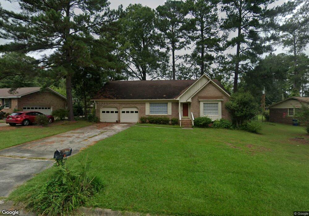
412 Flint St Columbia, SC 29212
Seven Oaks NeighborhoodEstimated Value: $223,000 - $262,000
3
Beds
2
Baths
1,847
Sq Ft
$134/Sq Ft
Est. Value
About This Home
This home is located at 412 Flint St, Columbia, SC 29212 and is currently estimated at $248,331, approximately $134 per square foot. 412 Flint St is a home located in Lexington County with nearby schools including Leaphart Elementary School, Irmo Middle, and Irmo High.
Ownership History
Date
Name
Owned For
Owner Type
Purchase Details
Closed on
Aug 3, 2023
Sold by
Bennett Pamela S
Bought by
Nagel Samuel Eduardo and Spann Kayla Adia
Current Estimated Value
Home Financials for this Owner
Home Financials are based on the most recent Mortgage that was taken out on this home.
Original Mortgage
$232,608
Outstanding Balance
$227,168
Interest Rate
6.67%
Mortgage Type
FHA
Estimated Equity
$21,163
Purchase Details
Closed on
May 16, 2014
Sold by
Lowe Rosalind Robertson and Youmans Lisa Robertson
Bought by
Bennett Pamela S
Create a Home Valuation Report for This Property
The Home Valuation Report is an in-depth analysis detailing your home's value as well as a comparison with similar homes in the area
Home Values in the Area
Average Home Value in this Area
Purchase History
| Date | Buyer | Sale Price | Title Company |
|---|---|---|---|
| Nagel Samuel Eduardo | $236,900 | None Listed On Document | |
| Bennett Pamela S | $80,000 | -- | |
| Lowe Rosalind Robertson | -- | -- | |
| Dekle Barbara R | -- | -- |
Source: Public Records
Mortgage History
| Date | Status | Borrower | Loan Amount |
|---|---|---|---|
| Open | Nagel Samuel Eduardo | $232,608 |
Source: Public Records
Tax History Compared to Growth
Tax History
| Year | Tax Paid | Tax Assessment Tax Assessment Total Assessment is a certain percentage of the fair market value that is determined by local assessors to be the total taxable value of land and additions on the property. | Land | Improvement |
|---|---|---|---|---|
| 2024 | $6,160 | $14,214 | $1,800 | $12,414 |
| 2023 | $6,160 | $5,472 | $1,179 | $4,293 |
| 2022 | $470 | $5,472 | $1,179 | $4,293 |
| 2020 | $494 | $5,472 | $1,179 | $4,293 |
| 2019 | $388 | $4,759 | $720 | $4,039 |
| 2018 | $334 | $4,759 | $720 | $4,039 |
| 2017 | $321 | $4,759 | $720 | $4,039 |
| 2016 | $339 | $4,758 | $720 | $4,038 |
| 2014 | $2,833 | $7,205 | $1,339 | $5,866 |
| 2013 | -- | $4,800 | $890 | $3,910 |
Source: Public Records
Map
Nearby Homes
- 806 Lockner Rd
- 700 Lockner Rd
- 513 Pitney Rd
- 113 Lyndhurst Rd
- 319 Valcour Rd
- 213 Lyndhurst Rd
- 105 Garmony Cir
- 203 Broken Hill Rd
- 183 Jefferson Place
- 217 Hunters Blind Dr
- 224 Stirlington Rd
- 340 Avery Place Dr
- 5802 Mcmillan Cir
- 401 Quail Trace Dr
- 5227 Bush River Rd
- 1112 Baffin Bay Rd
- 154 N Beaver Dam Rd
- 612 Lewisham Rd
- 324 Hunters Blind Dr
- 5839 Corley St