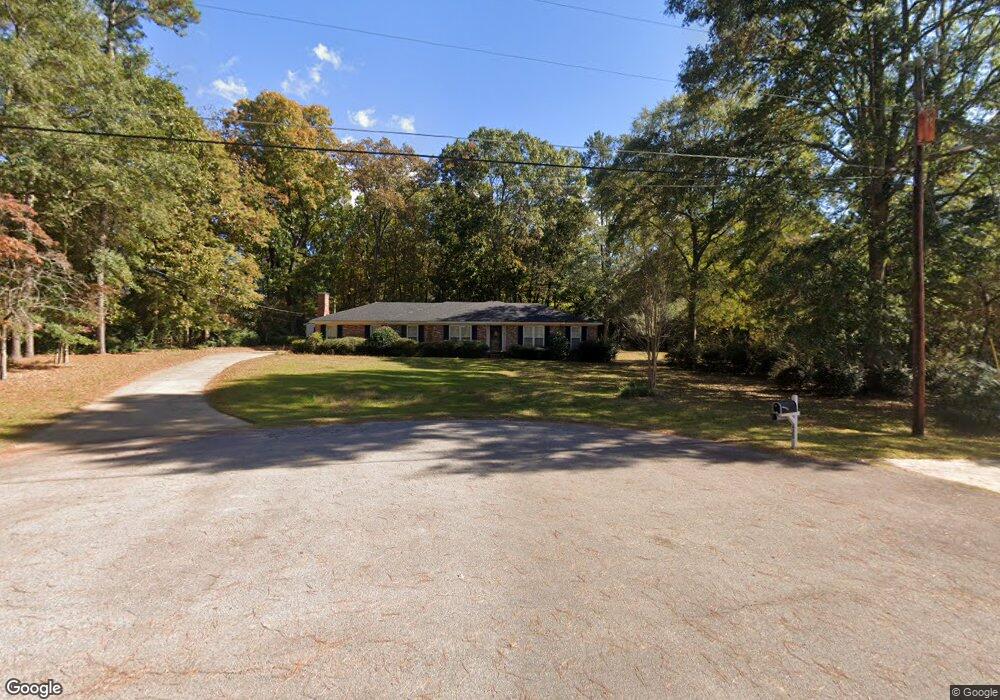
412 Ginger Cir Lagrange, GA 30240
Estimated Value: $277,785 - $310,000
3
Beds
3
Baths
2,867
Sq Ft
$103/Sq Ft
Est. Value
About This Home
This home is located at 412 Ginger Cir, Lagrange, GA 30240 and is currently estimated at $294,946, approximately $102 per square foot. 412 Ginger Cir is a home located in Troup County with nearby schools including Berta Weathersbee Elementary School, Long Cane Elementary School, and Whitesville Road Elementary School.
Ownership History
Date
Name
Owned For
Owner Type
Purchase Details
Closed on
Apr 4, 2025
Sold by
Norton Ashley Meghan
Bought by
Shealy Charles Braden
Current Estimated Value
Home Financials for this Owner
Home Financials are based on the most recent Mortgage that was taken out on this home.
Original Mortgage
$272,964
Outstanding Balance
$271,002
Interest Rate
6.63%
Mortgage Type
New Conventional
Estimated Equity
$23,944
Purchase Details
Closed on
Mar 29, 2021
Sold by
Hayes Donald E
Bought by
Norton Colby Jake and Norton Ashley Meghan
Home Financials for this Owner
Home Financials are based on the most recent Mortgage that was taken out on this home.
Original Mortgage
$172,800
Interest Rate
2.9%
Mortgage Type
New Conventional
Purchase Details
Closed on
Oct 1, 1970
Sold by
Knight & Knight Const
Bought by
Hayes Donald E and Hayes Freddie B
Create a Home Valuation Report for This Property
The Home Valuation Report is an in-depth analysis detailing your home's value as well as a comparison with similar homes in the area
Purchase History
| Date | Buyer | Sale Price | Title Company |
|---|---|---|---|
| Shealy Charles Braden | $278,000 | -- | |
| Norton Colby Jake | $216,000 | -- | |
| Hayes Donald E | -- | -- |
Source: Public Records
Mortgage History
| Date | Status | Borrower | Loan Amount |
|---|---|---|---|
| Open | Shealy Charles Braden | $272,964 | |
| Previous Owner | Norton Colby Jake | $172,800 |
Source: Public Records
Tax History
| Year | Tax Paid | Tax Assessment Tax Assessment Total Assessment is a certain percentage of the fair market value that is determined by local assessors to be the total taxable value of land and additions on the property. | Land | Improvement |
|---|---|---|---|---|
| 2025 | $3,081 | $112,976 | $10,000 | $102,976 |
| 2024 | $2,471 | $90,616 | $10,000 | $80,616 |
| 2023 | $2,382 | $87,336 | $8,000 | $79,336 |
| 2022 | $2,301 | $82,456 | $8,000 | $74,456 |
| 2021 | $2,080 | $78,912 | $8,000 | $70,912 |
| 2020 | $1,841 | $70,992 | $8,000 | $62,992 |
| 2019 | $1,254 | $51,512 | $4,200 | $47,312 |
| 2018 | $1,120 | $47,084 | $4,200 | $42,884 |
| 2017 | $1,120 | $47,084 | $4,200 | $42,884 |
| 2016 | $1,080 | $45,738 | $4,200 | $41,538 |
| 2015 | $1,084 | $45,738 | $4,200 | $41,538 |
| 2014 | $1,019 | $43,558 | $4,200 | $39,358 |
| 2013 | -- | $46,234 | $4,200 | $42,034 |
Source: Public Records
Map
Nearby Homes
- 402 Ginger Cir
- 427 Fling Rd
- 8 Horace Carter Rd
- 245 Teaver Rd
- 53 Horace Carter Rd
- 808 S Fling Rd
- 0 Bradfield Dr Unit 10568803
- 98 Hearn Rd
- 112 Foxdale Dr
- 2239 Pegasus Pkwy
- 288 Bradfield Dr
- 0 Glass Bridge Rd Unit 10679358
- 210 Pinehaven Dr
- 112 Brookwood Dr
- 117 Brookwood Dr
- 3 Reed Dr
- 104 Spring Valley Dr
- 129 Angela East Dr
- 4.5 ACRES Whatley Rd N
- 0 Deming St Unit 10550189
Your Personal Tour Guide
Ask me questions while you tour the home.