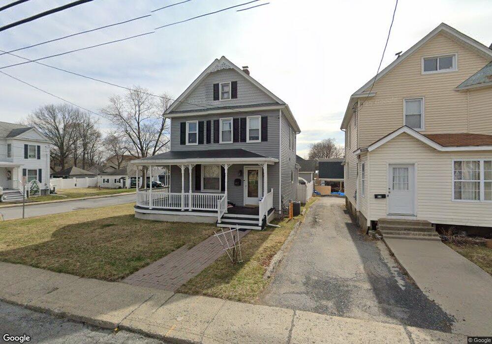
412 Homestead Ave Maybrook, NY 12543
Estimated Value: $309,000 - $357,000
3
Beds
2
Baths
1,398
Sq Ft
$236/Sq Ft
Est. Value
About This Home
This home is located at 412 Homestead Ave, Maybrook, NY 12543 and is currently estimated at $330,313, approximately $236 per square foot. 412 Homestead Ave is a home located in Orange County with nearby schools including Valley Central High School and Montgomery Montessori School.
Ownership History
Date
Name
Owned For
Owner Type
Purchase Details
Closed on
Jul 15, 2002
Sold by
Balacich Mario
Bought by
Brahm Paul D and Brahm Kelly J
Current Estimated Value
Home Financials for this Owner
Home Financials are based on the most recent Mortgage that was taken out on this home.
Original Mortgage
$136,655
Outstanding Balance
$58,013
Interest Rate
6.73%
Estimated Equity
$272,300
Create a Home Valuation Report for This Property
The Home Valuation Report is an in-depth analysis detailing your home's value as well as a comparison with similar homes in the area
Home Values in the Area
Average Home Value in this Area
Purchase History
| Date | Buyer | Sale Price | Title Company |
|---|---|---|---|
| Brahm Paul D | $138,800 | -- |
Source: Public Records
Mortgage History
| Date | Status | Borrower | Loan Amount |
|---|---|---|---|
| Open | Brahm Paul D | $136,655 |
Source: Public Records
Tax History Compared to Growth
Tax History
| Year | Tax Paid | Tax Assessment Tax Assessment Total Assessment is a certain percentage of the fair market value that is determined by local assessors to be the total taxable value of land and additions on the property. | Land | Improvement |
|---|---|---|---|---|
| 2024 | $6,712 | $100,300 | $21,100 | $79,200 |
| 2023 | $6,712 | $100,300 | $21,100 | $79,200 |
| 2022 | $6,657 | $100,300 | $21,100 | $79,200 |
| 2021 | $6,571 | $100,300 | $21,100 | $79,200 |
| 2020 | $5,773 | $100,300 | $21,100 | $79,200 |
| 2019 | $5,376 | $100,300 | $21,100 | $79,200 |
| 2018 | $5,376 | $100,300 | $21,100 | $79,200 |
| 2017 | $5,171 | $100,300 | $21,100 | $79,200 |
| 2016 | $5,051 | $100,300 | $21,100 | $79,200 |
| 2015 | -- | $100,300 | $21,100 | $79,200 |
| 2014 | -- | $100,300 | $21,100 | $79,200 |
Source: Public Records
Map
Nearby Homes
- 311 Tower Ave
- 807 Abbey Ave
- 812 Tower Ave
- 119 Clark Place
- 108 Homestead Ave
- 101 Homestead Ave
- 0 Homestead Ave Unit ONEH6328393
- 109 Indian Trail
- 111 Indian Trail
- 204 Chrystal Dr
- 217 Blake Rd
- 0 Neelytown Rd Unit KEYH6313123
- 108 Chrystal Dr
- 202 Blake Rd
- 4 Palmer Ct
- 16 Palmer Ct
- 205 Everett Place
- 3 Ted Miller Dr
- 2323 State Route 207
- 38 Jones Ln
- 410 Homestead Ave
- 502 Homestead Ave
- 408 Homestead Ave
- 504 Homestead Ave
- 406 Homestead Ave
- 413 Tower Ave
- 413 Tower Ave Unit 1
- 413 Tower Ave Unit 2
- 501 Tower Ave
- 506 Homestead Ave
- 404 Homestead Ave
- 407 Homestead Ave
- 411 Homestead Ave
- 405 Tower Ave
- 503 Tower Ave
- 405 Homestead Ave
- 508 Homestead Ave
- 402 Homestead Ave
- 511 Tower Ave
- 414 Tower Ave