Estimated Value: $407,216 - $434,000
4
Beds
3
Baths
2,125
Sq Ft
$200/Sq Ft
Est. Value
About This Home
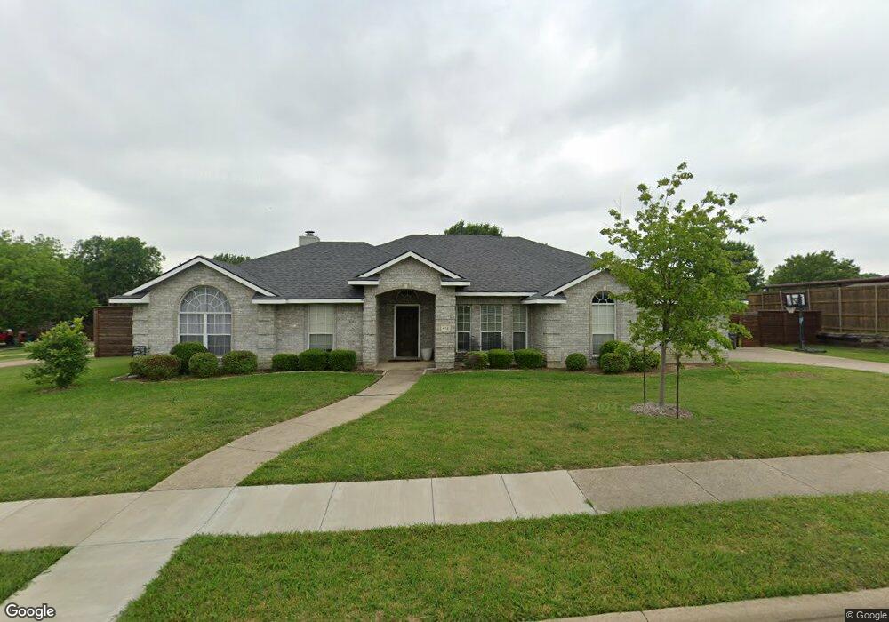
This home is located at 412 Lanwood, Wylie, TX 75098 and is currently estimated at $426,054, approximately $200 per square foot. 412 Lanwood is a home located in Collin County with nearby schools including P M Akin Elementary School, AB Harrison Intermediate School, and Grady Burnett J High School.
Ownership History
Date
Name
Owned For
Owner Type
Purchase Details
Closed on
Aug 7, 2015
Sold by
Garner Marion E and Garner Lee A
Bought by
Singleton Percy L and Singleton Kristian
Current Estimated Value
Home Financials for this Owner
Home Financials are based on the most recent Mortgage that was taken out on this home.
Original Mortgage
$183,658
Outstanding Balance
$143,656
Interest Rate
3.87%
Mortgage Type
FHA
Estimated Equity
$282,399
Purchase Details
Closed on
Nov 1, 1999
Sold by
D R Horton Texas Ltd
Bought by
Garner Lee A and Garner Marion E
Home Financials for this Owner
Home Financials are based on the most recent Mortgage that was taken out on this home.
Original Mortgage
$153,891
Interest Rate
7.83%
Mortgage Type
VA
Create a Home Valuation Report for This Property
The Home Valuation Report is an in-depth analysis detailing your home's value as well as a comparison with similar homes in the area
Home Values in the Area
Average Home Value in this Area
Purchase History
| Date | Buyer | Sale Price | Title Company |
|---|---|---|---|
| Singleton Percy L | -- | Lawyers Title | |
| Garner Lee A | -- | Drh Title |
Source: Public Records
Mortgage History
| Date | Status | Borrower | Loan Amount |
|---|---|---|---|
| Open | Singleton Percy L | $183,658 | |
| Previous Owner | Garner Lee A | $153,891 |
Source: Public Records
Tax History Compared to Growth
Tax History
| Year | Tax Paid | Tax Assessment Tax Assessment Total Assessment is a certain percentage of the fair market value that is determined by local assessors to be the total taxable value of land and additions on the property. | Land | Improvement |
|---|---|---|---|---|
| 2025 | $6,100 | $412,353 | $156,250 | $261,369 |
| 2024 | $6,100 | $374,866 | $156,250 | $238,750 |
| 2023 | $6,100 | $340,787 | $125,000 | $275,478 |
| 2022 | $6,797 | $309,806 | $125,000 | $303,319 |
| 2021 | $6,627 | $281,642 | $72,500 | $209,142 |
| 2020 | $6,906 | $278,135 | $72,500 | $205,635 |
| 2019 | $7,395 | $281,395 | $72,500 | $210,644 |
| 2018 | $6,889 | $255,814 | $72,500 | $191,665 |
| 2017 | $6,263 | $232,558 | $60,000 | $172,558 |
| 2016 | $6,328 | $227,744 | $60,000 | $167,744 |
| 2015 | $5,076 | $191,059 | $60,000 | $131,059 |
| 2014 | $5,076 | $178,998 | $0 | $0 |
Source: Public Records
Map
Nearby Homes
- 825 Forest Edge Ln
- 825 Foxwood Ln
- 820 Foxwood Ln
- 409 Cedar Ridge Dr
- 216 Cedar Ridge St
- 811 Forest Edge Ln
- 306 Foxwood Ct
- 1201 E Stone Rd
- 104 Rushcreek Dr
- 1209 Surrey Cir
- 416 Dogwood Dr
- 306 Woodhollow Ct
- 312 Maltese Cir
- 300 Woodhollow Ct
- 414 Briarwood Dr
- 1210 Iron Horse St
- 304 Hawthorn Dr
- 114 Liberty Dr
- 327 S 4th St
- 1056 Fairview Dr
- 408 Lanwood
- 918 Springwood Ln
- 918 Springwood Ln
- 919 Heatherwood Dr
- 914 Heatherwood Dr
- 913 Heatherwood Dr
- 910 Heatherwood Dr
- 404 Lanwood
- 920 Springwood Ln
- 909 Heatherwood Dr
- 921 Heatherwood Dr
- 922 Springwood Ln
- 400 Lanwood
- 906 Heatherwood Dr
- 403 Bentwood Dr
- 912 Foxwood Ln
- 923 Heatherwood Dr
- 905 Heatherwood Dr
- 920 Heatherwood Dr
- 924 Springwood Ln