
Seller's Agent in 2025
Michelle Otten
RE/MAX
(636) 259-6289
38 in this area
126 Total Sales

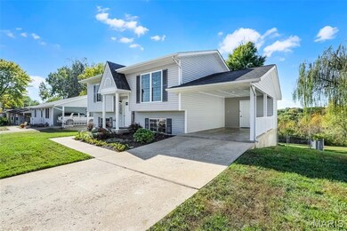
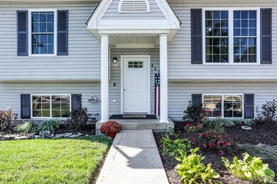
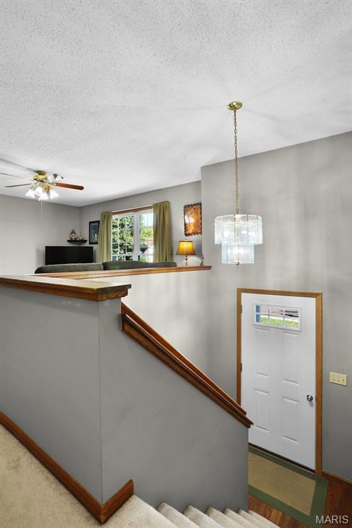
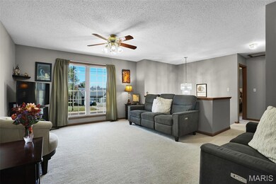
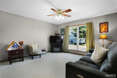
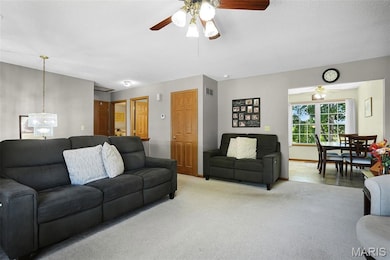
Move-in ready and full of updates! This well-maintained split foyer offers 4 bedrooms, 2 full baths, and a spacious, private fenced backyard that backs to trees, perfect for enjoying nature and watching deer throughout the year! The main floor features an eat-in kitchen with updated flooring and kitchen appliances that stay along with 2 bedrooms, and a full bath. The lower level adds even more living space with 2 additional bedrooms, a 2nd full bath, laundry room, and a cozy family/rec room that opens to a large patio and deck, ideal for entertaining. Recent updates include a brand-new roof, HVAC less than 10 years old, new front entry door, newer windows throughout, and a newer walk-out lower-level door. A 1-car carport and storage shed complete the package. Home qualifies for FHA, VA, and USDA financing. Seller is offering a One - Year Home Warranty Package through Choice Home Warranty. Agent owned.
Last Agent to Sell the Property
RE/MAX Today License #2003001340 Listed on: 10/31/2025
| Date | Type | Sale Price | Title Company |
|---|---|---|---|
| Warranty Deed | -- | None Listed On Document | |
| Interfamily Deed Transfer | -- | -- | |
| Special Warranty Deed | -- | None Available | |
| Foreclosure Deed | -- | None Available |
| Date | Status | Loan Amount | Loan Type |
|---|---|---|---|
| Open | $227,272 | New Conventional | |
| Previous Owner | $98,000 | New Conventional |
| Date | Event | Price | List to Sale | Price per Sq Ft |
|---|---|---|---|---|
| 12/12/2025 12/12/25 | Sold | -- | -- | -- |
| 10/31/2025 10/31/25 | For Sale | $219,900 | -- | $151 / Sq Ft |
| Year | Tax Paid | Tax Assessment Tax Assessment Total Assessment is a certain percentage of the fair market value that is determined by local assessors to be the total taxable value of land and additions on the property. | Land | Improvement |
|---|---|---|---|---|
| 2025 | $2,155 | $28,424 | $0 | $0 |
| 2024 | $2,155 | $21,746 | $0 | $0 |
| 2023 | $1,675 | $21,746 | $0 | $0 |
| 2022 | $1,720 | $23,594 | $0 | $0 |
| 2021 | $1,717 | $23,594 | $0 | $0 |
| 2020 | $1,532 | $21,149 | $0 | $0 |
| 2019 | $1,470 | $21,149 | $0 | $0 |
| 2018 | $1,419 | $19,527 | $0 | $0 |
| 2017 | $1,420 | $19,527 | $0 | $0 |
| 2016 | $1,395 | $19,247 | $0 | $0 |
| 2015 | $1,336 | $19,247 | $0 | $0 |
| 2014 | $1,360 | $19,612 | $0 | $0 |
Seller's Agent in 2025
Michelle Otten
RE/MAX
(636) 259-6289
38 in this area
126 Total Sales
Buyer's Agent in 2025
Matt McClelland
RE/MAX
(314) 922-7767
11 in this area
507 Total Sales
Source: MARIS MLS
MLS Number: MIS25070171
APN: 04-7-260-4-001-045300
Disclaimer: Certain information contained herein is derived from information provided by parties other than Homes.com. All information provided is deemed reliable, but is not guaranteed to be accurate and should be independently verified.
![]() Based on information submitted to the MLS GRID. All data is obtained from various sources and may not have been verified by broker or MLS GRID. Supplied Open House Information is subject to change without notice. All information should be independently reviewed and verified for accuracy. Properties may or may not be listed by the office/agent presenting the information. Some IDX listings have been excluded from this website.
Based on information submitted to the MLS GRID. All data is obtained from various sources and may not have been verified by broker or MLS GRID. Supplied Open House Information is subject to change without notice. All information should be independently reviewed and verified for accuracy. Properties may or may not be listed by the office/agent presenting the information. Some IDX listings have been excluded from this website.
Based on information submitted to the MLS GRID
Ask me questions while you tour the home.