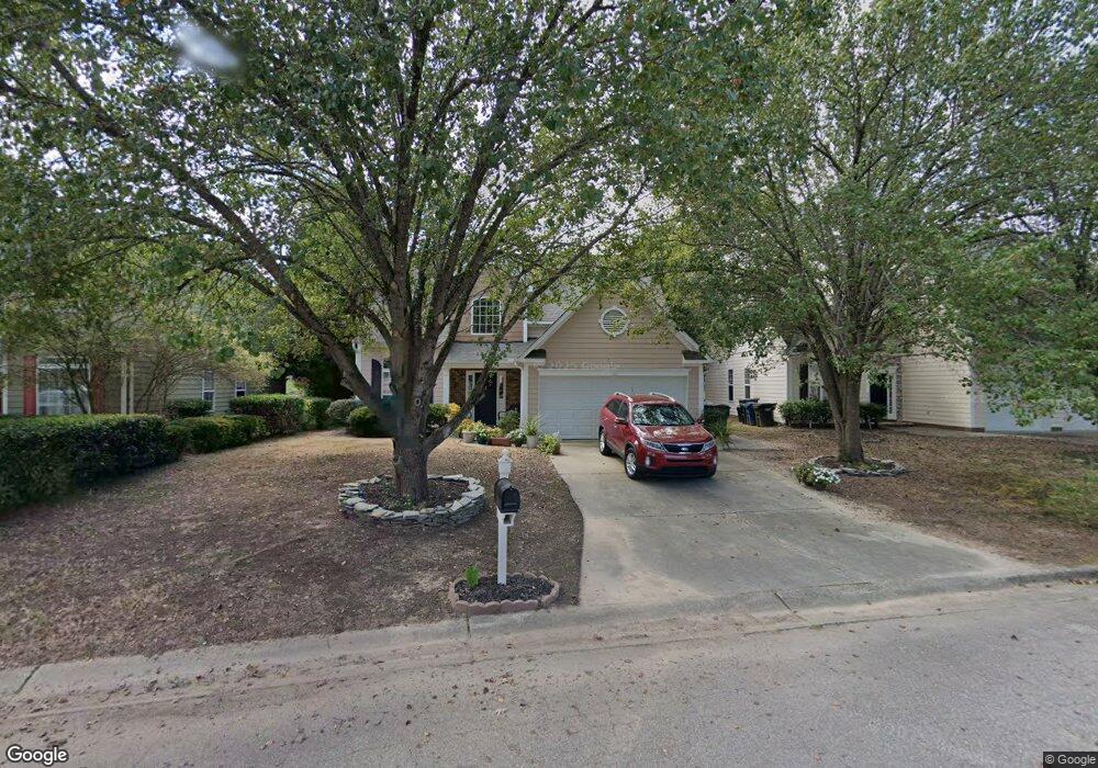
412 N Water's Edge Dr Durham, NC 27703
Eastern Durham NeighborhoodEstimated Value: $375,684 - $496,000
3
Beds
3
Baths
1,770
Sq Ft
$235/Sq Ft
Est. Value
About This Home
This home is located at 412 N Water's Edge Dr, Durham, NC 27703 and is currently estimated at $416,171, approximately $235 per square foot. 412 N Water's Edge Dr is a home located in Durham County with nearby schools including Oak Grove Elementary, John W Neal Middle School, and Southern School of Energy & Sustainability.
Ownership History
Date
Name
Owned For
Owner Type
Purchase Details
Closed on
Jan 28, 2005
Sold by
Abboud Akram and Abboud Stacey
Bought by
Charles Jean Luc
Current Estimated Value
Home Financials for this Owner
Home Financials are based on the most recent Mortgage that was taken out on this home.
Original Mortgage
$167,627
Outstanding Balance
$84,473
Interest Rate
5.62%
Mortgage Type
FHA
Estimated Equity
$331,698
Purchase Details
Closed on
Feb 28, 2001
Sold by
Janish Ronald C
Bought by
Abboud Akram
Home Financials for this Owner
Home Financials are based on the most recent Mortgage that was taken out on this home.
Original Mortgage
$156,257
Interest Rate
7.06%
Mortgage Type
FHA
Create a Home Valuation Report for This Property
The Home Valuation Report is an in-depth analysis detailing your home's value as well as a comparison with similar homes in the area
Home Values in the Area
Average Home Value in this Area
Purchase History
| Date | Buyer | Sale Price | Title Company |
|---|---|---|---|
| Charles Jean Luc | $170,000 | -- | |
| Abboud Akram | $159,000 | -- |
Source: Public Records
Mortgage History
| Date | Status | Borrower | Loan Amount |
|---|---|---|---|
| Open | Charles Jean Luc | $167,627 | |
| Previous Owner | Abboud Akram | $156,257 |
Source: Public Records
Tax History Compared to Growth
Tax History
| Year | Tax Paid | Tax Assessment Tax Assessment Total Assessment is a certain percentage of the fair market value that is determined by local assessors to be the total taxable value of land and additions on the property. | Land | Improvement |
|---|---|---|---|---|
| 2025 | $3,590 | $362,151 | $59,668 | $302,483 |
| 2024 | $2,825 | $202,542 | $35,608 | $166,934 |
| 2023 | $2,653 | $202,542 | $35,608 | $166,934 |
| 2022 | $2,592 | $202,542 | $35,608 | $166,934 |
| 2021 | $2,580 | $202,542 | $35,608 | $166,934 |
| 2020 | $2,519 | $202,542 | $35,608 | $166,934 |
| 2019 | $2,519 | $202,542 | $35,608 | $166,934 |
| 2018 | $2,486 | $183,246 | $37,635 | $145,611 |
| 2017 | $2,441 | $181,257 | $37,635 | $143,622 |
| 2016 | $2,358 | $196,926 | $37,635 | $159,291 |
| 2015 | $2,411 | $174,158 | $38,566 | $135,592 |
| 2014 | $2,411 | $174,158 | $38,566 | $135,592 |
Source: Public Records
Map
Nearby Homes
- 503 Bellmeade Bay Dr
- 1 Kings Grant Ct
- 301 Sylvias Ct
- 615 Southshore Pkwy
- 715 Southshore Pkwy
- 128 Leacroft Way
- 537 Crossview Ln
- 208 Lick Creek Ln
- 16 Vestrial Ln
- 110 Kindlewood Dr
- 106 Newberry Ln
- 10 Autrey Mill Cir
- 506 Currin St
- 406 Robbins Rd
- 402 Robbins Rd
- 210 Stoney Creek Cir
- 416 Chivalry Dr
- 103 Bermuda Green Dr
- 519 Keith St
- 507 Chivalry Dr
- 412 N Waters Edge Dr
- 500 N Waters Edge Dr
- 408 N Waters Edge Dr
- WE464 Waters Edge Dr
- WE454 Waters Edge Dr
- WE456 Waters Edge Dr
- WE475 Waters Edge Dr
- WE459 N Waters Edge Dr
- WE517 Waters Edge Dr
- WE463 N Waters Edge Dr
- WE480 Waters Edge Dr
- WE466 N Waters Edge Dr
- WE481 Waters Edge Dr
- WE465 N Waters Edge
- 502 N Waters Edge Dr
- 406 N Waters Edge Dr
- 504 N Waters Edge Dr
- 501 N Water's Edge Dr
- 404 N Waters Edge Dr
- 318 Winward Pointe Dr