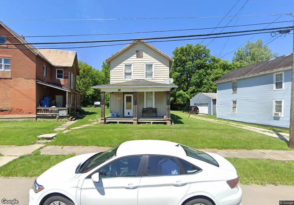
412 Norton Way Bucyrus, OH 44820
Estimated Value: $58,509 - $134,000
3
Beds
2
Baths
1,212
Sq Ft
$75/Sq Ft
Est. Value
About This Home
This home is located at 412 Norton Way, Bucyrus, OH 44820 and is currently estimated at $91,377, approximately $75 per square foot. 412 Norton Way is a home located in Crawford County with nearby schools including Bucyrus Elementary School, Bucyrus Secondary School, and Holy Trinity School.
Ownership History
Date
Name
Owned For
Owner Type
Purchase Details
Closed on
Oct 3, 2024
Sold by
Crum Michael A and Crum Matthew S
Bought by
Groves Roger D and Groves Robyn L
Current Estimated Value
Purchase Details
Closed on
Dec 15, 2010
Sold by
Perdue Gilbert C and Perdue Perdue
Bought by
Crum Michael A
Purchase Details
Closed on
Mar 11, 2002
Bought by
Perdue Gilbert C and Perdue Wayne H
Create a Home Valuation Report for This Property
The Home Valuation Report is an in-depth analysis detailing your home's value as well as a comparison with similar homes in the area
Home Values in the Area
Average Home Value in this Area
Purchase History
| Date | Buyer | Sale Price | Title Company |
|---|---|---|---|
| Groves Roger D | $30,000 | None Listed On Document | |
| Groves Roger D | $30,000 | None Listed On Document | |
| Crum Michael A | -- | None Available | |
| Scrum Matthew S | -- | None Available | |
| Perdue Gilbert C | -- | -- |
Source: Public Records
Tax History Compared to Growth
Tax History
| Year | Tax Paid | Tax Assessment Tax Assessment Total Assessment is a certain percentage of the fair market value that is determined by local assessors to be the total taxable value of land and additions on the property. | Land | Improvement |
|---|---|---|---|---|
| 2024 | $898 | $19,900 | $2,950 | $16,950 |
| 2023 | $898 | $8,980 | $2,570 | $6,410 |
| 2022 | $479 | $8,980 | $2,570 | $6,410 |
| 2021 | $478 | $8,980 | $2,570 | $6,410 |
| 2020 | $471 | $8,380 | $2,570 | $5,810 |
| 2019 | $481 | $8,380 | $2,570 | $5,810 |
| 2018 | $479 | $8,380 | $2,570 | $5,810 |
| 2017 | $545 | $9,200 | $2,570 | $6,630 |
| 2016 | $528 | $9,200 | $2,570 | $6,630 |
| 2015 | $521 | $9,200 | $2,570 | $6,630 |
| 2014 | $519 | $9,200 | $2,570 | $6,630 |
| 2013 | $519 | $9,200 | $2,570 | $6,630 |
Source: Public Records
Map
Nearby Homes
- 407 E Mansfield St
- 412 E Rensselaer St
- 520 E Warren St
- 444 Woodlawn Ave
- 319 Sheckler St
- 124 N Spring St
- 303 W Galen St
- 550 S Walnut St
- 316 W Warren St
- 346 Hopley Ave
- 317 S Spring St
- 511 Plymouth St
- 517 Plymouth St
- 531 S Poplar St
- 1220 E Warren St
- 711 Plymouth St
- 508 W Charles St
- 622 S Poplar St
- 325 W Liberty St
- 703 S Poplar St
- 408 Norton Way
- 416 Norton Way
- 422 Norton Way
- 400 Norton Way
- 436 Norton Way
- 200 N Lane St
- 440 Norton Way
- 406 E Mansfield St
- 400 E Mansfield St
- 436 Lincoln Hwy
- 412 Lincoln Hwy
- 488 Lincoln Hwy
- 494 Lincoln Hwy
- 314 E Mansfield St
- 312 E Mansfield St
- 000 Lincoln Hwy
- 108 N Lane St
- 304 N Lane St
- 310 E Mansfield St
- 215 N Lane St