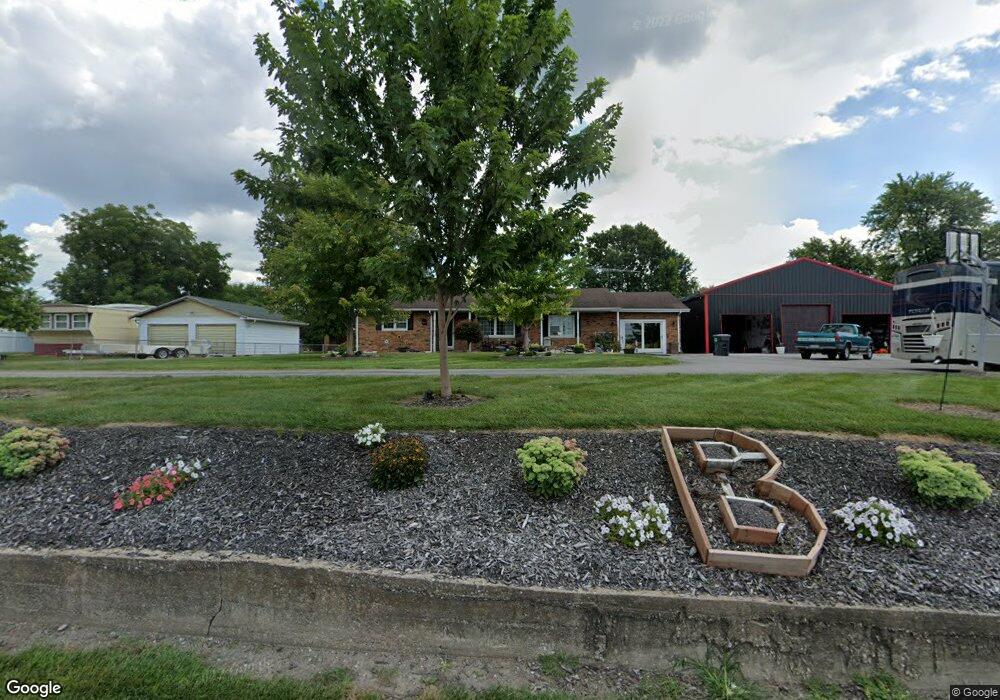
412 Old Rock Rd Granite City, IL 62040
Estimated Value: $167,000 - $298,000
3
Beds
3
Baths
1,700
Sq Ft
$137/Sq Ft
Est. Value
About This Home
This home is located at 412 Old Rock Rd, Granite City, IL 62040 and is currently estimated at $233,091, approximately $137 per square foot. 412 Old Rock Rd is a home located in Madison County with nearby schools including Granite City High School, St. Elizabeth Elementary School, and Metro East Montessori School.
Ownership History
Date
Name
Owned For
Owner Type
Purchase Details
Closed on
Mar 19, 2010
Sold by
Burgess William C and Burgess Barbara Ann
Bought by
Boyd Gary A
Current Estimated Value
Home Financials for this Owner
Home Financials are based on the most recent Mortgage that was taken out on this home.
Original Mortgage
$181,649
Outstanding Balance
$122,006
Interest Rate
5.25%
Mortgage Type
FHA
Estimated Equity
$111,085
Create a Home Valuation Report for This Property
The Home Valuation Report is an in-depth analysis detailing your home's value as well as a comparison with similar homes in the area
Home Values in the Area
Average Home Value in this Area
Purchase History
| Date | Buyer | Sale Price | Title Company |
|---|---|---|---|
| Boyd Gary A | $185,000 | Pontoon Title Co |
Source: Public Records
Mortgage History
| Date | Status | Borrower | Loan Amount |
|---|---|---|---|
| Open | Boyd Gary A | $181,649 |
Source: Public Records
Tax History Compared to Growth
Tax History
| Year | Tax Paid | Tax Assessment Tax Assessment Total Assessment is a certain percentage of the fair market value that is determined by local assessors to be the total taxable value of land and additions on the property. | Land | Improvement |
|---|---|---|---|---|
| 2024 | $2,356 | $44,670 | $2,970 | $41,700 |
| 2023 | $2,356 | $34,460 | $2,600 | $31,860 |
| 2022 | $1,871 | $30,470 | $2,300 | $28,170 |
| 2021 | $1,594 | $28,700 | $2,170 | $26,530 |
| 2020 | $1,556 | $28,070 | $2,120 | $25,950 |
| 2019 | $1,634 | $28,580 | $2,160 | $26,420 |
| 2018 | $1,742 | $33,590 | $2,530 | $31,060 |
| 2017 | $1,994 | $33,950 | $2,560 | $31,390 |
| 2016 | $2,175 | $33,950 | $2,560 | $31,390 |
| 2015 | $1,917 | $32,900 | $2,480 | $30,420 |
| 2014 | $1,917 | $32,900 | $2,480 | $30,420 |
| 2013 | $1,917 | $33,280 | $2,510 | $30,770 |
Source: Public Records
Map
Nearby Homes
- TBD Century Dr
- 2235 Dewey Ave
- 2345 Rock Rd
- 116 Wilson Park Ln
- 2207 Rock Rd
- 2202 Missouri Ave
- 2205 Ohio Ave
- 122 Wilson Park Ln
- 2909 Idaho Ave
- 2128 Dewey Ave
- 2560 Adams St
- 2544 Adams St
- 2823 Indiana Ave
- 2564 Benton St
- 2030 Illinois Ave
- 2301 Benton St
- 2263 Benton St
- 2830 Cayuga St
- 2306 Benton St
- 3132 Harvard Place
- 408 Old Rock Rd
- 404 Old Rock Rd
- 420 Old Rock Rd
- 428 Old Rock Rd
- 430 Old Rock Rd
- 432 Old Rock Rd
- 425 Old Rock Rd
- 423 Old Rock Rd
- 436 Old Rock Rd
- 440 Old Rock Rd
- 427 Old Rock Rd
- 444 Old Rock Rd
- 431 Old Rock Rd
- 448 Old Rock Rd
- 435 Old Rock Rd
- 501 Old Rock Rd
- 452 Old Rock Rd
- 503 Old Rock Rd
- 507 Old Rock Rd
- 511 Old Rock Rd