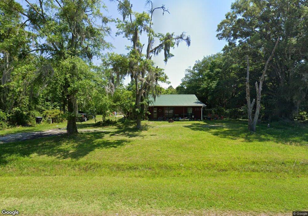
412 Pine Dr Woodbine, GA 31569
Estimated Value: $265,000 - $326,000
3
Beds
2
Baths
1,749
Sq Ft
$170/Sq Ft
Est. Value
About This Home
This home is located at 412 Pine Dr, Woodbine, GA 31569 and is currently estimated at $296,821, approximately $169 per square foot. 412 Pine Dr is a home located in Camden County with nearby schools including Mamie Lou Gross Elementary School, Saint Marys Middle School, and Camden County High School.
Ownership History
Date
Name
Owned For
Owner Type
Purchase Details
Closed on
Nov 10, 2020
Sold by
Riggs Earl H
Bought by
Riggs Earl Hale and Riggs Chantal
Current Estimated Value
Home Financials for this Owner
Home Financials are based on the most recent Mortgage that was taken out on this home.
Original Mortgage
$91,047
Outstanding Balance
$80,163
Interest Rate
2.8%
Mortgage Type
VA
Estimated Equity
$216,658
Purchase Details
Closed on
Mar 31, 2005
Sold by
Richards William M
Bought by
Riggs Earl H and Riggs Elizabeth Ann
Home Financials for this Owner
Home Financials are based on the most recent Mortgage that was taken out on this home.
Original Mortgage
$126,875
Interest Rate
5.74%
Mortgage Type
New Conventional
Create a Home Valuation Report for This Property
The Home Valuation Report is an in-depth analysis detailing your home's value as well as a comparison with similar homes in the area
Home Values in the Area
Average Home Value in this Area
Purchase History
| Date | Buyer | Sale Price | Title Company |
|---|---|---|---|
| Riggs Earl Hale | $89,000 | -- | |
| Riggs Earl Hale | $89,000 | -- | |
| Riggs Earl H | $125,000 | -- |
Source: Public Records
Mortgage History
| Date | Status | Borrower | Loan Amount |
|---|---|---|---|
| Open | Riggs Earl Hale | $91,047 | |
| Closed | Riggs Earl Hale | $91,047 | |
| Previous Owner | Riggs Earl H | $126,875 |
Source: Public Records
Tax History Compared to Growth
Tax History
| Year | Tax Paid | Tax Assessment Tax Assessment Total Assessment is a certain percentage of the fair market value that is determined by local assessors to be the total taxable value of land and additions on the property. | Land | Improvement |
|---|---|---|---|---|
| 2025 | $2,740 | $95,288 | $22,914 | $72,374 |
| 2024 | $2,863 | $95,288 | $22,914 | $72,374 |
| 2023 | $2,691 | $86,774 | $14,400 | $72,374 |
| 2022 | $2,235 | $73,203 | $14,400 | $58,803 |
| 2021 | $1,787 | $55,373 | $14,400 | $40,973 |
| 2020 | $2,023 | $60,960 | $24,396 | $36,564 |
| 2019 | $2,039 | $60,960 | $24,396 | $36,564 |
| 2018 | $1,832 | $60,960 | $24,396 | $36,564 |
| 2017 | $1,727 | $56,314 | $24,396 | $31,918 |
| 2016 | $1,657 | $54,126 | $24,396 | $29,730 |
| 2015 | $1,605 | $54,125 | $24,396 | $29,730 |
| 2014 | $1,598 | $54,125 | $24,396 | $29,730 |
Source: Public Records
Map
Nearby Homes
- VL/45 PINE DRIV Pine Dr
- 273 Village Dr
- 381 Serenity Farms Rd
- 220 Deerwood Village Dr
- 0 Sheffield Island Rd Unit 2
- 0 Sheffield Island Rd Unit 1657713
- 0 Sheffield Island Rd Unit 5 10597696
- 0 Sheffield Island Rd Unit 1657408
- 0 Sheffield Island Rd Unit 7
- 0 Sheffield Island Rd Unit 3
- 0 Sheffield Island Rd Unit 6 10613099
- 0 Sheffield Island Rd Unit 1656491
- 0 Sheffield Island Rd Unit 1656907
- 0 Sheffield Island Rd Unit 4 10593732
- 0 Sheffield Island Rd Unit 1657085
- 0 Sheffield Island Rd Unit 1656363
- 321 Mallard Pointe Dr
- 295 Mallard Pointe Dr
- 46 Pintail Ln
- 0 Simmons Bluff Rd Unit 10371213
- 381 Pine Dr
- 0 VL/44 Pine Dr
- 368 Pine Dr
- 411 Pine Dr
- 448 Pine Dr
- 477 Pine Dr
- 326 Pine Dr
- Lot 46 Pine St NE Unit Harriett Bluff Villa
- 508 Pine Dr
- 155 Pine Crossing
- 575 Pine Dr
- 256 Pine Dr
- 121 Pine Crossing St
- 121 Pine Crossing St
- 215 Pine Crossing St
- 327 Pine Dr
- 274 Village Dr
- 274 Village Dr
- 328 Pine Crossing St
- 229 Pine Dr