Estimated Value: $101,000 - $194,000
4
Beds
2
Baths
1,425
Sq Ft
$105/Sq Ft
Est. Value
About This Home
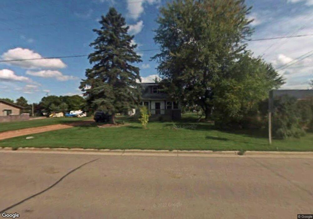
This home is located at 412 S Main St, Loyal, WI 54446 and is currently estimated at $149,206, approximately $104 per square foot. 412 S Main St is a home located in Clark County with nearby schools including Loyal Elementary School, Loyal Middle School, and Loyal High School.
Ownership History
Date
Name
Owned For
Owner Type
Purchase Details
Closed on
Feb 19, 2016
Sold by
Nelson Michael M
Bought by
Nelson Michael M
Current Estimated Value
Purchase Details
Closed on
Apr 8, 2009
Sold by
Deutsche Bank Nationsl Trust Company As
Bought by
Nelson Michael M
Purchase Details
Closed on
Mar 27, 2008
Sold by
Clark County Sheriff
Bought by
Deutsche Bank National Trust Company and Morgan Stanley Loan Trust 2006 He2
Create a Home Valuation Report for This Property
The Home Valuation Report is an in-depth analysis detailing your home's value as well as a comparison with similar homes in the area
Purchase History
| Date | Buyer | Sale Price | Title Company |
|---|---|---|---|
| Nelson Michael M | $56,000 | -- | |
| Nelson Michael M | $27,800 | Gowey Abstract And Title | |
| Deutsche Bank National Trust Company As | -- | Gowey Abstract And Title | |
| Deutsche Bank National Trust Company | -- | -- |
Source: Public Records
Tax History
| Year | Tax Paid | Tax Assessment Tax Assessment Total Assessment is a certain percentage of the fair market value that is determined by local assessors to be the total taxable value of land and additions on the property. | Land | Improvement |
|---|---|---|---|---|
| 2025 | $1,536 | $69,500 | $9,400 | $60,100 |
| 2024 | $1,583 | $69,500 | $9,400 | $60,100 |
| 2023 | $1,431 | $69,500 | $9,400 | $60,100 |
| 2022 | $1,312 | $69,500 | $9,400 | $60,100 |
| 2021 | $1,288 | $54,000 | $8,700 | $45,300 |
| 2020 | $1,416 | $54,000 | $8,700 | $45,300 |
| 2019 | $1,381 | $54,000 | $8,700 | $45,300 |
| 2018 | $1,404 | $54,000 | $8,700 | $45,300 |
| 2017 | $246 | $54,000 | $8,700 | $45,300 |
| 2016 | $1,362 | $58,900 | $10,300 | $48,600 |
| 2015 | -- | $58,900 | $10,300 | $48,600 |
| 2014 | -- | $58,400 | $10,300 | $48,100 |
| 2013 | -- | $58,400 | $10,300 | $48,100 |
| 2011 | -- | $58,400 | $10,300 | $48,100 |
Source: Public Records
Map
Nearby Homes
- 101 S West St
- 121 N West St
- 314 N Division St
- 0 Chickadee Rd Unit 22505635
- 506 E 1st St
- 609 E Schofield Ave
- N6479 County Road K
- 502 E Begley St
- 300 E Miller St
- 114 W School St
- 105 N Hendren Ave
- 214 W Hunt St
- N8296 River Ave
- W4768 Capital Rd
- W839 W Rosewood Dr Unit Lot 4
- W887 W Rosewood Dr Unit Lot 1
- N9126 Highway O
- Lot 4 and 5 Fairhaven Ave
- N10409 Hiline Ave
- N7066 County Road Y Unit Lot 2
- 413 S Main St
- 409 S Main St
- 403 S Main St
- 500 S Main St
- 410 S Main St
- 405 S Union St
- 502 S Main St
- 408 S Division St
- 404 S Division St
- 407 S Union St
- 403 S Union St
- 401 S Union St
- 503 S Union St
- 404 S Union St
- 316 S Main St
- 409 S Division St
- 402 S Union St
- 405 S Division St
- 406 S Union St
- 403 S Division St
Your Personal Tour Guide
Ask me questions while you tour the home.