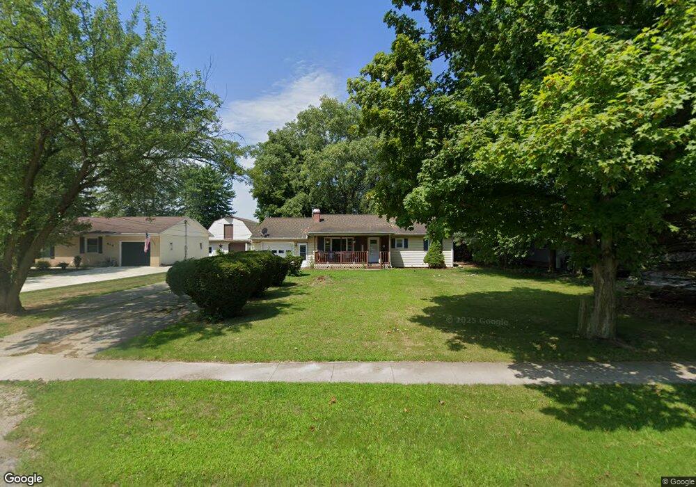
412 S Main St West Unity, OH 43570
Estimated Value: $114,000 - $157,000
3
Beds
1
Bath
1,120
Sq Ft
$117/Sq Ft
Est. Value
About This Home
This home is located at 412 S Main St, West Unity, OH 43570 and is currently estimated at $131,569, approximately $117 per square foot. 412 S Main St is a home located in Williams County with nearby schools including Hilltop Elementary School and Hilltop High School.
Ownership History
Date
Name
Owned For
Owner Type
Purchase Details
Closed on
Sep 2, 2017
Sold by
Tri Satae Property Inv Inc
Bought by
Lucas Chester Angela
Current Estimated Value
Purchase Details
Closed on
Jan 16, 2013
Sold by
Mccague Karen
Bought by
Tri State Property Investmetns Inc
Purchase Details
Closed on
Apr 9, 2003
Sold by
Mccague Karen
Bought by
Mccague C/O Tri State Property Investmen
Purchase Details
Closed on
Aug 3, 1999
Sold by
Smith Debra J
Bought by
Mccague Karen
Purchase Details
Closed on
May 20, 1996
Sold by
Stotz Deborah S
Bought by
Smith Debra J
Purchase Details
Closed on
Jan 1, 1990
Bought by
Stotz Deborah S
Create a Home Valuation Report for This Property
The Home Valuation Report is an in-depth analysis detailing your home's value as well as a comparison with similar homes in the area
Purchase History
| Date | Buyer | Sale Price | Title Company |
|---|---|---|---|
| Lucas Chester Angela | -- | None Available | |
| Tri State Property Investmetns Inc | $75,000 | None Available | |
| Mccague C/O Tri State Property Investmen | $75,000 | -- | |
| Mccague Karen | $74,500 | -- | |
| Smith Debra J | $62,000 | -- | |
| Stotz Deborah S | $34,100 | -- |
Source: Public Records
Tax History
| Year | Tax Paid | Tax Assessment Tax Assessment Total Assessment is a certain percentage of the fair market value that is determined by local assessors to be the total taxable value of land and additions on the property. | Land | Improvement |
|---|---|---|---|---|
| 2025 | $1,242 | $30,670 | $4,660 | $26,010 |
| 2024 | $1,242 | $30,670 | $4,660 | $26,010 |
| 2023 | $1,263 | $25,660 | $4,620 | $21,040 |
| 2022 | $1,256 | $25,660 | $4,620 | $21,040 |
| 2021 | $1,256 | $25,660 | $4,620 | $21,040 |
| 2020 | $1,133 | $22,340 | $4,030 | $18,310 |
| 2019 | $1,116 | $22,340 | $4,030 | $18,310 |
| 2018 | $564 | $22,340 | $4,030 | $18,310 |
| 2017 | $1,031 | $20,450 | $3,820 | $16,630 |
| 2016 | $982 | $20,450 | $3,820 | $16,630 |
| 2015 | $1,122 | $20,450 | $3,820 | $16,630 |
| 2014 | $1,122 | $21,530 | $4,030 | $17,500 |
| 2013 | $1,107 | $21,530 | $4,030 | $17,500 |
Source: Public Records
Map
Nearby Homes
- 000 W Jackson
- 611 W Jackson St
- 613 W Jackson St
- 402 N Liberty St
- 502 N Lincoln St
- 902 E Church St
- 11017 County Road 22
- 22227 Us Highway 20a
- 9019 19-50 Rd
- 8437 18 Rd
- 21184 20n Rd Unit Tract 1
- 21184 20n Rd Unit Tract 3
- 20-n Road Unit Tract 2
- 8520 County Road 16
- 8520 Williams County Road 16
- 301 Horton St
- 303 E Curtis St
- 200 Tyler Ln
- 302 Tyler Ln
- 14640 U S 20a
Your Personal Tour Guide
Ask me questions while you tour the home.