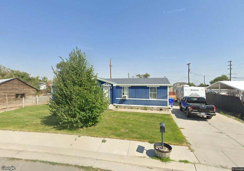
412 W Richard St Grantsville, UT 84029
Estimated Value: $166,000 - $356,000
4
Beds
2
Baths
1,404
Sq Ft
$186/Sq Ft
Est. Value
About This Home
This home is located at 412 W Richard St, Grantsville, UT 84029 and is currently estimated at $261,422, approximately $186 per square foot. 412 W Richard St is a home located in Tooele County with nearby schools including Grantsville Elementary School, Grantsville Junior High School, and Grantsville High School.
Ownership History
Date
Name
Owned For
Owner Type
Purchase Details
Closed on
Aug 10, 2016
Sold by
Everbank
Bought by
Blacker Dee Ray
Current Estimated Value
Purchase Details
Closed on
Dec 1, 2015
Sold by
Secretary Of Veterans Affairs
Bought by
Green Tree Servicing Llc
Purchase Details
Closed on
Jul 17, 2015
Sold by
Green Tree Servicing Llc
Bought by
The Secretary Of Veterans Affairs
Purchase Details
Closed on
Mar 25, 2015
Sold by
Knotts James L
Bought by
Everbank
Create a Home Valuation Report for This Property
The Home Valuation Report is an in-depth analysis detailing your home's value as well as a comparison with similar homes in the area
Home Values in the Area
Average Home Value in this Area
Purchase History
| Date | Buyer | Sale Price | Title Company |
|---|---|---|---|
| Blacker Dee Ray | -- | Servicelink Aliquippa | |
| Green Tree Servicing Llc | -- | Lsi Title Agency Inc | |
| The Secretary Of Veterans Affairs | -- | Lsi Title Agency Inc | |
| Everbank | $77,395 | Trustees Title & Escrow |
Source: Public Records
Tax History Compared to Growth
Tax History
| Year | Tax Paid | Tax Assessment Tax Assessment Total Assessment is a certain percentage of the fair market value that is determined by local assessors to be the total taxable value of land and additions on the property. | Land | Improvement |
|---|---|---|---|---|
| 2025 | $604 | $155,358 | $42,240 | $113,118 |
| 2024 | $604 | $98,616 | $42,240 | $56,376 |
| 2023 | $604 | $126,531 | $40,920 | $85,611 |
| 2022 | $1,239 | $113,996 | $43,428 | $70,568 |
| 2021 | $664 | $99,647 | $33,193 | $66,454 |
| 2020 | $703 | $185,666 | $60,350 | $125,316 |
| 2019 | $1,298 | $167,509 | $35,000 | $132,509 |
| 2018 | $1,126 | $136,930 | $35,000 | $101,930 |
| 2017 | $930 | $119,942 | $35,000 | $84,942 |
| 2016 | $894 | $61,721 | $19,250 | $42,471 |
| 2015 | $894 | $61,721 | $0 | $0 |
| 2014 | -- | $57,612 | $0 | $0 |
Source: Public Records
Map
Nearby Homes
- 407 W Richard St
- 600 W Clark St
- 500 W Clark St
- 49 Tiebreaker Cir
- 26 N Wayne Way
- 55 S Cooley St
- 537 W Apple St Unit 3
- 39 N Wayne Way
- 37 N Wayne Way
- 643 W Banner Dr
- 282 W Apple St
- Logan Plan at Springfield Estates
- Lily Plan at Springfield Estates
- Asher Plan at Springfield Estates
- Jordan Plan at Springfield Estates
- Kingston Craftsman Plan at Springfield Estates
- Brooklyn Plan at Springfield Estates
- McCade Modern Plan at Springfield Estates
- Sawyer Craftsman Plan at Springfield Estates
- Fisher Plan at Springfield Estates
- 406 W Richard St
- 418 W Richard St
- 417 W Richard St
- 415 W Clark St
- 98 N West St
- 421 W Clark St
- 427 W Richard St
- 429 W Clark St
- 430 W Richard St
- 87 N Blaine Ave
- 87 N Blaine Ave Unit 1
- 433 W Richard St
- 89 N Blaine Ave
- 431 W Clark St
- 442 W Richard St
- 412 W Clark St
- 443 W Richard St
- 422 W Clark St
- 402 W Clark St
- 81 N Blaine Ave