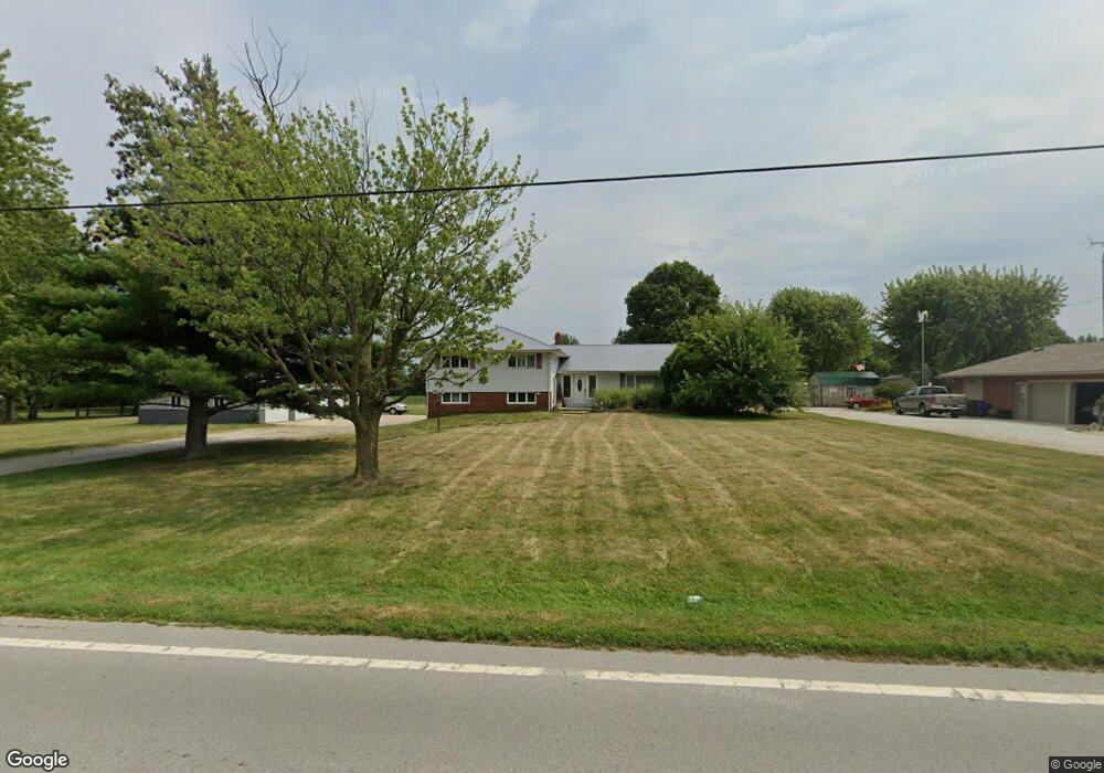
412 Wells Rd Forest, OH 45843
Estimated Value: $188,000 - $217,000
4
Beds
3
Baths
1,956
Sq Ft
$103/Sq Ft
Est. Value
About This Home
This home is located at 412 Wells Rd, Forest, OH 45843 and is currently estimated at $201,591, approximately $103 per square foot. 412 Wells Rd is a home located in Hardin County with nearby schools including Riverdale Middle School and Riverdale High School.
Ownership History
Date
Name
Owned For
Owner Type
Purchase Details
Closed on
Aug 25, 2016
Bought by
Kandi Lynn Clark
Current Estimated Value
Purchase Details
Closed on
Dec 31, 2013
Sold by
Brunkhart Charles A and Brunkhart Barbara J
Bought by
Clark Matthew D and Clark Kandi L
Home Financials for this Owner
Home Financials are based on the most recent Mortgage that was taken out on this home.
Original Mortgage
$93,575
Interest Rate
4.5%
Mortgage Type
New Conventional
Purchase Details
Closed on
Sep 4, 2009
Sold by
Morris Ryan Scott and Morris Ryan
Bought by
The Bank Of New York Mellion
Purchase Details
Closed on
May 17, 1993
Bought by
Morris Ryan Scott and Morris Bren
Create a Home Valuation Report for This Property
The Home Valuation Report is an in-depth analysis detailing your home's value as well as a comparison with similar homes in the area
Purchase History
| Date | Buyer | Sale Price | Title Company |
|---|---|---|---|
| Kandi Lynn Clark | -- | -- | |
| Clark Matthew D | $98,500 | Assured Title Agency Inc | |
| The Bank Of New York Mellion | $60,000 | None Available | |
| Morris Ryan Scott | $75,000 | -- |
Source: Public Records
Mortgage History
| Date | Status | Borrower | Loan Amount |
|---|---|---|---|
| Previous Owner | Clark Matthew D | $93,575 |
Source: Public Records
Tax History
| Year | Tax Paid | Tax Assessment Tax Assessment Total Assessment is a certain percentage of the fair market value that is determined by local assessors to be the total taxable value of land and additions on the property. | Land | Improvement |
|---|---|---|---|---|
| 2024 | $1,343 | $41,250 | $4,250 | $37,000 |
| 2023 | $1,345 | $41,250 | $4,250 | $37,000 |
| 2022 | $1,340 | $36,040 | $3,910 | $32,130 |
| 2021 | $1,453 | $36,040 | $3,910 | $32,130 |
| 2020 | $1,456 | $36,040 | $3,910 | $32,130 |
| 2019 | $1,177 | $29,670 | $3,720 | $25,950 |
| 2018 | $1,126 | $29,670 | $3,720 | $25,950 |
| 2017 | $1,211 | $29,670 | $3,720 | $25,950 |
| 2016 | $1,279 | $34,370 | $4,330 | $30,040 |
| 2015 | $919 | $25,970 | $4,330 | $21,640 |
| 2014 | $925 | $25,970 | $4,330 | $21,640 |
| 2013 | $470 | $25,970 | $4,330 | $21,640 |
Source: Public Records
Map
Nearby Homes
- 406 Wells Rd
- 317 Smith St
- 18660 County Road 20
- 402 E Lima St
- 0 S Davis St
- 412 S Patterson St
- 0 S Patterson St
- 11270 Township Road 79
- 0 Cr 215 Unit 11594771
- 0 Cr 215 Unit 25370311
- 0 Cr 215 Unit 11598074
- 3065 County Road 205
- 21426 County Road 17
- 15047 Ohio 37
- 15090 County Road 304
- 213 Sandusky St W
- 19507 County Highway 70
- 20453 Township Road 187
- 162 N Main St
- 5091 County Road 175
Your Personal Tour Guide
Ask me questions while you tour the home.