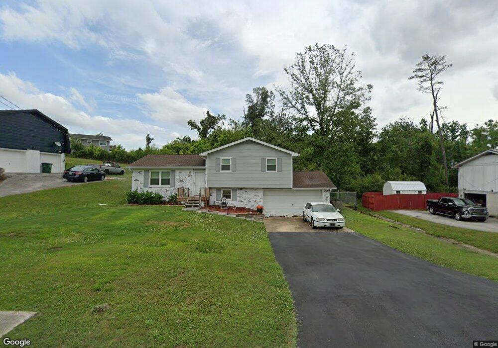
4120 Lost Oaks Dr Ooltewah, TN 37363
Estimated Value: $311,000 - $323,000
3
Beds
2
Baths
1,455
Sq Ft
$218/Sq Ft
Est. Value
About This Home
This home is located at 4120 Lost Oaks Dr, Ooltewah, TN 37363 and is currently estimated at $316,651, approximately $217 per square foot. 4120 Lost Oaks Dr is a home located in Hamilton County with nearby schools including Wolftever Creek Elementary School, Ooltewah Middle School, and Ooltewah High School.
Ownership History
Date
Name
Owned For
Owner Type
Purchase Details
Closed on
Dec 30, 2008
Sold by
Curtis Robert M and Curtis Debbie
Bought by
Curtis Robert M
Current Estimated Value
Home Financials for this Owner
Home Financials are based on the most recent Mortgage that was taken out on this home.
Original Mortgage
$129,527
Outstanding Balance
$81,532
Interest Rate
5.43%
Mortgage Type
FHA
Estimated Equity
$235,119
Purchase Details
Closed on
May 31, 2002
Sold by
Bond Charity A
Bought by
Curtis Robert M and Curtis Debbie
Home Financials for this Owner
Home Financials are based on the most recent Mortgage that was taken out on this home.
Original Mortgage
$111,469
Interest Rate
6.85%
Mortgage Type
FHA
Purchase Details
Closed on
May 26, 2000
Sold by
Coffelt Diana N and Coffelt Diana N
Bought by
Bond Donald K and Bond Charity A
Create a Home Valuation Report for This Property
The Home Valuation Report is an in-depth analysis detailing your home's value as well as a comparison with similar homes in the area
Home Values in the Area
Average Home Value in this Area
Purchase History
| Date | Buyer | Sale Price | Title Company |
|---|---|---|---|
| Curtis Robert M | -- | None Available | |
| Curtis Robert M | -- | None Available | |
| Curtis Robert M | $112,350 | -- | |
| Curtis Robert M | $112,350 | -- | |
| Bond Donald K | $88,000 | First Choice Title Inc | |
| Bond Donald K | $88,000 | First Choice Title Inc |
Source: Public Records
Mortgage History
| Date | Status | Borrower | Loan Amount |
|---|---|---|---|
| Open | Curtis Robert M | $129,527 | |
| Closed | Curtis Robert M | $111,469 |
Source: Public Records
Tax History
| Year | Tax Paid | Tax Assessment Tax Assessment Total Assessment is a certain percentage of the fair market value that is determined by local assessors to be the total taxable value of land and additions on the property. | Land | Improvement |
|---|---|---|---|---|
| 2025 | $999 | $65,925 | $0 | $0 |
| 2024 | $938 | $41,925 | $0 | $0 |
| 2023 | $947 | $41,925 | $0 | $0 |
| 2022 | $947 | $41,925 | $0 | $0 |
| 2021 | $947 | $41,925 | $0 | $0 |
| 2020 | $755 | $32,725 | $0 | $0 |
| 2019 | $914 | $32,725 | $0 | $0 |
| 2018 | $914 | $32,725 | $0 | $0 |
| 2017 | $914 | $32,725 | $0 | $0 |
| 2016 | $780 | $0 | $0 | $0 |
| 2015 | $780 | $27,875 | $0 | $0 |
| 2014 | $780 | $0 | $0 | $0 |
Source: Public Records
Map
Nearby Homes
- 4101 Shady Oak Dr
- 7930 Wilderness Way
- 7950 Chianti Way
- 8155 Burgundy Cir
- 3900 Brock Rd
- 4046 Brock Rd
- 4024 Smith Ln
- 8315 Harvest Oak Ln
- 2924 Old Britain Cir
- 4210 Pattentown Rd
- 8218 Bill Reed Rd
- 8016 Standifer Gap Rd
- 4608 Green Shanty Rd
- 8014 Bork Memorial Dr
- 2700 Autumn Chase Dr
- 4632 Pattentown Rd
- 7819 Stonehenge Dr
- 4728 Sussex Ln
- 8810 Great Family Trail
- 0 Bork Memorial Dr Unit RTC3015306
- 4120 Lost Oak Dr
- 4118 Lost Oak Dr
- 4118 Lost Oaks Dr
- 4122 Lost Oaks Dr
- 4122 Lost Oak Dr
- 4122 Lost Oaks Dr
- 4117 Lost Oaks Dr
- 4124 Lost Oak Dr
- 4124 Lost Oaks Dr Unit 2
- 4124 Lost Oaks Dr
- 4119 Lost Oaks Dr
- 4119 Lost Oak Dr
- 4117 Lost Oaks Dr
- 4117 Lost Oak Dr
- 4121 Lost Oaks Dr
- 4121 Lost Oak Dr
- 4119 Green Shanty Rd
- 4128 Lost Oaks Dr
- 4128 Lost Oak Dr
- 4113 Lost Oak Dr
Your Personal Tour Guide
Ask me questions while you tour the home.