4121 Blair Dr Springfield, IL 62712
Estimated Value: $300,114 - $330,000
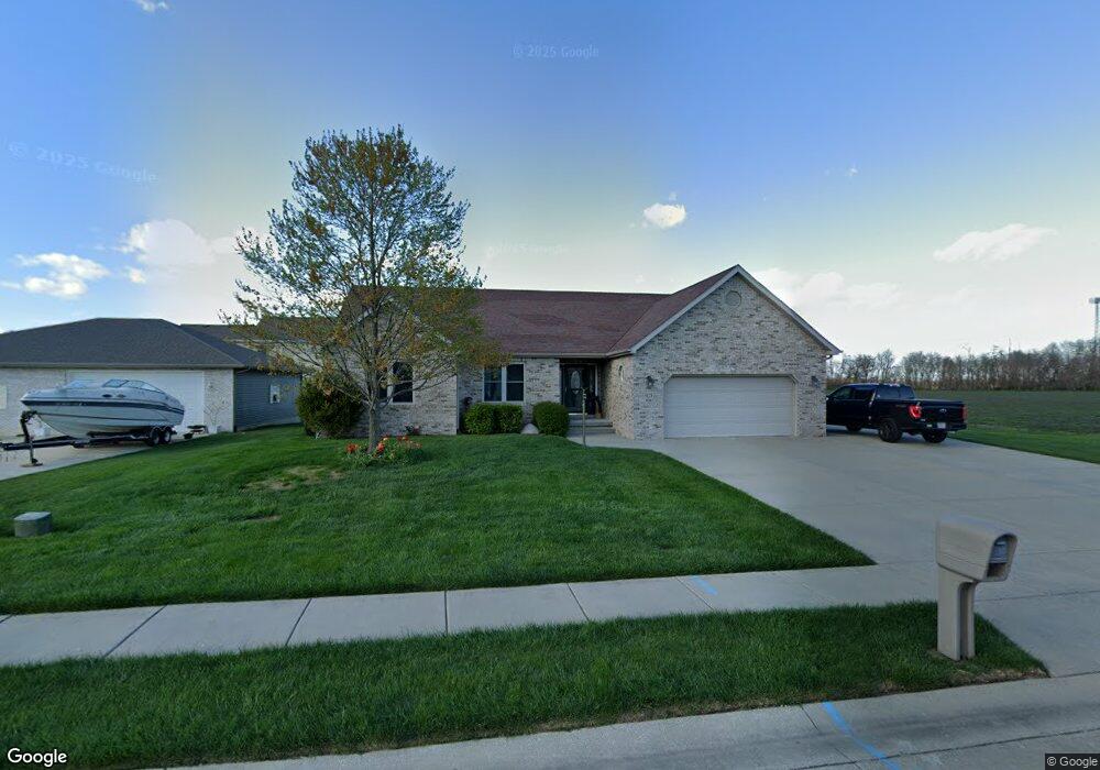
About This Home
This home is located at 4121 Blair Dr, Springfield, IL 62712 and is currently estimated at $317,529. 4121 Blair Dr is a home located in Sangamon County with nearby schools including Rochester Elementary Ec-1 School, Rochester Elementary School, and Rochester Intermediate School.
Ownership History
We collect this data history from publicly available records. To have your information removed, we recommend requesting removal directly through your county’s website.
Purchase Details
Purchase Details
Purchase Details
Purchase Details
Purchase Details
Purchase Details
Purchase Details
Purchase Details
Purchase History
We collect this data history from publicly available records. To have your information removed, we recommend requesting removal directly through your county’s website.
| Date | Buyer | Sale Price | Title Company |
|---|---|---|---|
| $37,500 | -- | ||
| -- | -- | ||
| -- | -- | ||
| -- | -- | ||
| $480,000 | -- | ||
| $1,950,000 | -- | ||
| $1,950,000 | -- | ||
| -- | -- |
Tax History
We collect this data history from publicly available records. To have your information removed, we recommend requesting removal directly through your county’s website.
| Year | Tax Paid | Tax Assessment Tax Assessment Total Assessment is a certain percentage of the fair market value that is determined by local assessors to be the total taxable value of land and additions on the property. | Land | Improvement |
|---|---|---|---|---|
| 2025 | $5,920 | $90,362 | $17,084 | $73,278 |
| 2024 | $5,577 | $84,278 | $15,934 | $68,344 |
| 2023 | $5,237 | $76,980 | $14,554 | $62,426 |
| 2022 | $4,995 | $72,593 | $13,806 | $58,787 |
| 2021 | $4,816 | $69,875 | $13,289 | $56,586 |
| 2020 | $4,787 | $69,980 | $13,309 | $56,671 |
| 2019 | $4,691 | $69,736 | $13,263 | $56,473 |
| 2018 | $4,439 | $65,693 | $13,198 | $52,495 |
| 2017 | $4,365 | $64,843 | $13,027 | $51,816 |
| 2016 | $4,304 | $63,897 | $12,837 | $51,060 |
| 2015 | $4,208 | $63,134 | $12,684 | $50,450 |
| 2014 | $4,191 | $62,726 | $12,602 | $50,124 |
| 2013 | $4,166 | $62,871 | $12,602 | $50,269 |
Map
- 2784 Hilltop Rd
- 3712 Viking Blvd
- 97 White Pine Dr
- 3712 Kerry Blvd
- 2632 Hilltop Rd
- 3806 Bristlecone Dr Unit 2
- 66 White Birch Rd
- 3501 Buckeye Dr
- 3603 Teakwood Dr
- 38 Maplehurst Dr
- 4502 Gaule Rd Unit 1
- 407 Burberry Ln
- 31 Penacook Dr
- 230 Twin Oaks Dr Unit 1
- 517 Heathrow Ln
- 4 Guinevere Dr Unit 1
- 35 Galahad Dr Unit 1
- 27 Mishawaka Dr Unit 1
- 4 Riverwood Dr
- 0 Oak Hill Rd
- 4117 Blair Dr
- 4120 Newtonmore Dr
- 4116 Newtonmore Dr
- 4113 Blair Dr
- 4120 Blair Dr
- 4112 Newtonmore Dr
- 4116 Blair Dr
- 4109 Blair Dr
- 4121 Newtonmore Dr
- 4121 Garry Dr
- 4117 Newtonmore Dr
- 4117 Garry Dr
- 4108 Blair Dr
- 4113 Newtonmore Dr
- 4105 Blair Dr
- 4113 Garry Dr
- 4104 Newtonmore Dr
- 4109 Newtonmore Dr
- 4104 Blair Dr
- 4109 Garry Dr
Ask me questions while you tour the home.