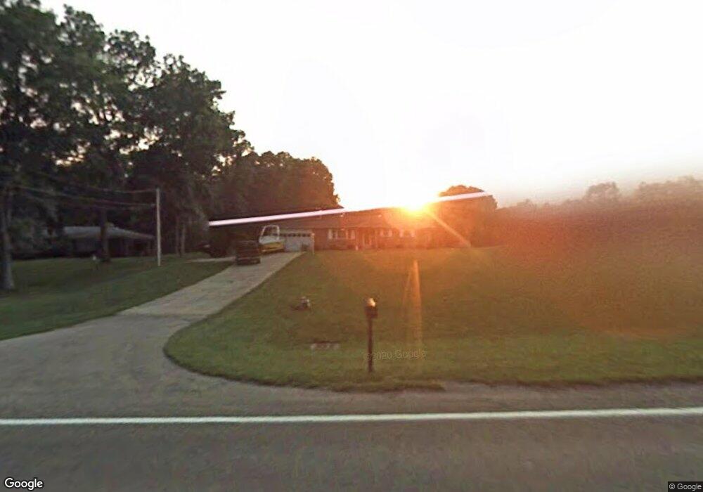
4121 Derr Rd Springfield, OH 45503
Estimated Value: $208,726 - $297,000
3
Beds
1
Bath
1,107
Sq Ft
$231/Sq Ft
Est. Value
About This Home
This home is located at 4121 Derr Rd, Springfield, OH 45503 and is currently estimated at $255,682, approximately $230 per square foot. 4121 Derr Rd is a home located in Clark County with nearby schools including Northridge Elementary School, Kenton Ridge Middle & High School, and Emmanuel Christian Academy.
Ownership History
Date
Name
Owned For
Owner Type
Purchase Details
Closed on
Mar 24, 2015
Sold by
Dunaway Aaron B and Yirak Dunaway Karey M
Bought by
Dunaway Aaron B and Yirak Dunaway Karey M
Current Estimated Value
Purchase Details
Closed on
Jun 9, 2000
Sold by
Will Of Truster Dale M
Bought by
Dunaway Aaron B and Yirak Karey M
Home Financials for this Owner
Home Financials are based on the most recent Mortgage that was taken out on this home.
Original Mortgage
$106,442
Outstanding Balance
$35,685
Interest Rate
8.14%
Mortgage Type
FHA
Estimated Equity
$219,997
Create a Home Valuation Report for This Property
The Home Valuation Report is an in-depth analysis detailing your home's value as well as a comparison with similar homes in the area
Home Values in the Area
Average Home Value in this Area
Purchase History
| Date | Buyer | Sale Price | Title Company |
|---|---|---|---|
| Dunaway Aaron B | -- | First American | |
| Dunaway Aaron B | $106,500 | -- |
Source: Public Records
Mortgage History
| Date | Status | Borrower | Loan Amount |
|---|---|---|---|
| Open | Dunaway Aaron B | $106,442 |
Source: Public Records
Tax History
| Year | Tax Paid | Tax Assessment Tax Assessment Total Assessment is a certain percentage of the fair market value that is determined by local assessors to be the total taxable value of land and additions on the property. | Land | Improvement |
|---|---|---|---|---|
| 2025 | $2,171 | $60,060 | $14,060 | $46,000 |
| 2024 | $2,171 | $49,650 | $10,910 | $38,740 |
| 2023 | $2,100 | $49,650 | $10,910 | $38,740 |
| 2022 | $2,107 | $49,650 | $10,910 | $38,740 |
| 2021 | $2,038 | $40,700 | $8,940 | $31,760 |
| 2020 | $2,040 | $40,700 | $8,940 | $31,760 |
| 2019 | $2,079 | $40,700 | $8,940 | $31,760 |
| 2018 | $1,902 | $35,740 | $8,280 | $27,460 |
| 2017 | $1,630 | $35,739 | $8,278 | $27,461 |
| 2016 | $1,619 | $35,739 | $8,278 | $27,461 |
| 2015 | $1,564 | $33,258 | $8,278 | $24,980 |
| 2014 | $1,564 | $33,258 | $8,278 | $24,980 |
| 2013 | $1,527 | $33,258 | $8,278 | $24,980 |
Source: Public Records
Map
Nearby Homes
- 4343 Burchill St
- 1162 Kingsgate Rd
- 1341 Student Ave
- 1201 Kingsgate Rd
- 4256 Midfield St Unit 9
- 862 Brendle Trace Unit 20
- 593 Hiser Ave
- 4741 Cullen Ave
- 4446 Ridgewood Rd E Unit 3
- 4802 Willowbrook Dr
- 1500 Kingsgate Rd
- 1502 Kingsgate Rd
- 1500 Kingsgate Rd Unit 19430
- 1502 Kingsgate Rd Unit 19432
- 1509 Kingsgate Rd
- 3631 Kingsgate Ln
- 1149 Foxboro Rd
- 1503 Kingsgate Rd
- 1136 Foxboro Rd Unit 202
- 1505 Kingsgate Rd
- 4133 Derr Rd
- 4145 Derr Rd
- 1011 Woodhaven Ct
- 4163 Derr Rd
- 1023 Woodhaven Ct
- 1012 Woodhaven Ct
- 4120 Derr Rd
- 4100 Derr Rd
- 1018 Woodhaven Ct
- 1035 Woodhaven Ct
- 4242 Derr Rd
- 1023 Montego Dr
- 4080 Derr Rd
- 1032 Woodhaven Ct
- 1041 Woodhaven Ct
- 1041 Montego Dr
- 1053 Montego Dr
- 1040 Woodhaven Ct
- 1104 Greenoak Ct
- 1020 Montego Dr
Your Personal Tour Guide
Ask me questions while you tour the home.