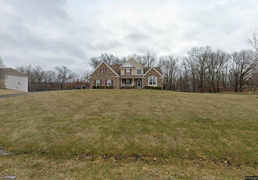
4121 Kelsey Ave Adrian, MI 49221
Estimated Value: $426,593 - $456,000
--
Bed
3
Baths
2,833
Sq Ft
$156/Sq Ft
Est. Value
About This Home
This home is located at 4121 Kelsey Ave, Adrian, MI 49221 and is currently estimated at $441,648, approximately $155 per square foot. 4121 Kelsey Ave is a home located in Lenawee County with nearby schools including Adrian High School, St. Joseph Academy, and St. Joseph's Academy.
Ownership History
Date
Name
Owned For
Owner Type
Purchase Details
Closed on
Oct 13, 2011
Sold by
Rsg Development Llc
Bought by
Hill John and Hill Jamie
Current Estimated Value
Home Financials for this Owner
Home Financials are based on the most recent Mortgage that was taken out on this home.
Original Mortgage
$202,980
Outstanding Balance
$138,574
Interest Rate
4.12%
Mortgage Type
New Conventional
Estimated Equity
$303,074
Purchase Details
Closed on
Dec 17, 2004
Bought by
Hill John and Hill Jamie
Create a Home Valuation Report for This Property
The Home Valuation Report is an in-depth analysis detailing your home's value as well as a comparison with similar homes in the area
Home Values in the Area
Average Home Value in this Area
Purchase History
| Date | Buyer | Sale Price | Title Company |
|---|---|---|---|
| Hill John | $255,050 | None Available | |
| Hill John | -- | -- |
Source: Public Records
Mortgage History
| Date | Status | Borrower | Loan Amount |
|---|---|---|---|
| Open | Hill John | $202,980 |
Source: Public Records
Tax History Compared to Growth
Tax History
| Year | Tax Paid | Tax Assessment Tax Assessment Total Assessment is a certain percentage of the fair market value that is determined by local assessors to be the total taxable value of land and additions on the property. | Land | Improvement |
|---|---|---|---|---|
| 2025 | $4,266 | $214,000 | $0 | $0 |
| 2024 | $2,606 | $214,100 | $0 | $0 |
| 2022 | $3,911 | $183,800 | $0 | $0 |
| 2021 | $3,868 | $174,200 | $0 | $0 |
| 2020 | $3,867 | $165,700 | $0 | $0 |
| 2019 | $353,191 | $144,700 | $0 | $0 |
| 2018 | $3,848 | $144,669 | $0 | $0 |
| 2017 | $3,786 | $145,872 | $0 | $0 |
| 2016 | $3,774 | $138,105 | $0 | $0 |
| 2014 | -- | $115,309 | $0 | $0 |
Source: Public Records
Map
Nearby Homes
- 4126 Mckenna Dr
- 2263 Sutton Rd
- 41 Bailey Dr
- 2000 blk Sutton Rd Unit Parcel B
- 2600 Blk Sutton Rd Unit Parcel C
- 4623 N Adrian Hwy
- 1023 Sutton Rd
- 4705 Robin Hood Trail
- 1010 W Valley Rd
- 3000 Breckel Hwy
- 6000 Occidental Hwy Unit 6000 Blk Occidental
- 3811 Torin Ln Unit Parcel G
- 3311 N Adrian Hwy
- 2771 Gady Rd
- 2775 Gady Rd
- 3508 N Wilmoth Hwy
- 2975 E Valley Rd
- 5679 Catawba Dr
- 3284 Sutton Rd
- 3616 Willow Nicole Ln
- 4121 Kelsey Ave Unit Lot C Middlebrook Me
- 4120 Kelsey Ave
- 4044 Kelsey Ave
- 4126 Kelsey Ave
- 4045 Kelsey Ave
- 4045 Kelsey Ave Unit KELSEY
- 1766 Sutton Rd
- 4155 Kelsey Ave
- 1763 Sutton Rd
- 4158 Kelsey Ave Unit Parcel J Middlebrook
- 4158 Kelsey Ave
- 4221 Kelsey Ave
- 4221 Kelsey Ave Unit KELSEY
- 1708 Sutton Rd
- 3971 Black Hwy
- 1806 Sutton Rd
- 1795 Sutton Rd
- 4125 Mckenna Dr
- 1820 Sutton Rd
- 4108 Mckenna Dr