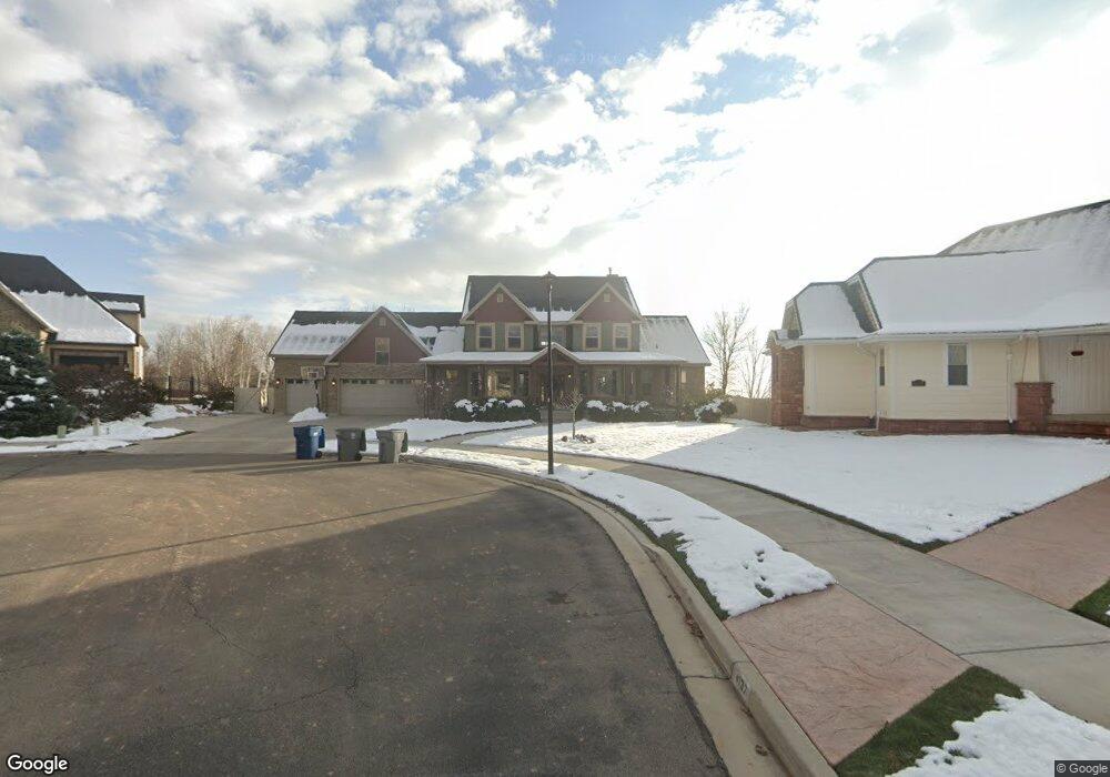
4121 N 810 W Pleasant Grove, UT 84062
Estimated Value: $1,172,000 - $1,503,374
4
Beds
4
Baths
7,041
Sq Ft
$195/Sq Ft
Est. Value
About This Home
This home is located at 4121 N 810 W, Pleasant Grove, UT 84062 and is currently estimated at $1,372,844, approximately $194 per square foot. 4121 N 810 W is a home located in Utah County with nearby schools including Deerfield Elementary School, Mountain Ridge Junior High School, and American Fork High School.
Ownership History
Date
Name
Owned For
Owner Type
Purchase Details
Closed on
Aug 6, 2020
Sold by
Wilson Terry David Ben and Wilson Tiffany Brooke
Bought by
Wilson Terry David Ben and Wilson Tiffany Brooke
Current Estimated Value
Home Financials for this Owner
Home Financials are based on the most recent Mortgage that was taken out on this home.
Original Mortgage
$510,400
Outstanding Balance
$363,219
Interest Rate
3.1%
Mortgage Type
New Conventional
Estimated Equity
$1,009,625
Purchase Details
Closed on
Aug 5, 2019
Sold by
Moore Spencer Andrew
Bought by
Moore Spencer A and Moore Laurie C
Home Financials for this Owner
Home Financials are based on the most recent Mortgage that was taken out on this home.
Original Mortgage
$484,350
Interest Rate
3.73%
Mortgage Type
New Conventional
Purchase Details
Closed on
Dec 21, 2017
Sold by
Jensen Rodney L and Jensen Rosetta A
Bought by
Moore Steven R and Moore Jillyn
Home Financials for this Owner
Home Financials are based on the most recent Mortgage that was taken out on this home.
Original Mortgage
$114,300
Interest Rate
3.9%
Mortgage Type
Future Advance Clause Open End Mortgage
Purchase Details
Closed on
Mar 3, 2009
Sold by
First Horizon Home Loans
Bought by
Moore Spencer A and Moore Laurie C
Home Financials for this Owner
Home Financials are based on the most recent Mortgage that was taken out on this home.
Original Mortgage
$408,500
Interest Rate
5.04%
Mortgage Type
Purchase Money Mortgage
Purchase Details
Closed on
Jan 5, 2009
Sold by
Walker James Michael and First Horizon Home Loan Corpor
Bought by
First Horizon Home Loans
Home Financials for this Owner
Home Financials are based on the most recent Mortgage that was taken out on this home.
Original Mortgage
$408,500
Interest Rate
5.04%
Mortgage Type
Purchase Money Mortgage
Purchase Details
Closed on
Sep 19, 2006
Sold by
Degelbeck Douglas G and Timpanogos Land Development
Bought by
Walker James Michael
Home Financials for this Owner
Home Financials are based on the most recent Mortgage that was taken out on this home.
Original Mortgage
$640,000
Interest Rate
6.53%
Mortgage Type
Construction
Create a Home Valuation Report for This Property
The Home Valuation Report is an in-depth analysis detailing your home's value as well as a comparison with similar homes in the area
Home Values in the Area
Average Home Value in this Area
Purchase History
| Date | Buyer | Sale Price | Title Company |
|---|---|---|---|
| Wilson Terry David Ben | -- | Accommodation | |
| Moore Spencer A | -- | Accommodation | |
| Moore Spencer Andrew | -- | Inwest Title Orem | |
| Moore Steven R | -- | Inwest Title | |
| Moore Spencer A | -- | Etitle Insurance Agency | |
| First Horizon Home Loans | $682,376 | Etitle Insurance Agency | |
| Walker James Michael | -- | Integrated Title Insurance | |
| Walker James Michael | -- | Integrated Title Insurance |
Source: Public Records
Mortgage History
| Date | Status | Borrower | Loan Amount |
|---|---|---|---|
| Open | Wilson Terry David Ben | $510,400 | |
| Closed | Moore Spencer Andrew | $484,350 | |
| Closed | Moore Steven R | $114,300 | |
| Previous Owner | Moore Spencer A | $408,500 | |
| Previous Owner | Walker James Michael | $640,000 | |
| Previous Owner | Walker James Michael | $79,920 |
Source: Public Records
Tax History Compared to Growth
Tax History
| Year | Tax Paid | Tax Assessment Tax Assessment Total Assessment is a certain percentage of the fair market value that is determined by local assessors to be the total taxable value of land and additions on the property. | Land | Improvement |
|---|---|---|---|---|
| 2025 | $5,410 | $760,980 | $456,200 | $927,400 |
| 2024 | $5,410 | $645,645 | $0 | $0 |
| 2023 | $5,282 | $645,370 | $0 | $0 |
| 2022 | $5,656 | $687,555 | $0 | $0 |
| 2021 | $4,358 | $806,600 | $259,600 | $547,000 |
| 2020 | $4,061 | $736,800 | $240,400 | $496,400 |
| 2019 | $3,591 | $673,800 | $223,200 | $450,600 |
| 2018 | $3,469 | $615,500 | $206,100 | $409,400 |
| 2017 | $3,483 | $329,010 | $0 | $0 |
| 2016 | $3,371 | $307,395 | $0 | $0 |
| 2015 | $3,559 | $307,395 | $0 | $0 |
| 2014 | $3,112 | $266,255 | $0 | $0 |
Source: Public Records
Map
Nearby Homes
- 4124 N 810 W
- 9506 N 4000 W
- 9481 N 3830 W
- 9547 N Canyon Rd
- 9575 Aztec Dr
- 3810 W Valley View Dr
- 9900 N Meadow Dr
- 3851 W Mountaintop Cir Unit 5
- 3870 Mountaintop Cir
- 4441 W Bridgestone Dr
- 248 N Deerfield Ln
- 9587 N 4500 W
- 1243 N 1270 E
- 4198 W Sage Rd N
- 1172 Murdock Dr
- 9681 N Peach Ct
- 1125 N 1270 E
- 9157 N Canyon Heights Dr
- 9078 Renaissance Dr
- 2969 N 1350 W
- 4137 N 810 W
- 3964 W 9600 N
- 9630 N 4000 W
- 4168 N 810 W
- 742 W 4000 N
- 4165 N 810 W Unit 11
- 754 W 4000 N
- 728 W 4000 N
- 692 W 4000 N Unit 2
- 4118 N 900 W
- 4084 N 900 W
- 3924 W 9600 N
- 4052 N 900 W
- 4156 N 900 W
- 3949 W 9600 N
- 9589 N Landon Cir Unit 1
- 9589 N Landon Cir
- 9589 N Landon Ct Unit 1
- 4206 N 810 W
- 4203 N 810 W