Estimated Value: $275,000 - $336,491
3
Beds
2
Baths
1,716
Sq Ft
$182/Sq Ft
Est. Value
About This Home
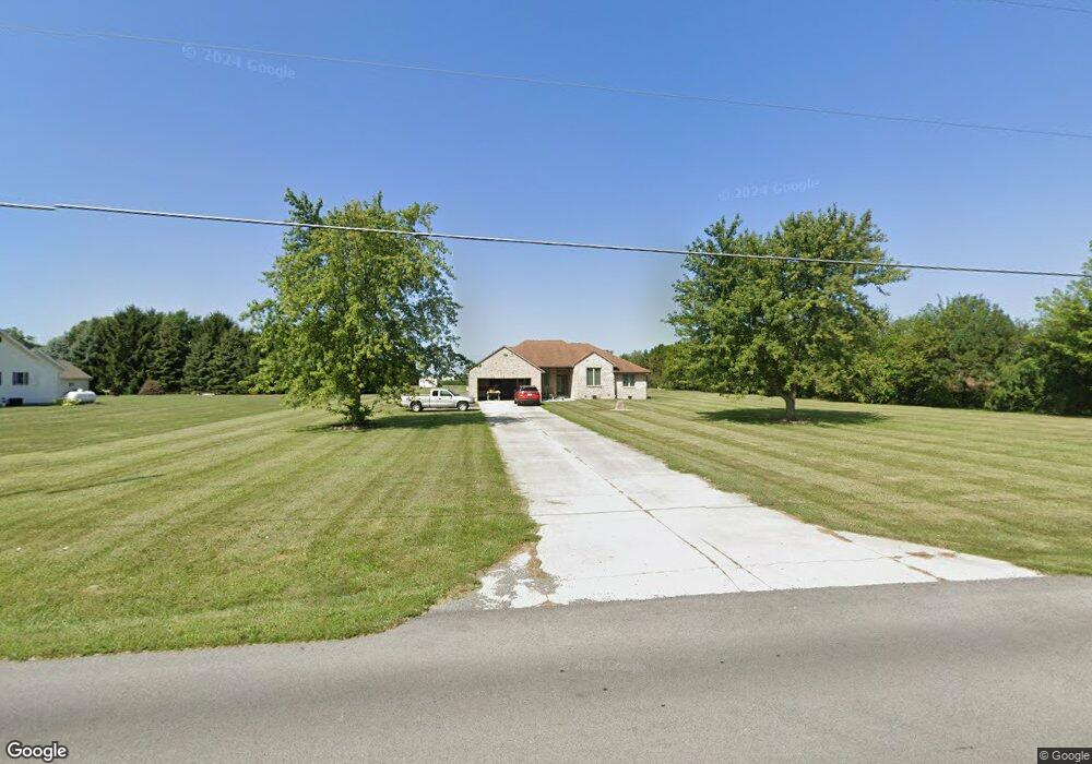
This home is located at 4121 N Cole St, Lima, OH 45807 and is currently estimated at $311,623, approximately $181 per square foot. 4121 N Cole St is a home located in Allen County with nearby schools including Elida Elementary School, Elida Middle School, and Elida High School.
Ownership History
Date
Name
Owned For
Owner Type
Purchase Details
Closed on
Jan 17, 2001
Sold by
Harford James P
Bought by
Eaton Walter D and Eaton Rosetta L
Current Estimated Value
Home Financials for this Owner
Home Financials are based on the most recent Mortgage that was taken out on this home.
Original Mortgage
$14,800
Interest Rate
7.58%
Mortgage Type
New Conventional
Create a Home Valuation Report for This Property
The Home Valuation Report is an in-depth analysis detailing your home's value as well as a comparison with similar homes in the area
Home Values in the Area
Average Home Value in this Area
Purchase History
| Date | Buyer | Sale Price | Title Company |
|---|---|---|---|
| Eaton Walter D | $18,500 | -- |
Source: Public Records
Mortgage History
| Date | Status | Borrower | Loan Amount |
|---|---|---|---|
| Closed | Eaton Walter D | $14,800 |
Source: Public Records
Tax History Compared to Growth
Tax History
| Year | Tax Paid | Tax Assessment Tax Assessment Total Assessment is a certain percentage of the fair market value that is determined by local assessors to be the total taxable value of land and additions on the property. | Land | Improvement |
|---|---|---|---|---|
| 2024 | $4,923 | $110,820 | $20,480 | $90,340 |
| 2023 | $4,007 | $80,290 | $14,840 | $65,450 |
| 2022 | $4,081 | $80,290 | $14,840 | $65,450 |
| 2021 | $4,102 | $80,290 | $14,840 | $65,450 |
| 2020 | $3,867 | $70,350 | $15,190 | $55,160 |
| 2019 | $3,867 | $70,350 | $15,190 | $55,160 |
| 2018 | $3,900 | $70,350 | $15,190 | $55,160 |
| 2017 | $3,381 | $63,140 | $15,190 | $47,950 |
| 2016 | $3,377 | $63,140 | $15,190 | $47,950 |
| 2015 | $3,401 | $63,140 | $15,190 | $47,950 |
| 2014 | $3,645 | $65,420 | $15,790 | $49,630 |
| 2013 | $3,290 | $65,420 | $15,790 | $49,630 |
Source: Public Records
Map
Nearby Homes
- 0 Fraunfelter Unit 307817
- 0 N Eastown Rd Unit 1034495
- 1129 W Bluelick Rd
- 4050 Brookshore Dr
- 4080 Brookshore Dr
- 3798 Kissing Hollow Dr
- 2718 Carolyn Dr
- 2630 Carolyn Dr
- 1743 Sherry Lee Dr
- 3270 Bonnieview Dr
- 520 Kenmore St
- 1619 Northbrook Dr
- 2371 Mandolin Dr
- 2370 N McDonel St
- 168 Lyre Bird Ln
- 2755 N Cable Rd
- 2268 N Glenwood Ave
- 815 Lutz Rd
- 2129 Reinell Ave
- 3456 Shearin Ave
- 4199 N Cole St
- 4071 N Cole St
- 4255 N Cole St
- 1370 Beery Rd
- 1370 Beery Rd
- 1432 Beery Rd
- 0 Fraunfelter Unit 96596
- 0 Fraunfelter Unit 304027
- 0 N Eastown Rd Unit 1027759
- 0 Fraunfelter Unit 68324
- 0 Fraunfelter Unit 100508
- 0 N Eastown Rd Unit 201396
- 00 Fraunfelter
- 0 N Eastown Rd Unit 1006022
- 0 Kemp Rd N Unit 367697
- 0 Kemp Rd N Unit 362296
- 0 Elida Rd Unit 363821
- 0 Fraunfelter Unit 377224
- 0 State Rd Rd Unit 421887