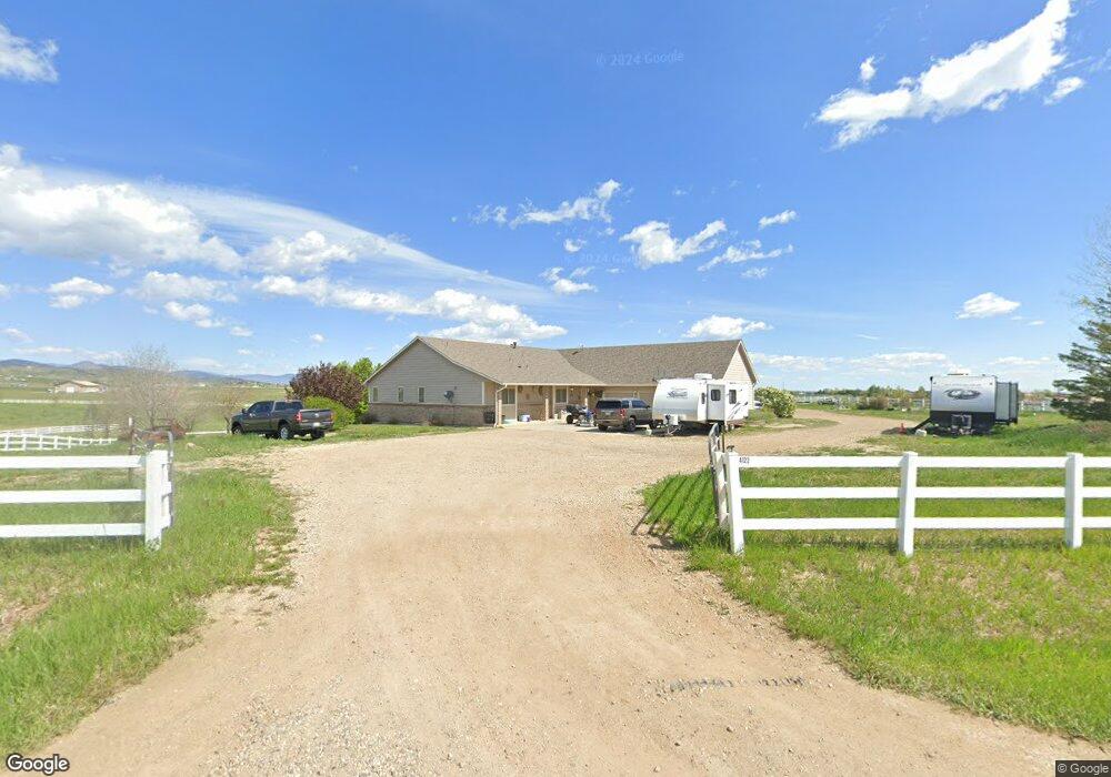
4122 John Galt Dr Berthoud, CO 80513
Estimated Value: $1,170,364 - $1,561,000
5
Beds
3
Baths
4,218
Sq Ft
$305/Sq Ft
Est. Value
About This Home
This home is located at 4122 John Galt Dr, Berthoud, CO 80513 and is currently estimated at $1,286,591, approximately $305 per square foot. 4122 John Galt Dr is a home located in Larimer County with nearby schools including Berthoud Elementary School, Turner Middle School, and Berthoud High School.
Ownership History
Date
Name
Owned For
Owner Type
Purchase Details
Closed on
Mar 25, 2004
Sold by
Smikahl Larry D
Bought by
Swanson Wesley C and Swanson Shelly Lynae
Current Estimated Value
Home Financials for this Owner
Home Financials are based on the most recent Mortgage that was taken out on this home.
Original Mortgage
$380,011
Interest Rate
5%
Mortgage Type
Purchase Money Mortgage
Purchase Details
Closed on
Nov 8, 2002
Sold by
Harmon Homes Of Loveland Llp
Bought by
Smikahl Larry D
Create a Home Valuation Report for This Property
The Home Valuation Report is an in-depth analysis detailing your home's value as well as a comparison with similar homes in the area
Home Values in the Area
Average Home Value in this Area
Purchase History
| Date | Buyer | Sale Price | Title Company |
|---|---|---|---|
| Swanson Wesley C | $475,000 | -- | |
| Smikahl Larry D | $192,500 | -- |
Source: Public Records
Mortgage History
| Date | Status | Borrower | Loan Amount |
|---|---|---|---|
| Closed | Swanson Wesley C | $380,011 |
Source: Public Records
Tax History Compared to Growth
Tax History
| Year | Tax Paid | Tax Assessment Tax Assessment Total Assessment is a certain percentage of the fair market value that is determined by local assessors to be the total taxable value of land and additions on the property. | Land | Improvement |
|---|---|---|---|---|
| 2025 | $6,840 | $82,739 | $15,243 | $67,496 |
| 2024 | $6,615 | $82,739 | $15,243 | $67,496 |
| 2022 | $5,385 | $62,425 | $15,811 | $46,614 |
| 2021 | $5,534 | $64,221 | $16,266 | $47,955 |
| 2020 | $5,193 | $60,246 | $16,266 | $43,980 |
| 2019 | $5,118 | $60,246 | $16,266 | $43,980 |
| 2018 | $4,185 | $47,052 | $16,380 | $30,672 |
| 2017 | $3,648 | $47,052 | $16,380 | $30,672 |
| 2016 | $3,868 | $48,381 | $18,109 | $30,272 |
| 2015 | $3,842 | $48,380 | $18,110 | $30,270 |
| 2014 | $3,551 | $42,630 | $18,110 | $24,520 |
Source: Public Records
Map
Nearby Homes
- 1932 N County Road 23
- 1822 Quarter Ln
- 2102 Shoreside Dr
- 2366 Shoreside Dr
- 871 N County Road 23e
- 4707 Lonetree Dr
- 0 W County Road 8e Unit RECIR1018960
- 3520 W County Road 8
- 4616 Lonetree Dr
- 4260 S County Road 23
- 6502 & 6200 Kiva Ridge Dr
- 5644 Kiva Ridge Dr
- 2517 Southwind Rd
- 5714 Bluff Ln
- 2672 Bluewater Rd
- 2598 Bluewater Rd
- 2552 Bluewater Rd
- 2622 Bluewater Rd
- 2654 Big Creek Ct
- 2668 Big Creek Ct
- 1908 N County Road 23
- 1800 N County Road 23
- 4234 John Galt Dr
- 0 N County Road 23
- 0 N Co Road 23
- 2028 N County Road 23
- 2028 N County Road 23
- 2022 N County Road 23
- 1932 N Co Road 23
- 4243 Getaway Dr
- 1616 N County Road 23
- 1616 N Co Road 23
- 1760 N County Road 23
- 4350 John Galt Dr
- 4335 Getaway Dr
- 2077 N County Road 23
- 1528 N County Road 23
- 4475 Getaway Dr
- 3720 W County Road 10
- 4480 Getaway Dr