Estimated Value: $441,349 - $480,000
3
Beds
3
Baths
2,296
Sq Ft
$201/Sq Ft
Est. Value
About This Home
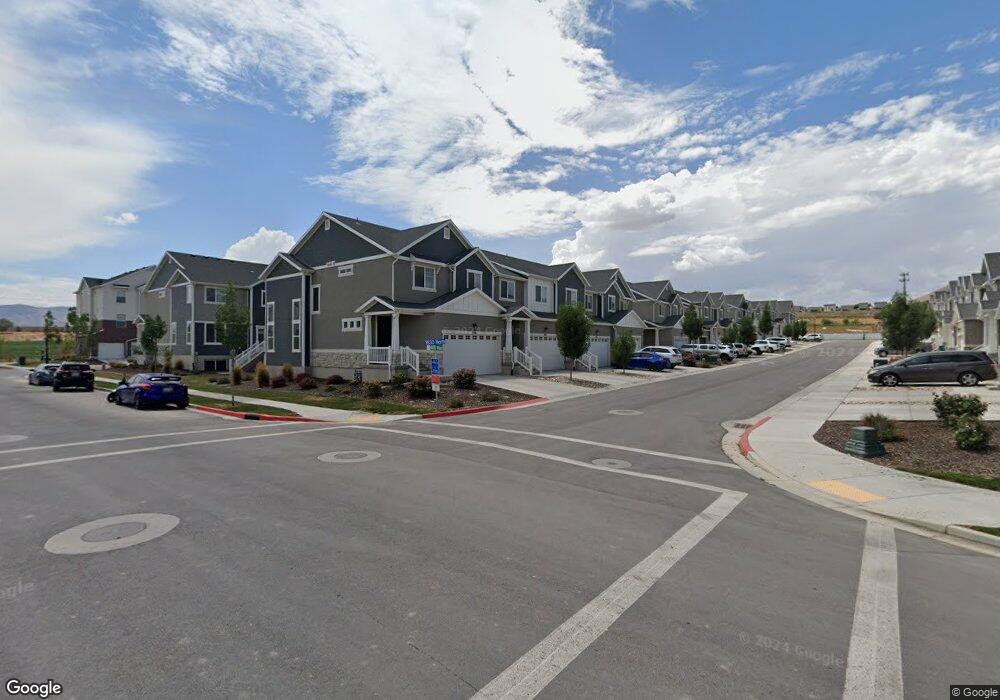
This home is located at 4123 W 1630 N Unit 764, Lehi, UT 84043 and is currently estimated at $460,587, approximately $200 per square foot. 4123 W 1630 N Unit 764 is a home located in Utah County with nearby schools including North Point Elementary School, Willowcreek Middle School, and Lehi High School.
Ownership History
Date
Name
Owned For
Owner Type
Purchase Details
Closed on
Nov 22, 2021
Sold by
Mitchell Henrie Kassidi
Bought by
4123 Lehi Llc
Current Estimated Value
Home Financials for this Owner
Home Financials are based on the most recent Mortgage that was taken out on this home.
Original Mortgage
$342,750
Outstanding Balance
$314,505
Interest Rate
3.09%
Mortgage Type
New Conventional
Estimated Equity
$146,082
Purchase Details
Closed on
Nov 15, 2021
Sold by
4123 Lehi Llc
Bought by
Henrie Douglas Colt and Henrie Kassidi Mitchell
Home Financials for this Owner
Home Financials are based on the most recent Mortgage that was taken out on this home.
Original Mortgage
$342,750
Outstanding Balance
$314,505
Interest Rate
3.09%
Mortgage Type
New Conventional
Estimated Equity
$146,082
Purchase Details
Closed on
Dec 3, 2018
Sold by
Edge Homes Utah Llc
Bought by
Henrie Douglas Colt and Henrie Kassidi
Create a Home Valuation Report for This Property
The Home Valuation Report is an in-depth analysis detailing your home's value as well as a comparison with similar homes in the area
Home Values in the Area
Average Home Value in this Area
Purchase History
| Date | Buyer | Sale Price | Title Company |
|---|---|---|---|
| 4123 Lehi Llc | -- | Old Republic Title | |
| Henrie Douglas Colt | -- | None Listed On Document | |
| Henrie Douglas Colt | -- | Provo Land Title Co |
Source: Public Records
Mortgage History
| Date | Status | Borrower | Loan Amount |
|---|---|---|---|
| Open | 4123 Lehi Llc | $342,750 |
Source: Public Records
Tax History Compared to Growth
Tax History
| Year | Tax Paid | Tax Assessment Tax Assessment Total Assessment is a certain percentage of the fair market value that is determined by local assessors to be the total taxable value of land and additions on the property. | Land | Improvement |
|---|---|---|---|---|
| 2025 | $2,109 | $243,320 | $65,000 | $377,400 |
| 2024 | $2,109 | $247,115 | $0 | $0 |
| 2023 | $1,903 | $242,110 | $0 | $0 |
| 2022 | $1,945 | $239,965 | $0 | $0 |
| 2021 | $1,647 | $307,200 | $46,100 | $261,100 |
| 2020 | $1,603 | $295,500 | $44,300 | $251,200 |
| 2019 | $1,456 | $279,100 | $41,900 | $237,200 |
| 2018 | $502 | $27,500 | $0 | $0 |
Source: Public Records
Map
Nearby Homes
- 1606 N 4230 W
- 4126 W 1530 N Unit DD101
- 4089 W 1700 N Unit 618
- 1700 N Boston St
- 1552 N Boston St Unit 5B
- 4037 W 1730 N
- 4057 W 1760 N
- 4028 W 1730 N
- 3972 W 1530 N
- 4173 W 1850 N
- 4827 N Sage Dr
- 4252 W 1850 N Unit J203
- 1629 N 3860 W
- 1689 W Canyon Rim Dr N Unit 636
- 3984 W 1850 N Unit D102
- 1632 N 3830 W
- 1941 N 4100 W
- 4155 W 1960 N
- 1453 N 3860 W Unit 108
- 2773 N Tower Way
- 4117 W 1630 N Unit 765
- 4117 W 1630 N
- 4129 W 1630 N Unit 763
- 4109 W 1630 N Unit 766
- 4109 W 1630 N
- 4149 W 1630 N
- 4149 W 1630 N Unit 762
- 4122 W 1530 N Unit 1209
- 4128 W 1530 N Unit DD201
- 4128 W 1530 N Unit 1210
- 4128 W 1530 N
- 4116 W 1530 N Unit 1208
- 4155 W 1630 N Unit 761
- 4108 W 1530 N
- 4108 W 1530 N Unit 1207
- 4148 W 1530 N
- 4148 W 1530 N Unit 1211
- 4163 W 1630 N
- 4163 W 1630 N Unit 760
- 4124 W 1630 N Unit 751