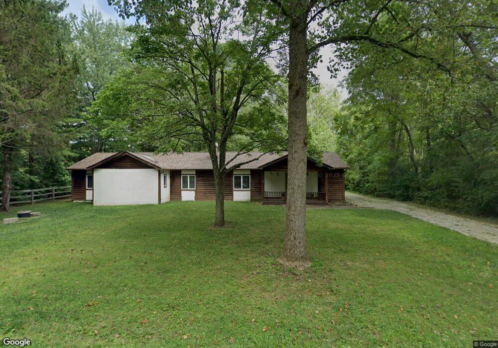
4124 Avis Rd New Albany, OH 43054
Estimated Value: $472,000 - $599,000
3
Beds
2
Baths
2,406
Sq Ft
$223/Sq Ft
Est. Value
About This Home
This home is located at 4124 Avis Rd, New Albany, OH 43054 and is currently estimated at $536,238, approximately $222 per square foot. 4124 Avis Rd is a home located in Franklin County with nearby schools including New Albany Primary School, New Albany Intermediate School, and New Albany Middle School.
Ownership History
Date
Name
Owned For
Owner Type
Purchase Details
Closed on
Sep 20, 2021
Sold by
Mclaughlin Karen Sue
Bought by
New Albany Company Llc
Current Estimated Value
Purchase Details
Closed on
Jun 10, 2002
Sold by
Mclaughlin Cynthia Ann
Bought by
Mclaughlin Karen Sue
Home Financials for this Owner
Home Financials are based on the most recent Mortgage that was taken out on this home.
Original Mortgage
$176,250
Interest Rate
6.93%
Purchase Details
Closed on
Jul 19, 1996
Sold by
Morton Mary E
Bought by
Mclaughlin Karen S and Mclaughlin Cynthia A
Home Financials for this Owner
Home Financials are based on the most recent Mortgage that was taken out on this home.
Original Mortgage
$166,400
Interest Rate
8.31%
Mortgage Type
New Conventional
Purchase Details
Closed on
Aug 13, 1991
Create a Home Valuation Report for This Property
The Home Valuation Report is an in-depth analysis detailing your home's value as well as a comparison with similar homes in the area
Home Values in the Area
Average Home Value in this Area
Purchase History
| Date | Buyer | Sale Price | Title Company |
|---|---|---|---|
| New Albany Company Llc | $385,000 | Stewart Title | |
| Mclaughlin Karen Sue | $95,700 | -- | |
| Mclaughlin Karen S | $185,000 | -- | |
| -- | $140,000 | -- |
Source: Public Records
Mortgage History
| Date | Status | Borrower | Loan Amount |
|---|---|---|---|
| Previous Owner | Mclaughlin Karen Sue | $176,250 | |
| Previous Owner | Mclaughlin Karen S | $166,400 |
Source: Public Records
Tax History Compared to Growth
Tax History
| Year | Tax Paid | Tax Assessment Tax Assessment Total Assessment is a certain percentage of the fair market value that is determined by local assessors to be the total taxable value of land and additions on the property. | Land | Improvement |
|---|---|---|---|---|
| 2024 | $8,573 | $134,760 | $56,460 | $78,300 |
| 2023 | $9,317 | $158,410 | $56,455 | $101,955 |
| 2022 | $6,167 | $78,820 | $33,880 | $44,940 |
| 2021 | $5,666 | $78,820 | $33,880 | $44,940 |
| 2020 | $5,634 | $78,820 | $33,880 | $44,940 |
| 2019 | $6,234 | $78,820 | $33,880 | $44,940 |
| 2018 | $7,009 | $93,310 | $33,880 | $59,430 |
| 2017 | $7,028 | $93,310 | $33,880 | $59,430 |
| 2016 | $6,689 | $78,830 | $31,680 | $47,150 |
| 2015 | $6,745 | $78,830 | $31,680 | $47,150 |
| 2014 | $6,563 | $78,830 | $31,680 | $47,150 |
| 2013 | $3,238 | $75,040 | $30,135 | $44,905 |
Source: Public Records
Map
Nearby Homes
- 7585 Morse Rd
- 8190 Clark State Ct
- 2942 Clark State Crossing
- 2896 Sandycombe Dr
- 3440 Kitzmiller Rd
- 8381 Laidbrook Place
- 7747 Sutton Place
- 5026 Babbitt Rd
- 8730 Swisher Creek Crossing
- 7754 Brandon Rd
- 7768 Ansante Dr Unit 101
- 6590 Wheatly Rd
- 7860 Clark State Rd
- 6540 Wheatly Rd Unit LOT 701
- 3385 Abberley Dr Unit LOT 904
- 0 Babbitt Rd Unit 225035797
- 6544 Wheatly Rd Unit LOT 702
- 3377 Abberley Dr Unit LOT 902
- 6531 Wheatly Rd Unit LOT 102
- 6522 Wheatly Rd Unit LOT 801