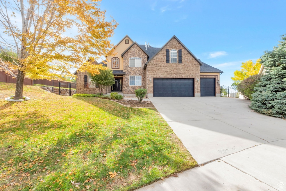

4124 N 810 W Pleasant Grove, UT 84062
Estimated payment $6,994/month
Highlights
- Lake View
- 0.5 Acre Lot
- Wood Flooring
- Mountain Ridge Junior High School Rated A-
- Fruit Trees
- Main Floor Primary Bedroom
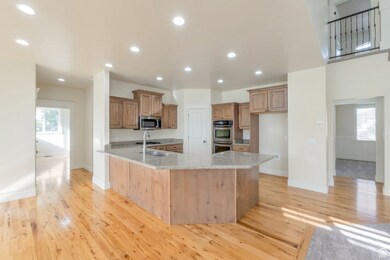
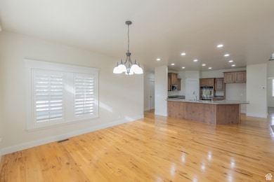
About This Home
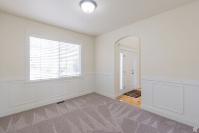
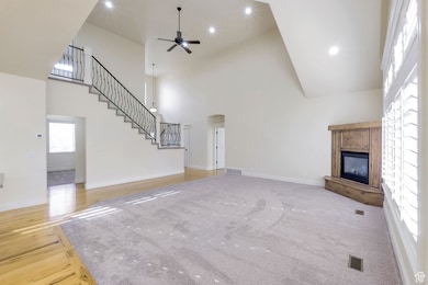
Enjoy the perfect blend of convenient city access and peaceful country living in this quiet cul-de-sac home. Situated on a beautifully landscaped half-acre lot, the property features a mini orchard with apple, nectarine, peach, and apricot trees, along with raised garden beds, established strawberries, and raspberries. The spacious, fenced backyard is ideal for watching fireworks or enjoying a quick game of football or soccer. Step inside to a bright, open-concept living space that's perfect for entertaining, with an oversized kitchen, dining, and family room. Large windows fill the home with natural light throughout the day. The main-floor master suite allows for true single-level living, while the basement offers the option for a roughed-in mother-in-law apartment with a separate entrance through the garage. Additional highlights include hickory hardwood floors, a gas cooktop, double ovens, recessed lighting, central vacuum, and plenty of storage throughout.
Listing Agent
Kaitlynn Sales
Maxfield Real Estate Experts License #11785735 Listed on: 10/14/2025
Home Details
Home Type
- Single Family
Est. Annual Taxes
- $5,258
Year Built
- Built in 2006
Lot Details
- 0.5 Acre Lot
- Cul-De-Sac
- Landscaped
- Sloped Lot
- Fruit Trees
- Mature Trees
- Property is zoned Single-Family
Parking
- 3 Car Attached Garage
- Open Parking
Property Views
- Lake
- Mountain
Home Design
- Brick Exterior Construction
- Stucco
Interior Spaces
- 5,249 Sq Ft Home
- 3-Story Property
- Central Vacuum
- Ceiling Fan
- Recessed Lighting
- 1 Fireplace
- Double Pane Windows
- Plantation Shutters
- Blinds
- Entrance Foyer
- Electric Dryer Hookup
Kitchen
- Double Oven
- Range
- Disposal
Flooring
- Wood
- Carpet
- Tile
Bedrooms and Bathrooms
- 7 Bedrooms | 1 Primary Bedroom on Main
- Walk-In Closet
- Hydromassage or Jetted Bathtub
- Bathtub With Separate Shower Stall
Basement
- Walk-Out Basement
- Basement Fills Entire Space Under The House
Schools
- Manila Elementary School
- Pleasant Grove Middle School
- Pleasant Grove High School
Utilities
- Forced Air Heating and Cooling System
- Natural Gas Connected
Additional Features
- Sprinkler System
- Covered Patio or Porch
Community Details
- No Home Owners Association
- Shady Meadows Subdivision
Listing and Financial Details
- Assessor Parcel Number 66-124-0008
Map
Home Values in the Area
Average Home Value in this Area
Tax History
| Year | Tax Paid | Tax Assessment Tax Assessment Total Assessment is a certain percentage of the fair market value that is determined by local assessors to be the total taxable value of land and additions on the property. | Land | Improvement |
|---|---|---|---|---|
| 2025 | $4,531 | $627,330 | $456,200 | $684,400 |
| 2024 | $4,531 | $540,595 | $0 | $0 |
| 2023 | $4,348 | $531,245 | $0 | $0 |
| 2022 | $4,390 | $533,720 | $0 | $0 |
| 2021 | $3,709 | $686,500 | $259,600 | $426,900 |
| 2020 | $3,503 | $635,700 | $240,400 | $395,300 |
| 2019 | $3,296 | $618,500 | $223,200 | $395,300 |
| 2018 | $3,135 | $556,200 | $206,100 | $350,100 |
| 2017 | $3,163 | $298,815 | $0 | $0 |
| 2016 | $3,277 | $298,815 | $0 | $0 |
| 2015 | $3,339 | $288,365 | $0 | $0 |
| 2014 | $2,919 | $249,700 | $0 | $0 |
Property History
| Date | Event | Price | List to Sale | Price per Sq Ft |
|---|---|---|---|---|
| 11/25/2025 11/25/25 | Pending | -- | -- | -- |
| 10/14/2025 10/14/25 | For Sale | $1,250,000 | -- | $238 / Sq Ft |
Purchase History
| Date | Type | Sale Price | Title Company |
|---|---|---|---|
| Warranty Deed | -- | Cache Title Company Salt L | |
| Special Warranty Deed | -- | Equity Title Production F | |
| Trustee Deed | $531,000 | Etitle Insurance Agency | |
| Warranty Deed | -- | Integrated Title Insurance | |
| Warranty Deed | -- | Integrated Title Insurance |
Source: UtahRealEstate.com
MLS Number: 2117482
APN: 66-124-0008
Disclaimer: Certain information contained herein is derived from information provided by parties other than Homes.com. All information provided is deemed reliable, but is not guaranteed to be accurate and should be independently verified.
![]() IDX information is provided exclusively for consumers’ personal, non-commercial use, that it may not be used for any purpose other than to identify prospective properties consumers may be interested in purchasing, and that the data is deemed reliable but is not guaranteed accurate by the MLS. Licensor is only providing the MLS Content and not other sources of data provided in the Product.
IDX information is provided exclusively for consumers’ personal, non-commercial use, that it may not be used for any purpose other than to identify prospective properties consumers may be interested in purchasing, and that the data is deemed reliable but is not guaranteed accurate by the MLS. Licensor is only providing the MLS Content and not other sources of data provided in the Product.
Based on information from the Wasatch Front Regional Multiple Listing Service, Inc.. All data, including all measurements and calculations of area, is obtained from various sources and has not been, and will not be, verified by broker or the MLS. All information should be independently reviewed and verified for accuracy. Properties may or may not be listed by the office/agent presenting the information.
- 9506 N 4000 W
- 9575 Aztec Dr
- 9481 N 3830 W
- 9547 N Canyon Rd
- 3810 W Valley View Dr
- 9616 N Canyon Heights Dr
- 3851 W Mountaintop Cir Unit 5
- 3870 Mountaintop Cir
- 9900 N Meadow Dr
- 9752 N Dorchester Dr
- 4441 W Bridgestone Dr
- 248 N Deerfield Ln
- 4198 W Sage Rd N
- 9242 N Emerald Lake Cove
- 9587 N 4500 W
- 1243 N 1270 E
- 1172 Murdock Dr
- 9681 N Peach Ct
- 9078 Renaissance Dr
- 1125 N 1270 E