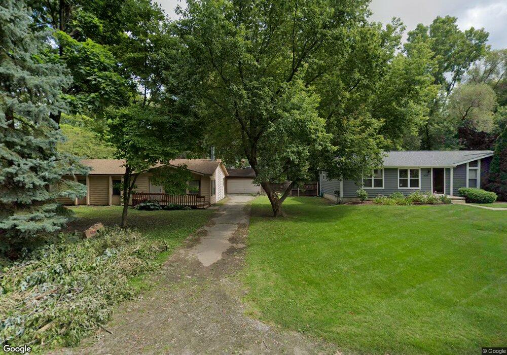
4127 Alston Blvd West Bloomfield, MI 48323
Estimated Value: $272,000 - $312,000
3
Beds
2
Baths
1,120
Sq Ft
$258/Sq Ft
Est. Value
About This Home
This home is located at 4127 Alston Blvd, West Bloomfield, MI 48323 and is currently estimated at $288,978, approximately $258 per square foot. 4127 Alston Blvd is a home located in Oakland County with nearby schools including Clifford H. Smart Middle School, Walled Lake Northern High School, and Our Lady Of Refuge School.
Ownership History
Date
Name
Owned For
Owner Type
Purchase Details
Closed on
Jan 2, 2020
Sold by
Jb & Df Properties Llc
Bought by
Jfb Properties Llc
Current Estimated Value
Purchase Details
Closed on
Jun 10, 2015
Sold by
Bemben John F and Fine Dorothy D
Bought by
Jb & Df Properties Llc
Purchase Details
Closed on
Apr 10, 1996
Sold by
Zucker Robert
Bought by
Bemben John F
Home Financials for this Owner
Home Financials are based on the most recent Mortgage that was taken out on this home.
Original Mortgage
$72,000
Interest Rate
7.78%
Purchase Details
Closed on
Jul 29, 1994
Sold by
Zucker Mitzie
Bought by
Bemben John F
Create a Home Valuation Report for This Property
The Home Valuation Report is an in-depth analysis detailing your home's value as well as a comparison with similar homes in the area
Home Values in the Area
Average Home Value in this Area
Purchase History
| Date | Buyer | Sale Price | Title Company |
|---|---|---|---|
| Jfb Properties Llc | -- | None Available | |
| Jb & Df Properties Llc | -- | Attorney | |
| Bemben John F | $90,000 | -- | |
| Bemben John F | -- | -- |
Source: Public Records
Mortgage History
| Date | Status | Borrower | Loan Amount |
|---|---|---|---|
| Previous Owner | Bemben John F | $72,000 |
Source: Public Records
Tax History Compared to Growth
Tax History
| Year | Tax Paid | Tax Assessment Tax Assessment Total Assessment is a certain percentage of the fair market value that is determined by local assessors to be the total taxable value of land and additions on the property. | Land | Improvement |
|---|---|---|---|---|
| 2024 | $4,044 | $111,740 | $0 | $0 |
| 2022 | $3,966 | $105,680 | $40,820 | $64,860 |
| 2021 | $5,282 | $101,990 | $0 | $0 |
| 2020 | $2,036 | $98,330 | $40,820 | $57,510 |
| 2018 | $2,733 | $87,320 | $40,820 | $46,500 |
| 2015 | -- | $75,420 | $0 | $0 |
| 2014 | -- | $70,610 | $0 | $0 |
| 2011 | -- | $64,070 | $0 | $0 |
Source: Public Records
Map
Nearby Homes
- 6978 Colony Dr
- 4245 Bunker Ave
- 4335 Crestdale Ave
- 3991 Fieldview Ave
- 6903 Dandison Blvd
- 4066 Green Lake Rd
- 3965 Carrick Ave
- 4212 Greendale Ave
- 0000 Langtoft
- 7337 Richardson Rd
- 4442 Borland St
- 3950 Bradmore Ave
- 6675 Langtoft St
- 6768 Buckland Ave
- 7381 Crestmore St
- 6980 Hambro St
- 3632 Fieldview Ave
- 4540 Rolling Pine Ct
- 7369 Sweetbriar
- 7359 Woodlore Dr
- 6955 Colony Dr
- 4151 Alston Blvd
- 4138 Howarth Terrace
- 4123 Alston Blvd
- 4163 Alston Blvd Unit Bldg-Unit
- 4163 Alston Blvd
- 0000 Howarth Terrace
- 4144 Alston Blvd
- 000 Howarth Terrace
- 00000 Howarth Terrace
- 7007 Colony Dr
- 4125 Howarth Terrace
- 4164 Alston Blvd
- 4292 Green Lake Rd
- 6949 Colony Dr
- 4154 Alston Blvd
- 4149 Howarth Terrace
- 4145 Cedar Ave
- 7015 Colony Dr
- 4176 Alston Blvd