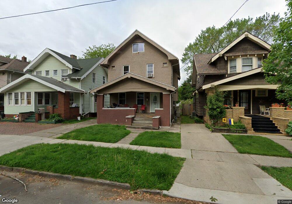
4129 Thornton Ave Toledo, OH 43612
Five Points NeighborhoodEstimated Value: $110,000 - $120,470
3
Beds
1
Bath
1,337
Sq Ft
$85/Sq Ft
Est. Value
About This Home
This home is located at 4129 Thornton Ave, Toledo, OH 43612 and is currently estimated at $114,118, approximately $85 per square foot. 4129 Thornton Ave is a home located in Lucas County with nearby schools including Whittier Elementary School, Start High School, and Bennett Venture Academy.
Ownership History
Date
Name
Owned For
Owner Type
Purchase Details
Closed on
Sep 8, 2021
Sold by
Duran Frank G and Duran Maria L
Bought by
Hurley Anna
Current Estimated Value
Purchase Details
Closed on
May 14, 1996
Sold by
Barone Michael P
Bought by
Duran Frank G and Duran Maria L
Home Financials for this Owner
Home Financials are based on the most recent Mortgage that was taken out on this home.
Original Mortgage
$25,900
Interest Rate
7.78%
Mortgage Type
New Conventional
Purchase Details
Closed on
Jan 26, 1990
Purchase Details
Closed on
Mar 29, 1989
Sold by
Kraemer J G and J G
Create a Home Valuation Report for This Property
The Home Valuation Report is an in-depth analysis detailing your home's value as well as a comparison with similar homes in the area
Home Values in the Area
Average Home Value in this Area
Purchase History
| Date | Buyer | Sale Price | Title Company |
|---|---|---|---|
| Hurley Anna | $20,000 | None Available | |
| Duran Frank G | $37,000 | -- | |
| -- | $23,000 | -- | |
| -- | -- | -- |
Source: Public Records
Mortgage History
| Date | Status | Borrower | Loan Amount |
|---|---|---|---|
| Previous Owner | Duran Frank G | $25,900 |
Source: Public Records
Tax History Compared to Growth
Tax History
| Year | Tax Paid | Tax Assessment Tax Assessment Total Assessment is a certain percentage of the fair market value that is determined by local assessors to be the total taxable value of land and additions on the property. | Land | Improvement |
|---|---|---|---|---|
| 2024 | $2,045 | $31,465 | $6,755 | $24,710 |
| 2023 | $1,557 | $24,045 | $5,880 | $18,165 |
| 2022 | $1,554 | $24,045 | $5,880 | $18,165 |
| 2021 | $1,629 | $24,045 | $5,880 | $18,165 |
| 2020 | $1,549 | $20,160 | $5,005 | $15,155 |
| 2019 | $1,514 | $20,160 | $5,005 | $15,155 |
| 2018 | $1,512 | $20,160 | $5,005 | $15,155 |
| 2017 | $1,488 | $18,795 | $4,795 | $14,000 |
| 2016 | $1,484 | $53,700 | $13,700 | $40,000 |
| 2015 | $1,470 | $53,700 | $13,700 | $40,000 |
| 2014 | $1,215 | $18,800 | $4,800 | $14,000 |
| 2013 | $1,215 | $18,800 | $4,800 | $14,000 |
Source: Public Records
Map
Nearby Homes
- 1016 Mallett St
- 4128 Thornton Ave
- 4112 Lewis Ave
- 1106 Martin Ave
- 4125 N Lockwood Ave
- 4112 Peak Ave
- 3912 Martha Ave
- 4239 Lewis Ave
- 4228 N Lockwood Ave
- 3915 Lockwood Ave
- 4137 Walker Ave
- 1013 Clymena St
- 4139 Walker Ave
- 4244 N Lockwood Ave
- 3829 Drexel Dr
- 4316 N Lockwood Ave
- 4008 Fairview Dr
- 1336 Laclede Rd
- 4039 Vermaas Ave
- 4419 Lewis Ave
- 4133 Thornton Ave
- 4127 Thornton Ave
- 4137 Thornton Ave
- 4123 Thornton Ave
- 4141 Thornton Ave
- 4119 Thornton Ave
- 4134 Mayfield Dr
- 4130 Mayfield Dr
- 4136 Mayfield Dr
- 4126 Mayfield Dr
- 4138 Mayfield Dr
- 4145 Thornton Ave
- 4122 Mayfield Dr
- 4142 Mayfield Dr
- 4134 Thornton Ave
- 4136 Thornton Ave
- 4118 Mayfield Dr
- 4126 Thornton Ave
- 4113 Thornton Ave
- 4138 Thornton Ave