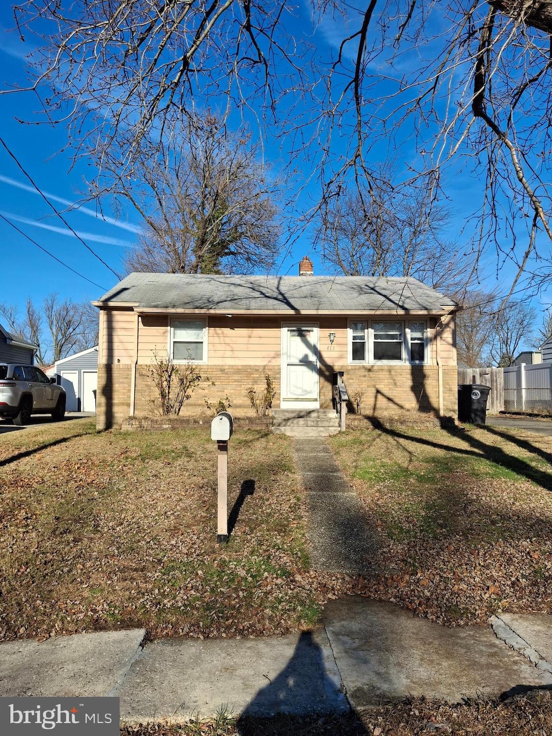
413 10th Ave Lindenwold, NJ 08021
Estimated payment $1,542/month
Highlights
- Rambler Architecture
- Back, Front, and Side Yard
- Forced Air Heating System
- No HOA
- Shed
- Open Lot
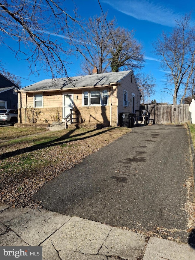
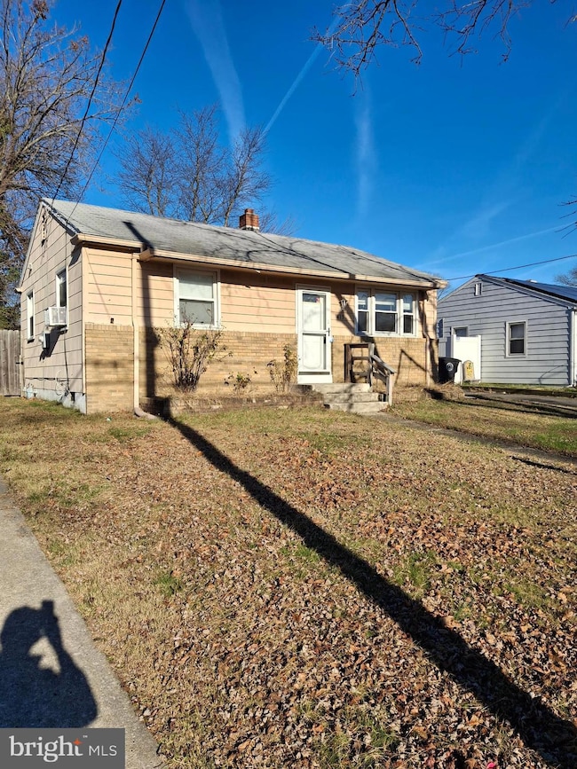
About This Home
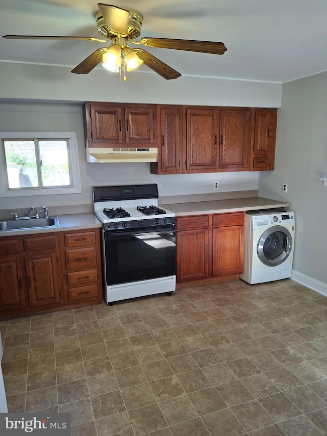
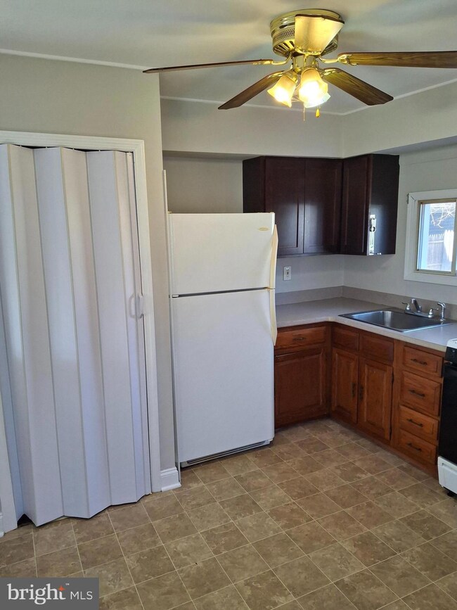
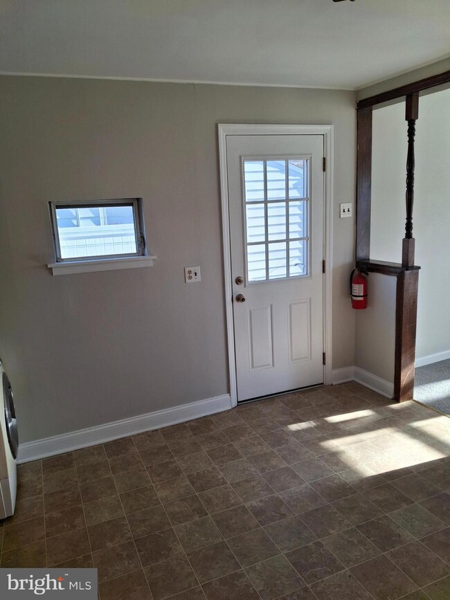
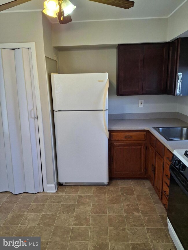
Welcome to this charming and affordable home—perfect for first-time buyers or those looking to downsize comfortably. Step inside to find an inviting eat-in kitchen featuring a gas stove and a convenient combo washer/dryer, making everyday living a breeze. Fresh, neutral carpeting runs throughout the home, creating a warm and move-in-ready feel. Offering two generously sized bedrooms and one well-maintained bath, this home is designed for easy, efficient living. Enjoy peace of mind with a gas heater, gas water heater, and several newer windows that enhance comfort and efficiency. Outside, the large fenced backyard provides endless possibilities—gardening, entertaining, or simply relaxing in your own private space. The extended driveway offers parking for up to three cars, a rare convenience you’ll truly appreciate.
Listing Agent
(856) 552-0505 jtwmtg65@gmail.com Sureway Realty License #1649402 Listed on: 12/06/2025
Home Details
Home Type
- Single Family
Est. Annual Taxes
- $4,095
Year Built
- Built in 1960
Lot Details
- 4,792 Sq Ft Lot
- Open Lot
- Back, Front, and Side Yard
Parking
- Driveway
Home Design
- Rambler Architecture
- Brick Foundation
- Shingle Roof
Interior Spaces
- 722 Sq Ft Home
- Property has 1 Level
- Laundry on main level
Bedrooms and Bathrooms
- 2 Main Level Bedrooms
- 1 Full Bathroom
Outdoor Features
- Shed
Schools
- Lindenwold High School
Utilities
- Cooling System Mounted In Outer Wall Opening
- Forced Air Heating System
- 100 Amp Service
- Natural Gas Water Heater
Community Details
- No Home Owners Association
- Garden Lakes Subdivision
Listing and Financial Details
- Assessor Parcel Number 22-00201-00003
Map
Home Values in the Area
Average Home Value in this Area
Tax History
| Year | Tax Paid | Tax Assessment Tax Assessment Total Assessment is a certain percentage of the fair market value that is determined by local assessors to be the total taxable value of land and additions on the property. | Land | Improvement |
|---|---|---|---|---|
| 2025 | $4,075 | $82,400 | $35,000 | $47,400 |
| 2024 | $4,097 | $82,400 | $35,000 | $47,400 |
| 2023 | $4,097 | $82,400 | $35,000 | $47,400 |
| 2022 | $4,093 | $82,400 | $35,000 | $47,400 |
| 2021 | $4,206 | $82,400 | $35,000 | $47,400 |
| 2020 | $4,181 | $82,400 | $35,000 | $47,400 |
| 2019 | $4,218 | $82,400 | $35,000 | $47,400 |
| 2018 | $4,207 | $82,400 | $35,000 | $47,400 |
| 2017 | $4,081 | $82,400 | $35,000 | $47,400 |
| 2016 | $3,990 | $82,400 | $35,000 | $47,400 |
| 2015 | $3,822 | $82,400 | $35,000 | $47,400 |
| 2014 | $3,655 | $82,400 | $35,000 | $47,400 |
Property History
| Date | Event | Price | List to Sale | Price per Sq Ft |
|---|---|---|---|---|
| 12/06/2025 12/06/25 | For Sale | $229,000 | -- | $317 / Sq Ft |
Purchase History
| Date | Type | Sale Price | Title Company |
|---|---|---|---|
| Deed | $144,200 | -- | |
| Deed | $69,000 | -- | |
| Deed | $60,000 | -- |
Mortgage History
| Date | Status | Loan Amount | Loan Type |
|---|---|---|---|
| Previous Owner | $141,950 | FHA | |
| Previous Owner | $68,005 | FHA | |
| Previous Owner | $48,000 | No Value Available |
Source: Bright MLS
MLS Number: NJCD2107232
APN: 22-00201-0000-00003
Disclaimer: Certain information contained herein is derived from information provided by parties other than Homes.com. All information provided is deemed reliable, but is not guaranteed to be accurate and should be independently verified.
![]() The data relating to real estate for sale on this website appears in part through the BRIGHT Internet Data Exchange program, a voluntary cooperative exchange of property listing data between licensed real estate brokerage firms, and is provided by BRIGHT through a licensing agreement.
The data relating to real estate for sale on this website appears in part through the BRIGHT Internet Data Exchange program, a voluntary cooperative exchange of property listing data between licensed real estate brokerage firms, and is provided by BRIGHT through a licensing agreement.
Listing information is from various brokers who participate in the Bright MLS IDX program and not all listings may be visible on the site.
The property information being provided on or through the website is for the personal, non-commercial use of consumers and such information may not be used for any purpose other than to identify prospective properties consumers may be interested in purchasing.
Some properties which appear for sale on the website may no longer be available because they are for instance, under contract, sold or are no longer being offered for sale.
Property information displayed is deemed reliable but is not guaranteed.
Copyright 2025 Bright MLS, Inc.
- 409 9th Ave
- 441 8th Ave
- 334 Chews Landing Rd
- 524 8th Ave
- 225 Chews Landing Rd
- 531 6th Ave
- 37 Chiswick Dr
- 609 8th Ave
- 2004 Greenwood Dr
- 2005 Greenwood Dr
- 2702 Greenwood Dr
- 1908 Greenwood Dr Unit C1908
- 1802 Greenwood Dr
- 2703 Greenwood Dr
- 323 3rd Ave
- 2209 Greenwood Dr
- 2210 Greenwood Dr
- 18 Glenwood Dr
- 335 2nd Ave
- 15 Dover Dr
- 6 Glenn Alpine
- 322 7th Ave
- 801 W Park Ave
- 1600 Laurel Rd
- 105 Blackwood Clementon Rd
- 828 Blackwood Clementon Rd
- 201 Timber Creek Rd
- 1800 Laurel Rd
- 1900 Laurel Rd
- 534 Park Ave
- 800 Chews Landing Rd
- 459 La Cascata
- 1990 Laurel Rd
- 58 Chews Landing Rd
- 1341 Blackwood Clementon Rd
- 1608 Huntingdon Mews
- 38 Broadway Unit C
- 38 Broadway Unit D
- 38 Broadway Unit A
- 1003 Huntingdon Mews
