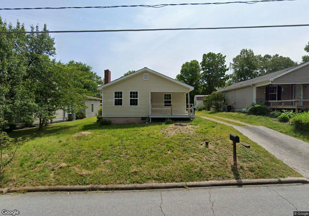
413 Barnwell St Thomasville, NC 27360
Estimated Value: $95,000 - $134,000
2
Beds
1
Bath
1,564
Sq Ft
$71/Sq Ft
Est. Value
About This Home
This home is located at 413 Barnwell St, Thomasville, NC 27360 and is currently estimated at $111,614, approximately $71 per square foot. 413 Barnwell St is a home located in Davidson County with nearby schools including Thomasville Primary School, Liberty Drive Elementary School, and Thomasville Middle School.
Ownership History
Date
Name
Owned For
Owner Type
Purchase Details
Closed on
Apr 14, 2022
Sold by
Skeen Patricia H and Skeen Larry D
Bought by
Hps Land Llc
Current Estimated Value
Home Financials for this Owner
Home Financials are based on the most recent Mortgage that was taken out on this home.
Original Mortgage
$76,500
Outstanding Balance
$71,476
Interest Rate
3.76%
Mortgage Type
New Conventional
Estimated Equity
$40,138
Purchase Details
Closed on
Aug 8, 2006
Sold by
Hall Jerry Wayne
Bought by
Skeen Roger Dale and Skeen Patricia H
Home Financials for this Owner
Home Financials are based on the most recent Mortgage that was taken out on this home.
Original Mortgage
$15,000
Interest Rate
6.71%
Mortgage Type
Purchase Money Mortgage
Create a Home Valuation Report for This Property
The Home Valuation Report is an in-depth analysis detailing your home's value as well as a comparison with similar homes in the area
Home Values in the Area
Average Home Value in this Area
Purchase History
| Date | Buyer | Sale Price | Title Company |
|---|---|---|---|
| Hps Land Llc | $70,000 | None Listed On Document | |
| Skeen Roger Dale | $30,000 | None Available |
Source: Public Records
Mortgage History
| Date | Status | Borrower | Loan Amount |
|---|---|---|---|
| Open | Hps Land Llc | $76,500 | |
| Previous Owner | Skeen Roger Dale | $15,000 |
Source: Public Records
Tax History Compared to Growth
Tax History
| Year | Tax Paid | Tax Assessment Tax Assessment Total Assessment is a certain percentage of the fair market value that is determined by local assessors to be the total taxable value of land and additions on the property. | Land | Improvement |
|---|---|---|---|---|
| 2025 | $843 | $63,150 | $0 | $0 |
| 2024 | $843 | $63,150 | $0 | $0 |
| 2023 | $843 | $63,150 | $0 | $0 |
| 2022 | $843 | $63,150 | $0 | $0 |
| 2021 | $846 | $63,150 | $0 | $0 |
| 2020 | $781 | $59,360 | $0 | $0 |
| 2019 | $795 | $59,360 | $0 | $0 |
| 2018 | $795 | $59,360 | $0 | $0 |
| 2017 | $784 | $59,360 | $0 | $0 |
| 2016 | $760 | $59,360 | $0 | $0 |
| 2015 | $760 | $59,360 | $0 | $0 |
| 2014 | $784 | $61,220 | $0 | $0 |
Source: Public Records
Map
Nearby Homes
- 208 Long St
- 210 Oakwood Dr
- 301 Brown St
- 801 Bowerwood Dr
- 807 Mary James Ave
- 407 Davidson St Unit a,b,c
- 811 Douglas Dr
- 0 Small St
- 600 Clay St Unit 602
- 329 W Main St
- 4 Elliott Dr
- 316 Spring St
- 314 Spring St
- 312 Phillips St
- 415 Spring St
- 305 Spring St
- 6 Mock St
- 17 Fisher Ferry St
- 0 Julia Ave
- 30 Culbreth Ave