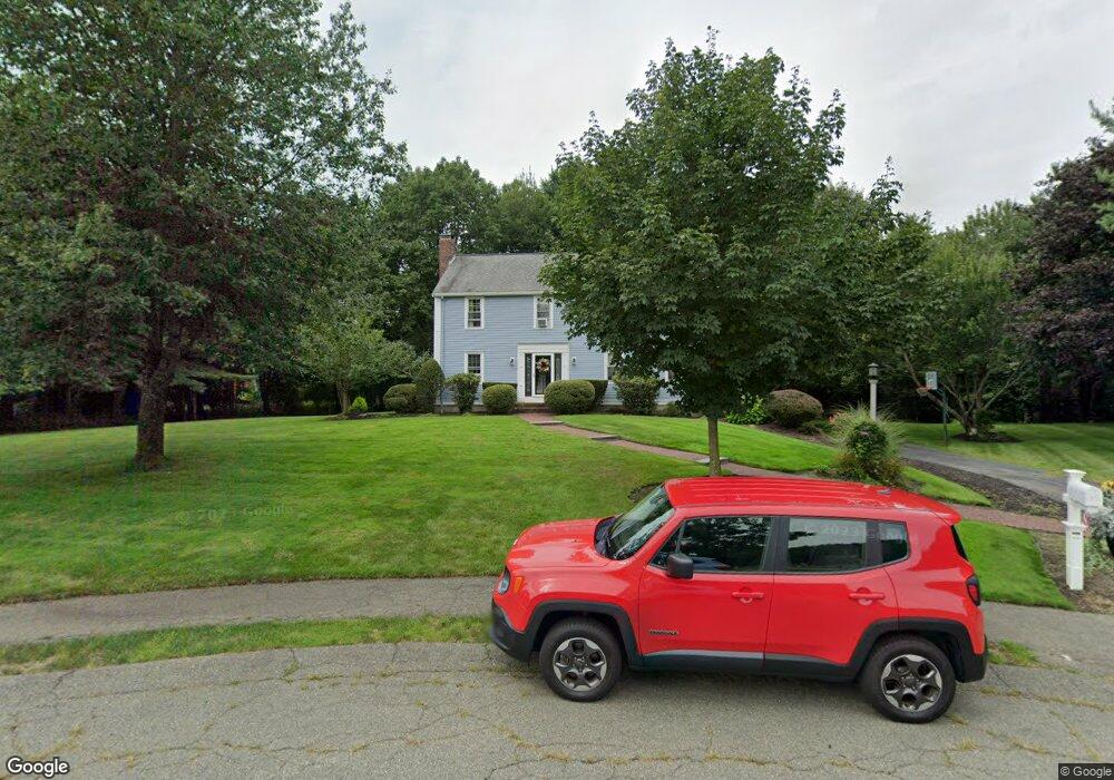
413 Brook Bend Rd Hanson, MA 02341
Estimated Value: $697,717 - $784,000
4
Beds
3
Baths
2,120
Sq Ft
$347/Sq Ft
Est. Value
About This Home
This home is located at 413 Brook Bend Rd, Hanson, MA 02341 and is currently estimated at $736,679, approximately $347 per square foot. 413 Brook Bend Rd is a home located in Plymouth County.
Ownership History
Date
Name
Owned For
Owner Type
Purchase Details
Closed on
Sep 20, 2016
Sold by
White Timothy J and White Diane E
Bought by
Timothy J White Ret
Current Estimated Value
Purchase Details
Closed on
Jun 30, 1999
Sold by
Mchugh Thomas S and Mchugh Leanne C
Bought by
White Timothy J and White Diane E
Purchase Details
Closed on
Jan 31, 1997
Sold by
Obrien Thomas F and Obrien Maureen A
Bought by
Mchugh Thomas S and Mchugh Leanne C
Purchase Details
Closed on
Feb 15, 1989
Sold by
C&J Devlp Co Inc
Bought by
Obrien Thomas F
Create a Home Valuation Report for This Property
The Home Valuation Report is an in-depth analysis detailing your home's value as well as a comparison with similar homes in the area
Home Values in the Area
Average Home Value in this Area
Purchase History
| Date | Buyer | Sale Price | Title Company |
|---|---|---|---|
| Timothy J White Ret | -- | -- | |
| White Timothy J | $250,000 | -- | |
| Mchugh Thomas S | $205,000 | -- | |
| Obrien Thomas F | $60,000 | -- |
Source: Public Records
Mortgage History
| Date | Status | Borrower | Loan Amount |
|---|---|---|---|
| Previous Owner | Obrien Thomas F | $215,000 | |
| Previous Owner | Obrien Thomas F | $60,000 |
Source: Public Records
Tax History
| Year | Tax Paid | Tax Assessment Tax Assessment Total Assessment is a certain percentage of the fair market value that is determined by local assessors to be the total taxable value of land and additions on the property. | Land | Improvement |
|---|---|---|---|---|
| 2025 | $8,088 | $604,500 | $192,200 | $412,300 |
| 2024 | $7,855 | $587,100 | $186,600 | $400,500 |
| 2023 | $7,538 | $531,600 | $186,600 | $345,000 |
| 2022 | $7,005 | $464,200 | $169,700 | $294,500 |
| 2021 | $6,333 | $419,400 | $163,200 | $256,200 |
| 2020 | $6,239 | $408,600 | $157,600 | $251,000 |
| 2019 | $5,575 | $383,400 | $154,600 | $228,800 |
| 2018 | $5,884 | $371,700 | $148,600 | $223,100 |
| 2017 | $1,607 | $357,100 | $141,600 | $215,500 |
| 2016 | $5,799 | $350,400 | $141,600 | $208,800 |
| 2015 | $5,496 | $345,200 | $141,600 | $203,600 |
Source: Public Records
Map
Nearby Homes
- 430 Brook Bend Rd
- 139 Fairwood Dr
- 108 Waterford Dr
- 339 State St
- 26 Stonebridge Dr
- 161 Winter St Unit 11
- Lot 5 Princeton Way
- 84 Liberty St
- 724 Whitman St
- 127 Crescent Place
- 95 Tecumseh Dr
- 134 Crescent St
- 269 Lakeside Rd
- Lot 6 Way
- 17 Hayford Trail Unit 12
- 7 Hayford Trail Unit 12
- 5 Hayford Trail Unit 11
- 22 Howland Trail Unit 34
- 114 Graham Hill Dr
- 361 County Rd
- 401 Brook Bend Rd
- 410 Brook Bend Rd
- 305 Brook Bend Rd
- 71 Winter Terrace
- 764 E Washington St
- 288 Brook Bend Rd
- 87 Winter Terrace
- 204 Brook Bend Rd
- 59 Winter Terrace
- 41 Winter Terrace
- 186 Brook Bend Rd
- 98 Winter Terrace
- 84 Winter Terrace
- 734 E Washington St
- 688 Winter St
- 648 Winter St
- 66 Winter Terrace
- 630 Winter St
- 29 Winter Terrace
- 750 E Washington St
Your Personal Tour Guide
Ask me questions while you tour the home.