Estimated Value: $52,000 - $91,000
2
Beds
1
Bath
775
Sq Ft
$94/Sq Ft
Est. Value
About This Home
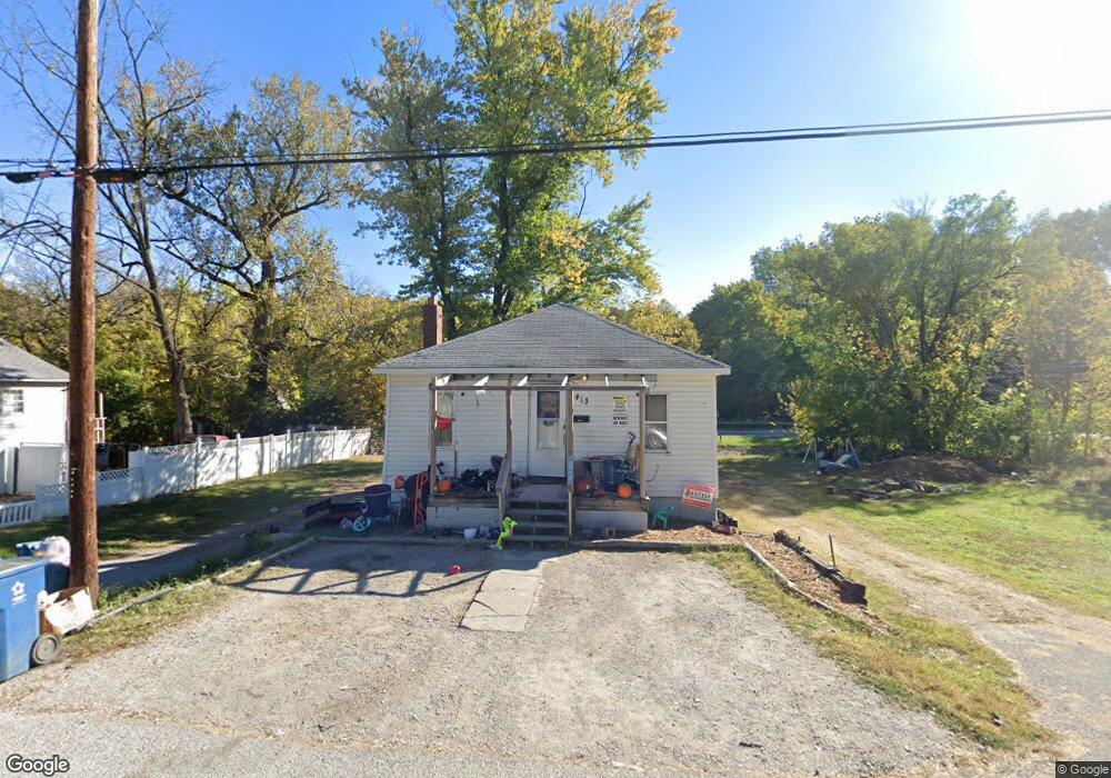
This home is located at 413 Brookside Ave, Alton, IL 62002 and is currently estimated at $72,711, approximately $93 per square foot. 413 Brookside Ave is a home located in Madison County with nearby schools including West Elementary School, Alton Middle School, and Alton High School.
Ownership History
Date
Name
Owned For
Owner Type
Purchase Details
Closed on
Nov 8, 2016
Sold by
Harrison Louis and Harrison Kimberly
Bought by
Berry India J
Current Estimated Value
Purchase Details
Closed on
Jan 2, 2009
Sold by
Hale Jacob Levi
Bought by
Roberts James
Purchase Details
Closed on
Jan 24, 2005
Sold by
Huntsman William E
Bought by
Hale Jacob Levi
Purchase Details
Closed on
Jun 9, 2004
Sold by
Alton Entertainment Holdings Inc
Bought by
Huntsman William E
Create a Home Valuation Report for This Property
The Home Valuation Report is an in-depth analysis detailing your home's value as well as a comparison with similar homes in the area
Home Values in the Area
Average Home Value in this Area
Purchase History
| Date | Buyer | Sale Price | Title Company |
|---|---|---|---|
| Berry India J | -- | Serenity Title & Escrow Ltd | |
| Roberts James | -- | None Available | |
| Hale Jacob Levi | -- | -- | |
| Huntsman William E | $23,000 | Community Title & Escrow Ltd |
Source: Public Records
Tax History
| Year | Tax Paid | Tax Assessment Tax Assessment Total Assessment is a certain percentage of the fair market value that is determined by local assessors to be the total taxable value of land and additions on the property. | Land | Improvement |
|---|---|---|---|---|
| 2024 | $444 | $11,460 | $1,040 | $10,420 |
| 2023 | $444 | $10,350 | $940 | $9,410 |
| 2022 | $368 | $9,360 | $850 | $8,510 |
| 2021 | $257 | $8,800 | $800 | $8,000 |
| 2020 | $230 | $8,480 | $770 | $7,710 |
| 2019 | $231 | $8,280 | $750 | $7,530 |
| 2018 | $231 | $8,060 | $730 | $7,330 |
| 2017 | $199 | $8,060 | $730 | $7,330 |
| 2016 | $223 | $8,060 | $730 | $7,330 |
| 2015 | $726 | $8,060 | $730 | $7,330 |
| 2014 | $726 | $8,060 | $730 | $7,330 |
| 2013 | $726 | $8,280 | $750 | $7,530 |
Source: Public Records
Map
Nearby Homes
- 3313 Leo St
- 609 Marsh Ave
- 516 Sering Ave
- 2617 Plainview Terrace
- 2614 Denny Ave
- 3310 Leroy Ave
- 2753 Hillcrest Ave
- 2619 Sidney St
- 3034 Glenwood Ave
- 3400 Milton Dr
- 3413 Milton Dr
- 2701 Watalee St
- 3505 Coronado Dr
- 2441 Sanford Ave
- 600 Lampert St
- 3608 Horn Ave
- 3502 Oscar Ave
- 608 Milton Rd
- 3416 Robin Ave
- 1220 Main St
- 415 Brookside Ave
- 417 Brookside Ave
- 416 Brookside Ave
- 2828 Viewland St
- 2829 North St
- 501 Miami Ave
- 505 Miami Ave
- 509 Miami Ave
- 2826 Viewland St
- 525 Miami Ave
- 502 Brookside Ave
- 2835 Viewland St
- 2824 Viewland St
- 2833 Viewland St
- 401 Miami Ave
- 2904 Shady Place
- 307 Brookside Ave
- 504 Brookside Ave
- 2822 Viewland St
- 2829 Viewland St
Your Personal Tour Guide
Ask me questions while you tour the home.