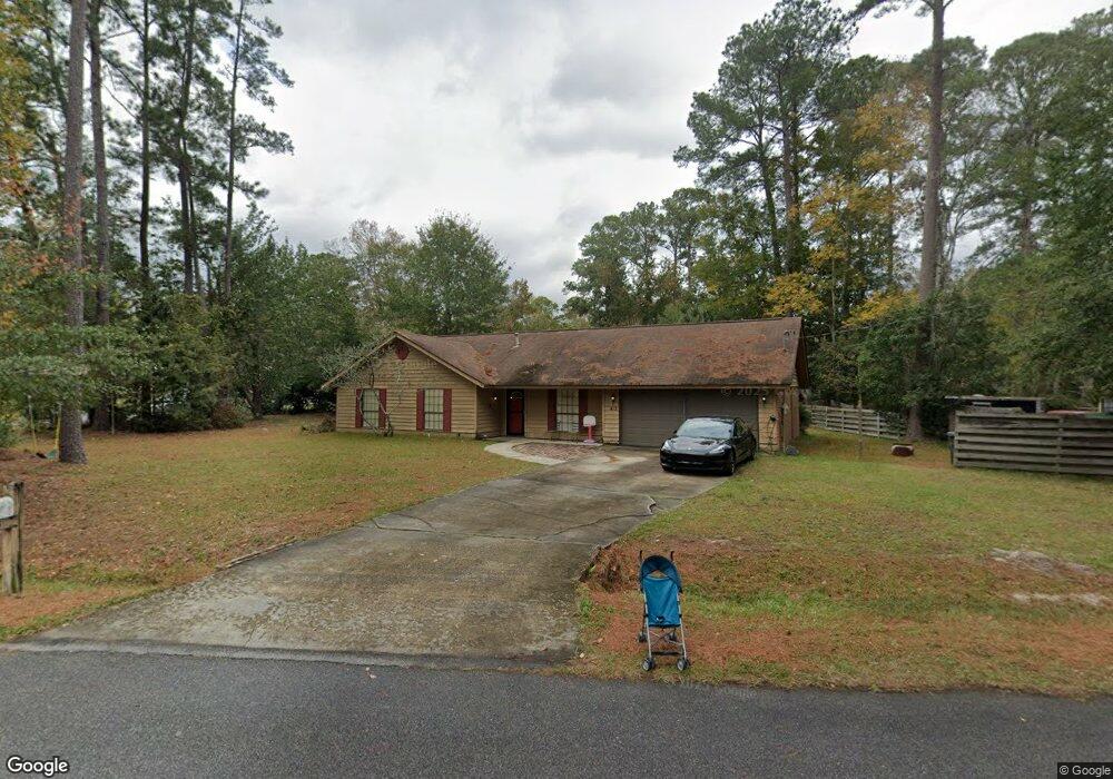
413 Floyd Cir Hinesville, GA 31313
Estimated Value: $230,000 - $271,000
3
Beds
2
Baths
1,829
Sq Ft
$139/Sq Ft
Est. Value
About This Home
This home is located at 413 Floyd Cir, Hinesville, GA 31313 and is currently estimated at $254,738, approximately $139 per square foot. 413 Floyd Cir is a home located in Liberty County with nearby schools including Joseph Martin Elementary School, Snelson-Golden Middle School, and Liberty County High School.
Ownership History
Date
Name
Owned For
Owner Type
Purchase Details
Closed on
Dec 4, 2015
Sold by
Sec Of Housing & U
Bought by
Paradis Timothy D and Paradis Kaylin R
Current Estimated Value
Purchase Details
Closed on
Sep 10, 2015
Sold by
Carrington Mtg Svcs Llc
Bought by
Sec Of Housing & Urban
Purchase Details
Closed on
Aug 4, 2015
Sold by
Howe Phillip
Bought by
Carrington Mtg Svcs Llc
Purchase Details
Closed on
Mar 29, 2002
Sold by
Boyce Donald L
Bought by
Howe Phillip L
Purchase Details
Closed on
Oct 27, 1993
Bought by
Boyce Donald L
Create a Home Valuation Report for This Property
The Home Valuation Report is an in-depth analysis detailing your home's value as well as a comparison with similar homes in the area
Home Values in the Area
Average Home Value in this Area
Purchase History
| Date | Buyer | Sale Price | Title Company |
|---|---|---|---|
| Paradis Timothy D | $61,000 | -- | |
| Sec Of Housing & Urban | -- | -- | |
| Carrington Mtg Svcs Llc | $83,160 | -- | |
| Howe Phillip L | $108,900 | -- | |
| Boyce Donald L | -- | -- |
Source: Public Records
Tax History Compared to Growth
Tax History
| Year | Tax Paid | Tax Assessment Tax Assessment Total Assessment is a certain percentage of the fair market value that is determined by local assessors to be the total taxable value of land and additions on the property. | Land | Improvement |
|---|---|---|---|---|
| 2024 | $2,939 | $81,474 | $16,000 | $65,474 |
| 2023 | $2,939 | $77,047 | $14,000 | $63,047 |
| 2022 | $2,517 | $65,586 | $14,000 | $51,586 |
| 2021 | $2,348 | $53,332 | $11,200 | $42,132 |
| 2020 | $2,305 | $51,968 | $11,200 | $40,768 |
| 2019 | $2,213 | $50,368 | $9,600 | $40,768 |
| 2018 | $2,227 | $50,918 | $9,600 | $41,318 |
| 2017 | $1,650 | $50,096 | $9,600 | $40,496 |
| 2016 | $1,111 | $48,682 | $9,600 | $39,082 |
| 2015 | $2,344 | $44,774 | $9,600 | $35,174 |
| 2014 | $2,344 | $55,179 | $10,400 | $44,779 |
| 2013 | -- | $57,585 | $10,400 | $47,185 |
Source: Public Records
Map
Nearby Homes
- 0 E General Stewart Way
- 0 General Stewart Way
- 411 Woodland Dr
- 24 Sherwood Dr
- 205 Wilson Ave
- 301 Lakeview Dr
- 108 W General Stewart Way
- 173 Ironwood Dr
- 830 Bradwell St
- 103 Stewart Terrace
- 812 Spanish Oak Dr
- 604 Caroline St
- 822 Lakeview Ct
- 1.76 AC Tranquill Way
- 1.76 AC Shyam Dr
- 4 Lots Memorial Dr
- 1 Oglethorpe Ave
- 804 Barrington Dr
- 996 Stone Ct
- 910 Kings Rd
- 457 Floyd Cir
- 0 Floyd Cir Unit 8257123
- 0 Floyd Cir Unit 8058971
- 0 Floyd Cir Unit 7075469
- 0 Floyd Cir Unit 3239245
- 0 Floyd Cir
- 427 Floyd Cir
- 427 Floyd Cir
- 414 Floyd Cir
- 408 Floyd St
- 462 Floyd Cir
- 408 Floyd Cir
- 435 Floyd Cir
- 416 Floyd Cir
- 447 Floyd Cir
- 456 Floyd Cir
- 406 Floyd St
- 418 Floyd St
- 418 Floyd Cir
- 402 Floyd Cir