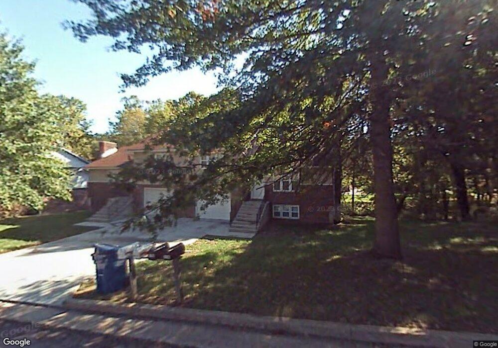
413 Hutton Ln Jefferson City, MO 65101
Estimated Value: $201,000 - $262,264
4
Beds
2
Baths
1,994
Sq Ft
$115/Sq Ft
Est. Value
About This Home
This home is located at 413 Hutton Ln, Jefferson City, MO 65101 and is currently estimated at $229,316, approximately $115 per square foot. 413 Hutton Ln is a home located in Cole County with nearby schools including East Elementary School, Lewis & Clark Middle School, and Jefferson City High School.
Ownership History
Date
Name
Owned For
Owner Type
Purchase Details
Closed on
Jun 5, 2019
Sold by
Patterson Property Mgmt
Bought by
Miller Ardell and Miller Kathy
Current Estimated Value
Home Financials for this Owner
Home Financials are based on the most recent Mortgage that was taken out on this home.
Original Mortgage
$138,446
Outstanding Balance
$121,728
Interest Rate
4.1%
Mortgage Type
FHA
Estimated Equity
$107,588
Create a Home Valuation Report for This Property
The Home Valuation Report is an in-depth analysis detailing your home's value as well as a comparison with similar homes in the area
Home Values in the Area
Average Home Value in this Area
Purchase History
| Date | Buyer | Sale Price | Title Company |
|---|---|---|---|
| Miller Ardell | -- | -- |
Source: Public Records
Mortgage History
| Date | Status | Borrower | Loan Amount |
|---|---|---|---|
| Open | Miller Ardell | $138,446 |
Source: Public Records
Tax History Compared to Growth
Tax History
| Year | Tax Paid | Tax Assessment Tax Assessment Total Assessment is a certain percentage of the fair market value that is determined by local assessors to be the total taxable value of land and additions on the property. | Land | Improvement |
|---|---|---|---|---|
| 2025 | $1,450 | $24,310 | $3,420 | $20,890 |
| 2024 | $1,450 | $24,310 | $3,420 | $20,890 |
| 2023 | $1,450 | $24,310 | $3,420 | $20,890 |
| 2022 | $1,383 | $23,120 | $0 | $23,120 |
| 2021 | $1,391 | $23,120 | $0 | $23,120 |
| 2020 | $1,408 | $25,916 | $3,420 | $22,496 |
| 2019 | $1,369 | $26,049 | $3,420 | $22,629 |
| 2018 | $1,367 | $25,631 | $3,420 | $22,211 |
| 2017 | $1,335 | $23,123 | $3,420 | $19,703 |
| 2016 | -- | $23,123 | $3,420 | $19,703 |
| 2015 | $1,141 | $0 | $0 | $0 |
| 2014 | $1,141 | $23,123 | $3,420 | $19,703 |
Source: Public Records
Map
Nearby Homes
- 337 David St
- 425 Cedar Creek Ct
- 0 David St
- 0 Rolling Hills Rd
- 415 Shagbark Rd
- 236 Ann Ct
- 235 Ann Ct
- 0 Eastland Dr
- 232 Ann Ct
- 228 Ann Ct
- 229 Ann Ct
- 225 Joe Ln
- 224 Joe Ln
- 2103 Expressview Dr
- 0 Schotthill Woods Dr
- 223 Woodridge Dr
- 0 Brookdale Dr
- 0 Eastland (Lots 338 339 340) Dr Unit 10066899
- 0 Eastland (Lot 361) Dr Unit 10065799
- 202 Haaf Dr