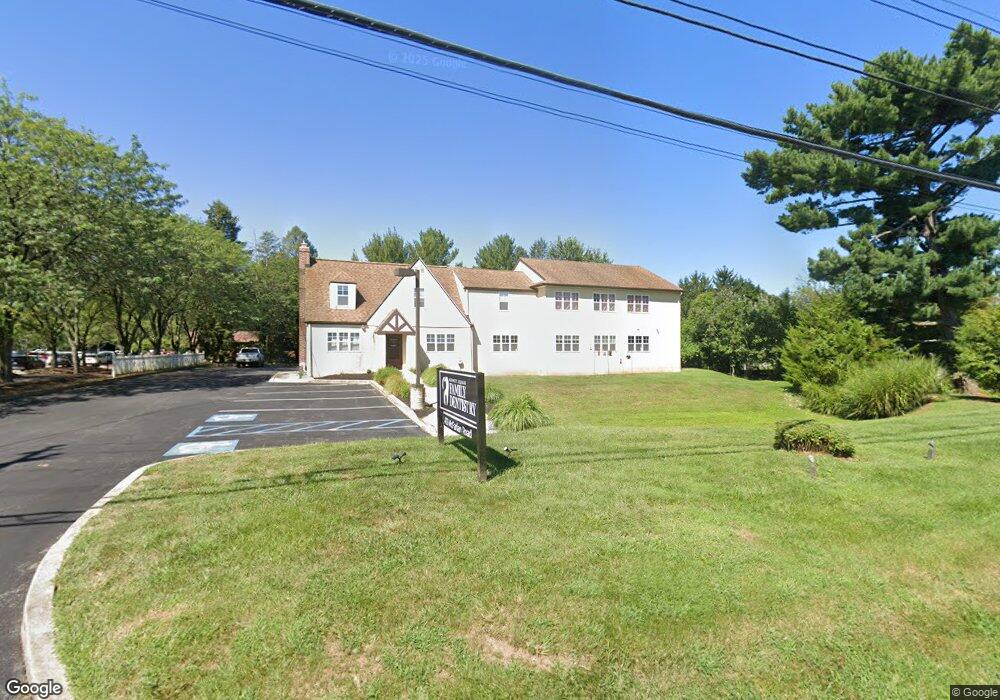
413 Mcfarlan Rd Kennett Square, PA 19348
Estimated Value: $764,522
3
Beds
1
Bath
4,682
Sq Ft
$163/Sq Ft
Est. Value
About This Home
This home is located at 413 Mcfarlan Rd, Kennett Square, PA 19348 and is currently estimated at $764,522, approximately $163 per square foot. 413 Mcfarlan Rd is a home located in Chester County with nearby schools including Kennett Middle School, Kennett High School, and St. Patrick School.
Ownership History
Date
Name
Owned For
Owner Type
Purchase Details
Closed on
Sep 20, 2024
Sold by
Tangco Property Llc
Bought by
413 Mcfarlan Rd Llc
Current Estimated Value
Home Financials for this Owner
Home Financials are based on the most recent Mortgage that was taken out on this home.
Original Mortgage
$505,000
Outstanding Balance
$495,459
Interest Rate
4.9%
Estimated Equity
$269,063
Purchase Details
Closed on
May 25, 2007
Sold by
Dr Albert J Schmitt Dmd Pc
Bought by
Tangco Property Llc
Home Financials for this Owner
Home Financials are based on the most recent Mortgage that was taken out on this home.
Original Mortgage
$570,000
Interest Rate
6.27%
Mortgage Type
Construction
Create a Home Valuation Report for This Property
The Home Valuation Report is an in-depth analysis detailing your home's value as well as a comparison with similar homes in the area
Home Values in the Area
Average Home Value in this Area
Purchase History
| Date | Buyer | Sale Price | Title Company |
|---|---|---|---|
| 413 Mcfarlan Rd Llc | $750,000 | None Listed On Document | |
| Tangco Property Llc | $173,191 | None Available |
Source: Public Records
Mortgage History
| Date | Status | Borrower | Loan Amount |
|---|---|---|---|
| Open | 413 Mcfarlan Rd Llc | $505,000 | |
| Closed | 413 Mcfarlan Rd Llc | $637,500 | |
| Previous Owner | Tangco Property Llc | $570,000 |
Source: Public Records
Tax History
| Year | Tax Paid | Tax Assessment Tax Assessment Total Assessment is a certain percentage of the fair market value that is determined by local assessors to be the total taxable value of land and additions on the property. | Land | Improvement |
|---|---|---|---|---|
| 2025 | $10,097 | $247,610 | $67,680 | $179,930 |
| 2024 | $10,097 | $247,610 | $67,680 | $179,930 |
| 2023 | $9,901 | $247,610 | $67,680 | $179,930 |
| 2022 | $9,637 | $247,610 | $67,680 | $179,930 |
| 2021 | $9,492 | $247,610 | $67,680 | $179,930 |
| 2020 | $9,315 | $247,610 | $67,680 | $179,930 |
| 2019 | $9,191 | $247,610 | $67,680 | $179,930 |
| 2018 | $9,000 | $247,610 | $67,680 | $179,930 |
| 2017 | $8,372 | $247,610 | $67,680 | $179,930 |
| 2016 | $982 | $247,610 | $67,680 | $179,930 |
| 2015 | $982 | $247,610 | $67,680 | $179,930 |
| 2014 | $982 | $247,610 | $67,680 | $179,930 |
Source: Public Records
Map
Nearby Homes
- 101 Keswick Ct
- 135 Waywood Dr
- 113 Waywood Dr Unit 32
- 103 Waywood Dr Unit 36
- 105 Waywood Dr
- 10104 Beacon St
- 10103 Beacon St
- 10101 Beacon St
- 10102 Beacon St
- 10102 Bramble St
- 10101 Austin Dr
- 10102 Austin Dr
- 10103 Louie Ln
- 10101 Bramble St
- 517 Louie Ln
- 10102 Louie Ln
- 10101 Louie Ln
- 527 Louie Ln
- 511 Louie Ln
- 10104 Louie Ln
- 413 Mcfarlan Rd Unit 2
- 413 Mcfarlan Rd Unit 3
- 411 Mcfarlan Rd
- 417 Mcfarlan Rd
- 434/436 Mcfarlan Rd
- 419 Mcfarlan Rd
- 410 Mcfarlan Rd
- 409 Mcfarlan Rd
- 415 Mcfarlan Rd Unit 213
- 415 Mcfarlan Rd Unit 205
- 415 Mcfarlan Rd Unit 112B
- 415 Mcfarlan Rd Unit 100
- 415 Mcfarlan Rd Unit 214
- 415 Mcfarlan Rd Unit 213
- 415 Mcfarlan Rd Unit 112-E
- 408 Mcfarlan Rd
- 712 E Baltimore Pike
- 710 E Baltimore Pike
- 708 E Baltimore Pike
- 706 E Baltimore Pike