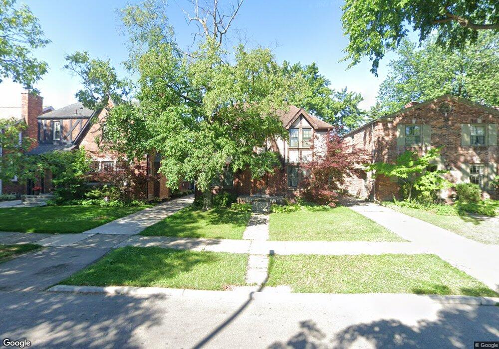
413 Moran Rd Grosse Pointe Farms, MI 48236
Estimated Value: $353,213 - $410,000
3
Beds
2
Baths
1,320
Sq Ft
$290/Sq Ft
Est. Value
About This Home
This home is located at 413 Moran Rd, Grosse Pointe Farms, MI 48236 and is currently estimated at $382,553, approximately $289 per square foot. 413 Moran Rd is a home located in Wayne County with nearby schools including Richard Elementary School, Brownell Middle School, and Grosse Pointe South High School.
Ownership History
Date
Name
Owned For
Owner Type
Purchase Details
Closed on
Jul 31, 2008
Sold by
Deyoung Michael and Deyoung Michelle
Bought by
Burrows Deanna
Current Estimated Value
Purchase Details
Closed on
Jun 9, 2004
Sold by
Bowler Steven C and Grabruck Kathleen M
Bought by
Deyoung Michael
Purchase Details
Closed on
Sep 10, 1996
Sold by
Christopher T and Christopher Robert L
Bought by
Steven C Bowler and Grabruck Kathleen M
Create a Home Valuation Report for This Property
The Home Valuation Report is an in-depth analysis detailing your home's value as well as a comparison with similar homes in the area
Home Values in the Area
Average Home Value in this Area
Purchase History
| Date | Buyer | Sale Price | Title Company |
|---|---|---|---|
| Burrows Deanna | $175,000 | Greco | |
| Deyoung Michael | $230,000 | Greco | |
| Steven C Bowler | $133,000 | -- |
Source: Public Records
Tax History Compared to Growth
Tax History
| Year | Tax Paid | Tax Assessment Tax Assessment Total Assessment is a certain percentage of the fair market value that is determined by local assessors to be the total taxable value of land and additions on the property. | Land | Improvement |
|---|---|---|---|---|
| 2025 | $2,546 | $162,200 | $0 | $0 |
| 2024 | $2,546 | $152,900 | $0 | $0 |
| 2023 | $2,426 | $141,200 | $0 | $0 |
| 2022 | $4,531 | $129,500 | $0 | $0 |
| 2021 | $4,281 | $118,200 | $0 | $0 |
| 2019 | $3,736 | $94,500 | $0 | $0 |
| 2018 | $2,049 | $93,100 | $0 | $0 |
| 2017 | $3,555 | $90,600 | $0 | $0 |
| 2016 | $3,726 | $88,900 | $0 | $0 |
| 2015 | $7,381 | $81,500 | $0 | $0 |
| 2013 | $7,150 | $71,500 | $0 | $0 |
| 2012 | $1,901 | $71,500 | $21,800 | $49,700 |
Source: Public Records
Map
Nearby Homes
- 415 Lothrop Rd
- 380 Merriweather Rd
- 975 Fisher Rd
- 343 Mount Vernon Ave
- 352 Mckinley Ave
- 317 Mount Vernon Ave
- 341 Mcmillan Rd
- 441 Manor St
- 314 Mount Vernon Ave
- 827 Fisher Rd
- 302 Mount Vernon Ave
- 876 Washington Rd
- 18119 Cornwall St
- 4598 Lodewyck St
- 471 Touraine Rd
- 276 Lewiston Rd
- 351 Moselle Place
- 265 Williams Ave
- 259 Mount Vernon Ave
- 432 Calvin Ave
- 422 Mckinley Ave
- 420 Mckinley Ave
- 424 Mckinley Ave
- 411 Moran Rd
- 415 Moran Rd
- 418 Mckinley Ave
- 426 Mckinley Ave
- 409 Moran Rd
- 417 Moran Rd
- 416 Mckinley Ave
- 407 Moran Rd
- 428 Mckinley Ave
- 419 Moran Rd
- 414 Mckinley Ave
- 405 Moran Rd
- 430 Mckinley Ave
- 421 Moran Rd
- 412 Mckinley Ave
- 403 Moran Rd
- 432 Mckinley Ave