Estimated Value: $741,000 - $842,000
4
Beds
4
Baths
3,388
Sq Ft
$238/Sq Ft
Est. Value
About This Home
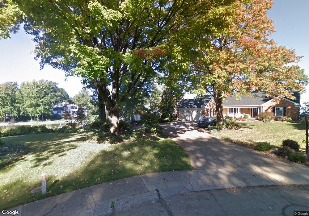
This home is located at 413 Newport Dr, Huron, OH 44839 and is currently estimated at $805,833, approximately $237 per square foot. 413 Newport Dr is a home located in Erie County with nearby schools including Shawnee Elementary School, Woodlands Intermediate School, and McCormick Junior High School.
Ownership History
Date
Name
Owned For
Owner Type
Purchase Details
Closed on
Oct 27, 2022
Sold by
Dalton Christopher
Bought by
Dalton Chris and Dalton Wendy
Current Estimated Value
Purchase Details
Closed on
Sep 17, 2008
Sold by
Hemker Charles D and Hemker Lisa M
Bought by
Dalton Christopher J
Home Financials for this Owner
Home Financials are based on the most recent Mortgage that was taken out on this home.
Original Mortgage
$544,000
Interest Rate
5%
Mortgage Type
Adjustable Rate Mortgage/ARM
Purchase Details
Closed on
Apr 4, 2003
Sold by
Holzapfel Richard D
Bought by
Hemker Charles D and Hemker Lisa M
Home Financials for this Owner
Home Financials are based on the most recent Mortgage that was taken out on this home.
Original Mortgage
$335,000
Interest Rate
2.87%
Mortgage Type
Unknown
Create a Home Valuation Report for This Property
The Home Valuation Report is an in-depth analysis detailing your home's value as well as a comparison with similar homes in the area
Home Values in the Area
Average Home Value in this Area
Purchase History
| Date | Buyer | Sale Price | Title Company |
|---|---|---|---|
| Dalton Chris | $500 | None Listed On Document | |
| Dalton Christopher J | $680,000 | Southern Title Of Ohio Ltd | |
| Hemker Charles D | $435,000 | Midland Title Security Inc |
Source: Public Records
Mortgage History
| Date | Status | Borrower | Loan Amount |
|---|---|---|---|
| Previous Owner | Dalton Christopher J | $544,000 | |
| Previous Owner | Hemker Charles D | $335,000 |
Source: Public Records
Tax History Compared to Growth
Tax History
| Year | Tax Paid | Tax Assessment Tax Assessment Total Assessment is a certain percentage of the fair market value that is determined by local assessors to be the total taxable value of land and additions on the property. | Land | Improvement |
|---|---|---|---|---|
| 2024 | $10,689 | $281,462 | $176,900 | $104,562 |
| 2023 | $10,689 | $228,119 | $160,818 | $67,301 |
| 2022 | $9,458 | $228,123 | $160,818 | $67,305 |
| 2021 | $9,399 | $227,340 | $160,820 | $66,520 |
| 2020 | $9,180 | $216,320 | $160,820 | $55,500 |
| 2019 | $9,585 | $216,320 | $160,820 | $55,500 |
| 2018 | $9,636 | $216,320 | $160,820 | $55,500 |
| 2017 | $7,245 | $158,090 | $108,230 | $49,860 |
| 2016 | $7,149 | $161,170 | $108,230 | $52,940 |
| 2015 | $7,141 | $161,170 | $108,230 | $52,940 |
| 2014 | $7,224 | $161,170 | $108,230 | $52,940 |
| 2013 | $7,121 | $161,170 | $108,230 | $52,940 |
Source: Public Records
Map
Nearby Homes
- 1120 By the Shores Dr Unit 2
- 1110 By the Shores Dr Unit 3
- 1135 Cleveland Rd E
- 1003 Cove Cir
- 516 Lincoln Ave
- 521 Washington Ave
- 542 Berlin Rd
- 1728 Shearwater Cir E
- 613 Oneida View Place
- 515 Berlin Rd
- 811 Berlin Rd
- 0 E Tracht Meadows Dr Unit 20252017
- 1318 Mirheath Dr
- 346 Main St
- 7311 Freeman Ln
- 4077 Coventry Cir
- 0 Main St
- 205 Wheeler Dr
- 927 Dallas Dr
- 505 Liberty Dr Unit 9B
- 412 Newport Dr
- 414 Newport Dr
- 415 Newport Dr
- 419 Newport Dr
- 416 Newport Dr
- 421 Newport Dr
- 1015 Beachside Ln
- 412 Dockway Dr
- 414 Dockway Dr
- 1021 Harborview Dr
- 423 Newport Dr
- 416 Dockway Dr
- 417 Newport Dr
- 1100 By-The-shores Dr Unit B2
- 1100 By-The-shores Dr Unit 4
- 1100 By-The-shores Dr Unit 1
- 1100 By-The-shores Dr Unit A 3
- 1100 By-The-shores Dr
- 1100 By-The-shores Dr Unit 6
- 1013 Beachside Ln