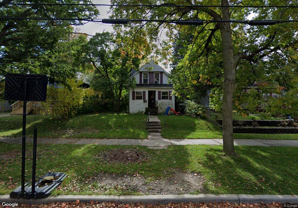
413 Smith Ave Lansing, MI 48910
Moores Park NeighborhoodEstimated Value: $94,000 - $139,000
3
Beds
2
Baths
900
Sq Ft
$122/Sq Ft
Est. Value
About This Home
This home is located at 413 Smith Ave, Lansing, MI 48910 and is currently estimated at $109,775, approximately $121 per square foot. 413 Smith Ave is a home located in Ingham County with nearby schools including Averill Elementary School, Pattengill Academy, and J.W. Sexton High School.
Ownership History
Date
Name
Owned For
Owner Type
Purchase Details
Closed on
Jul 6, 2011
Sold by
Opanasenko Terry
Bought by
Taft Street Llc
Current Estimated Value
Purchase Details
Closed on
Nov 19, 2009
Sold by
Kirby Douglas
Bought by
The Bank Of New York Mellon
Purchase Details
Closed on
Aug 29, 2006
Sold by
Norris Jaunell and Norris Gerald
Bought by
Kirby Douglas
Home Financials for this Owner
Home Financials are based on the most recent Mortgage that was taken out on this home.
Original Mortgage
$70,200
Interest Rate
10.5%
Mortgage Type
Purchase Money Mortgage
Purchase Details
Closed on
Aug 1, 2006
Sold by
Chase Home Finance Llc
Bought by
Homesales Inc
Home Financials for this Owner
Home Financials are based on the most recent Mortgage that was taken out on this home.
Original Mortgage
$70,200
Interest Rate
10.5%
Mortgage Type
Purchase Money Mortgage
Purchase Details
Closed on
Jul 27, 2006
Sold by
Norris Gerald and Norris Jaunell
Bought by
Chase Home Finance Llc
Home Financials for this Owner
Home Financials are based on the most recent Mortgage that was taken out on this home.
Original Mortgage
$70,200
Interest Rate
10.5%
Mortgage Type
Purchase Money Mortgage
Purchase Details
Closed on
Aug 1, 2004
Sold by
Norris Jaunell
Bought by
Kirby Douglas
Home Financials for this Owner
Home Financials are based on the most recent Mortgage that was taken out on this home.
Original Mortgage
$46,400
Interest Rate
9.62%
Mortgage Type
New Conventional
Purchase Details
Closed on
Jun 9, 2004
Sold by
Norris Kathryn E
Bought by
Norris Gerald and Norris Jaunell
Home Financials for this Owner
Home Financials are based on the most recent Mortgage that was taken out on this home.
Original Mortgage
$46,400
Interest Rate
9.62%
Mortgage Type
New Conventional
Purchase Details
Closed on
May 17, 2004
Sold by
Haynes Robert L and Haynes Ada Grace
Bought by
Webster Christopher B
Home Financials for this Owner
Home Financials are based on the most recent Mortgage that was taken out on this home.
Original Mortgage
$46,400
Interest Rate
9.62%
Mortgage Type
New Conventional
Purchase Details
Closed on
Oct 15, 1991
Sold by
Haynes Robert and Haynes Ada G
Bought by
Webster Christopher
Create a Home Valuation Report for This Property
The Home Valuation Report is an in-depth analysis detailing your home's value as well as a comparison with similar homes in the area
Home Values in the Area
Average Home Value in this Area
Purchase History
| Date | Buyer | Sale Price | Title Company |
|---|---|---|---|
| Taft Street Llc | -- | None Available | |
| The Bank Of New York Mellon | $54,900 | None Available | |
| Kirby Douglas | $78,000 | Titlequest | |
| Homesales Inc | -- | None Available | |
| Chase Home Finance Llc | $54,582 | None Available | |
| Kirby Douglas | $73,000 | None Available | |
| Norris Gerald | -- | Bell Title | |
| Norris Katherine E | $42,500 | Bell Title | |
| Webster Christopher B | $39,500 | Bell Title | |
| Webster Christopher | $39,500 | -- |
Source: Public Records
Mortgage History
| Date | Status | Borrower | Loan Amount |
|---|---|---|---|
| Previous Owner | Kirby Douglas | $70,200 | |
| Previous Owner | Norris Gerald | $46,400 |
Source: Public Records
Tax History
| Year | Tax Paid | Tax Assessment Tax Assessment Total Assessment is a certain percentage of the fair market value that is determined by local assessors to be the total taxable value of land and additions on the property. | Land | Improvement |
|---|---|---|---|---|
| 2025 | $3,098 | $45,000 | $5,200 | $39,800 |
| 2024 | $26 | $46,100 | $5,200 | $40,900 |
| 2023 | $3,444 | $40,400 | $5,200 | $35,200 |
| 2022 | $2,608 | $38,300 | $7,400 | $30,900 |
| 2021 | $2,474 | $34,600 | $5,300 | $29,300 |
| 2020 | $2,457 | $33,300 | $5,300 | $28,000 |
| 2019 | $4,288 | $30,400 | $5,300 | $25,100 |
| 2018 | $2,251 | $30,300 | $5,300 | $25,000 |
| 2017 | $2,166 | $30,300 | $5,300 | $25,000 |
| 2016 | $3,870 | $29,800 | $5,300 | $24,500 |
| 2015 | $3,870 | $28,500 | $10,614 | $17,886 |
| 2014 | $3,870 | $27,600 | $5,999 | $21,601 |
Source: Public Records
Map
Nearby Homes
- 1824 Davis Ave
- 1723 Osband Ave
- 310 W Barnes Ave
- 1917 Osband Ave
- 612 W Mount Hope Ave
- 205 Moores River Dr
- 717 Smith Ave
- 227 Woodlawn Ave
- 712 Lenore Ave
- 139 Woodlawn Ave
- 815 Smith Ave
- 900 W Mount Hope Ave
- 1807 Teel Ave
- 1408 Reo Ave
- 1406 Reo Ave
- 1917 Teel Ave
- 147 Isbell St
- 1017 W Barnes Ave
- 315 E Mount Hope Ave
- 1319 Pico Ave
Your Personal Tour Guide
Ask me questions while you tour the home.