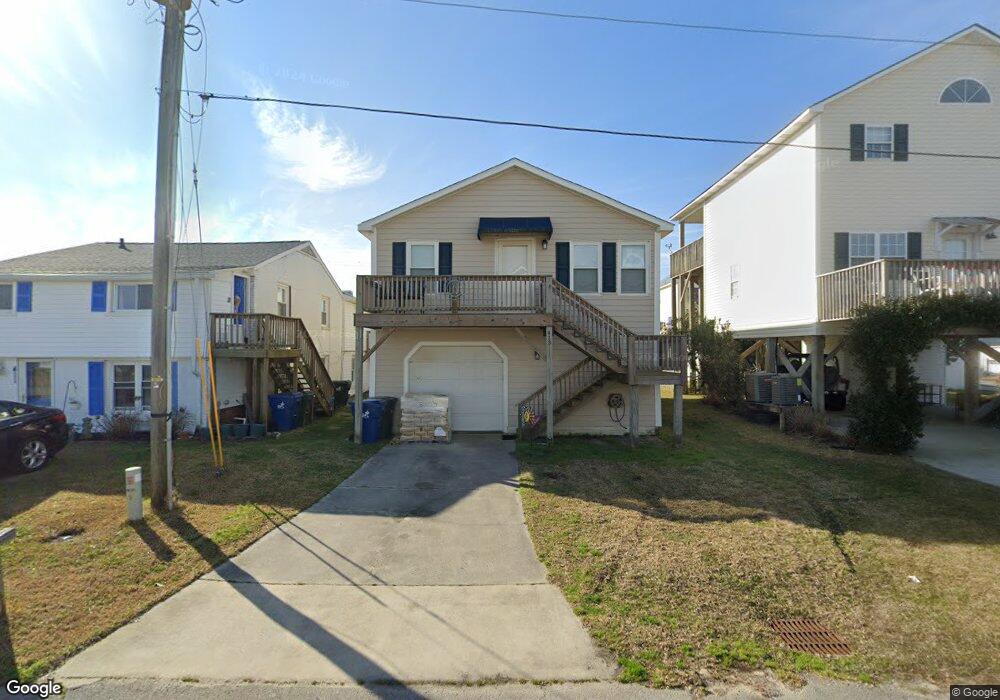
413 W Terminal Blvd Atlantic Beach, NC 28512
Estimated Value: $446,885 - $617,000
3
Beds
2
Baths
988
Sq Ft
$570/Sq Ft
Est. Value
About This Home
This home is located at 413 W Terminal Blvd, Atlantic Beach, NC 28512 and is currently estimated at $563,221, approximately $570 per square foot. 413 W Terminal Blvd is a home located in Carteret County with nearby schools including Morehead City Primary School, Morehead Elementary School at Camp Glenn, and Morehead City Middle School.
Ownership History
Date
Name
Owned For
Owner Type
Purchase Details
Closed on
May 15, 2023
Sold by
Hansley Bradley Patsy
Bought by
Tracy White Ethridge Revocable Trust
Current Estimated Value
Purchase Details
Closed on
Mar 3, 2009
Sold by
Bradley David J
Bought by
Bradley Patsy H
Create a Home Valuation Report for This Property
The Home Valuation Report is an in-depth analysis detailing your home's value as well as a comparison with similar homes in the area
Home Values in the Area
Average Home Value in this Area
Purchase History
| Date | Buyer | Sale Price | Title Company |
|---|---|---|---|
| Tracy White Ethridge Revocable Trust | -- | None Listed On Document | |
| Patsy Hansley Bradley Irrevocable Trust | -- | None Listed On Document | |
| Bradley Patsy H | -- | None Available |
Source: Public Records
Tax History Compared to Growth
Tax History
| Year | Tax Paid | Tax Assessment Tax Assessment Total Assessment is a certain percentage of the fair market value that is determined by local assessors to be the total taxable value of land and additions on the property. | Land | Improvement |
|---|---|---|---|---|
| 2025 | $1,296 | $532,561 | $274,897 | $257,664 |
| 2024 | $888 | $232,369 | $85,500 | $146,869 |
| 2023 | $805 | $232,369 | $85,500 | $146,869 |
| 2022 | $782 | $232,369 | $85,500 | $146,869 |
| 2021 | $465 | $232,369 | $85,500 | $146,869 |
| 2020 | $782 | $232,369 | $85,500 | $146,869 |
| 2019 | $796 | $252,009 | $130,500 | $121,509 |
| 2017 | $796 | $252,009 | $130,500 | $121,509 |
| 2016 | $796 | $252,009 | $130,500 | $121,509 |
| 2015 | $749 | $244,759 | $130,500 | $114,259 |
| 2014 | -- | $226,823 | $104,762 | $122,061 |
Source: Public Records
Map
Nearby Homes
- 415 W Boardwalk Blvd
- 108 W Terminal Blvd Unit B
- 503 W Bogue Blvd
- 117 W Bogue Blvd Unit A&B
- 117 W Bogue Blvd
- 602 Ft MacOn Rd W Unit 117
- 602 Ft MacOn Rd Unit 132
- 602 Ft MacOn Rd W Unit 231
- 602 W Fort MacOn Rd Unit 118
- 602 W Fort MacOn Rd Unit 242
- 602 W Fort MacOn Rd Unit 135
- 602 W Fort MacOn Rd Unit 204/139
- 602 W Fort MacOn Rd Unit 109
- 602 W Fort MacOn Rd Unit 139
- 602 Fort MacOn Rd
- 602 W Fort MacOn Rd Unit 231
- 100 Davis Blvd
- 121 Sound Dr
- 113 E Atlantic Blvd
- 108 N Kinston Ave
- 411 W Terminal Blvd
- 415 W Terminal Blvd
- 409 W Terminal Blvd
- 301 S Durham St
- 410 W Atlantic Blvd
- 414 W Atlantic Blvd
- 408 W Atlantic Blvd
- 410 W Atlantic Blvd Unit B
- 410 W Atlantic Blvd
- 416 W Atlantic Blvd
- 416 W Terminal Blvd
- 406 W Atlantic Blvd
- 414 W Terminal Blvd
- 410 W Terminal Blvd
- 406 W Atlantic Blvd Unit A
- 406 W Atlantic Blvd Unit B
- 403 W Terminal Blvd
- 500 W Atlantic Blvd
- 406 W Terminal Blvd
- 503 W Terminal Blvd