Estimated Value: $502,000 - $585,025
--
Bed
--
Bath
2,621
Sq Ft
$207/Sq Ft
Est. Value
About This Home
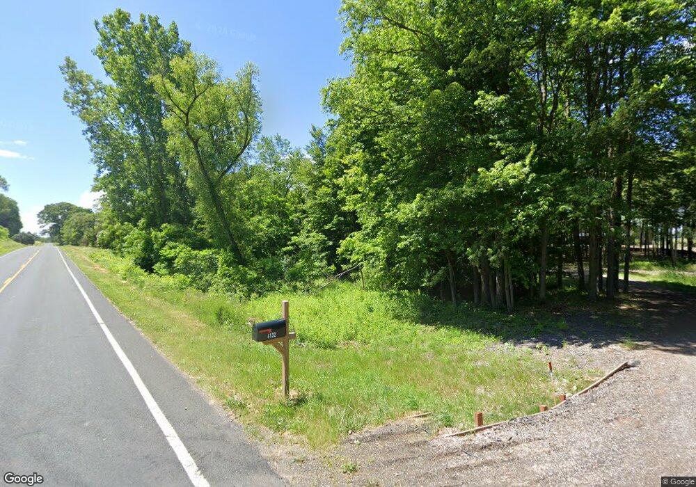
This home is located at 4132 32nd St, Dorr, MI 49323 and is currently estimated at $543,256, approximately $207 per square foot. 4132 32nd St is a home with nearby schools including Hamilton High School.
Ownership History
Date
Name
Owned For
Owner Type
Purchase Details
Closed on
May 20, 2022
Sold by
Nyenhuis and Cassandra
Bought by
Staal Todd and Staal Cheryl
Current Estimated Value
Purchase Details
Closed on
Sep 27, 2012
Sold by
Perry Carl W and Perry Nancy M
Bought by
Nyenhuis Jacob and Nyenhuis Cassandra
Home Financials for this Owner
Home Financials are based on the most recent Mortgage that was taken out on this home.
Original Mortgage
$44,800
Interest Rate
3.66%
Mortgage Type
Future Advance Clause Open End Mortgage
Purchase Details
Closed on
Jan 16, 2006
Sold by
Perry Carl W and Perry Nancy M
Bought by
Perry Carl W
Create a Home Valuation Report for This Property
The Home Valuation Report is an in-depth analysis detailing your home's value as well as a comparison with similar homes in the area
Home Values in the Area
Average Home Value in this Area
Purchase History
| Date | Buyer | Sale Price | Title Company |
|---|---|---|---|
| Staal Todd | $150,000 | None Listed On Document | |
| Nyenhuis Jacob | $56,000 | Devon Title Agency | |
| Perry Carl W | -- | None Available |
Source: Public Records
Mortgage History
| Date | Status | Borrower | Loan Amount |
|---|---|---|---|
| Previous Owner | Nyenhuis Jacob | $44,800 |
Source: Public Records
Tax History Compared to Growth
Tax History
| Year | Tax Paid | Tax Assessment Tax Assessment Total Assessment is a certain percentage of the fair market value that is determined by local assessors to be the total taxable value of land and additions on the property. | Land | Improvement |
|---|---|---|---|---|
| 2025 | $7,350 | $254,600 | $52,500 | $202,100 |
| 2024 | -- | $244,400 | $42,500 | $201,900 |
| 2023 | $2,452 | $69,100 | $38,000 | $31,100 |
| 2022 | $1,171 | $34,000 | $34,000 | $0 |
| 2021 | $1,163 | $35,000 | $35,000 | $0 |
| 2020 | $1,141 | $33,500 | $33,500 | $0 |
| 2019 | $1,117 | $28,000 | $28,000 | $0 |
| 2018 | $1,076 | $28,000 | $28,000 | $0 |
| 2017 | $0 | $27,500 | $27,500 | $0 |
| 2016 | $0 | $25,000 | $25,000 | $0 |
| 2015 | -- | $25,000 | $25,000 | $0 |
| 2014 | -- | $22,500 | $22,500 | $0 |
| 2013 | -- | $24,500 | $24,500 | $0 |
Source: Public Records
Map
Nearby Homes
- 3123 140th Ave
- 3449 Lone Oak Ln Unit 3
- 3465 Hawthorne Ct
- 3047 144th Ave
- 4510 32nd St
- 3453 138th Ave
- 2864 Fairway Dr
- 3819 Hare Ln Unit 3
- 4589 Winding Creek Ln
- 3215 136th Ave
- 4590 Winding Creek Ln Unit 2
- 3575 32nd St
- 2963 Mackenzie Dr
- 2579 142nd Ave
- 0 142nd Ave Unit 25028931
- Parcel A 30th St
- 4277 Mason St
- Parcel 1 146th Ave
- 2338 142nd Ave
- 3479 Jeffrey Spur
- 4141 32nd St
- 4111 32nd St
- 4151 32nd St
- 4100 32nd St
- 4155 32nd St
- 4140 Cottontail Ct
- 4182 32nd St
- 4154 Cottontail Ct
- 4087 32nd St
- 4095 32nd St
- 3184 142nd Ave
- 4170 Cottontail Ct
- 3198 142nd Ave
- 3196 142nd Ave
- 4143 Cottontail Ct
- 4155 Cottontail Ct
- 4167 Cottontail Ct
- 4182 Cottontail Ct Unit 10
- 0 Cottontail Ct Unit M15032941
- 0 Cottontail Ct Unit M16001009
