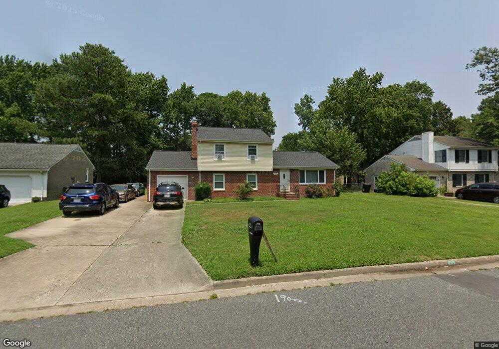
4132 Swannanoa Dr Portsmouth, VA 23703
Churchland NeighborhoodEstimated Value: $347,000 - $369,000
4
Beds
2
Baths
1,804
Sq Ft
$197/Sq Ft
Est. Value
About This Home
This home is located at 4132 Swannanoa Dr, Portsmouth, VA 23703 and is currently estimated at $355,887, approximately $197 per square foot. 4132 Swannanoa Dr is a home located in Portsmouth City with nearby schools including Churchland Primary/Intermediate School, Churchland Middle School, and Churchland High School.
Ownership History
Date
Name
Owned For
Owner Type
Purchase Details
Closed on
Oct 1, 2002
Sold by
Edmondson Angela Nichole
Bought by
Anderson Eddie
Current Estimated Value
Home Financials for this Owner
Home Financials are based on the most recent Mortgage that was taken out on this home.
Original Mortgage
$137,738
Outstanding Balance
$57,664
Interest Rate
6.27%
Mortgage Type
FHA
Estimated Equity
$298,223
Create a Home Valuation Report for This Property
The Home Valuation Report is an in-depth analysis detailing your home's value as well as a comparison with similar homes in the area
Home Values in the Area
Average Home Value in this Area
Purchase History
| Date | Buyer | Sale Price | Title Company |
|---|---|---|---|
| Anderson Eddie | $140,000 | -- |
Source: Public Records
Mortgage History
| Date | Status | Borrower | Loan Amount |
|---|---|---|---|
| Open | Anderson Eddie | $137,738 |
Source: Public Records
Tax History Compared to Growth
Tax History
| Year | Tax Paid | Tax Assessment Tax Assessment Total Assessment is a certain percentage of the fair market value that is determined by local assessors to be the total taxable value of land and additions on the property. | Land | Improvement |
|---|---|---|---|---|
| 2025 | $4,169 | $333,460 | $93,000 | $240,460 |
| 2024 | $4,169 | $325,000 | $93,000 | $232,000 |
| 2023 | $3,809 | $304,680 | $93,000 | $211,680 |
| 2022 | $3,473 | $267,160 | $77,500 | $189,660 |
| 2021 | $3,168 | $243,690 | $62,500 | $181,190 |
| 2020 | $3,085 | $237,330 | $59,520 | $177,810 |
| 2019 | $2,975 | $228,860 | $59,520 | $169,340 |
| 2018 | $2,975 | $228,860 | $59,520 | $169,340 |
| 2017 | $2,975 | $228,860 | $59,520 | $169,340 |
| 2016 | $2,975 | $228,860 | $59,520 | $169,340 |
| 2015 | $2,966 | $228,160 | $59,520 | $168,640 |
| 2014 | $2,898 | $228,160 | $59,520 | $168,640 |
Source: Public Records
Map
Nearby Homes
- 4200 Quince Rd
- 4028 Swannanoa Dr
- 4224 Burnham Dr
- 4232 Summerset Dr
- 5807 Dunkin St
- 5833 Hawthorne Ln
- 5728 Hawthorne Ln
- 4100 Mayfair Way
- 3433 Willow Breeze Dr
- 4008 Oakhurst Rd
- 5606 Gregory Ct
- 21 Windy Pines Crescent
- 8 Compass Ct
- 4444 Southampton Arch
- 17 Shoal Ct
- 5693 Rivermill Cir
- 3860 Sugar Creek Cir
- 3866 Augustine Cir
- 5806 Fawkes St
- 4071 Long Point Blvd
- 4200 Swannanoa Dr
- 4128 Swannanoa Dr
- 4204 Swannanoa Dr
- 4129 Swannanoa Dr
- 4124 Swannanoa Dr
- 4125 Swannanoa Dr
- 4201 Swannanoa Dr
- 5813 Craneybrook Ln
- 4121 Swannanoa Dr
- 4205 Swannanoa Dr
- 4208 Swannanoa Dr
- 5821 Craneybrook Ln
- 4120 Swannanoa Dr
- 5809 Craneybrook Ln
- 4128 Sunnyfields Rd
- 4200 Sunnyfields Rd
- 4117 Swannanoa Dr
- 4209 Swannanoa Dr
- 4120 Sunnyfields Rd
- 5805 Craneybrook Ln