Estimated Value: $93,000 - $162,000
3
Beds
1
Bath
600
Sq Ft
$223/Sq Ft
Est. Value
About This Home
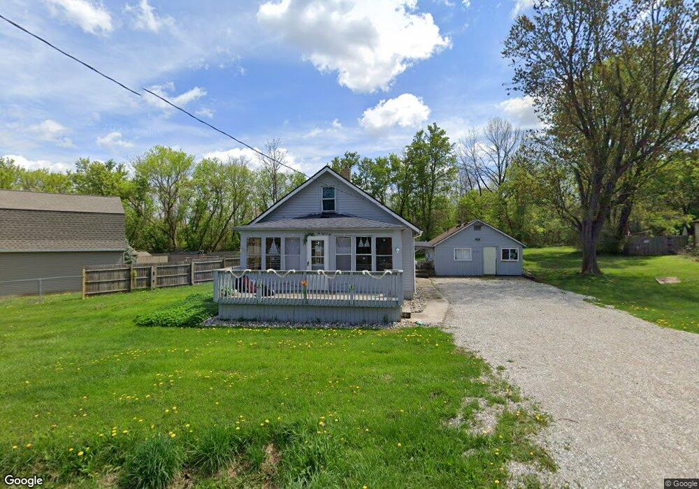
This home is located at 4135 Corbin Dr Unit DRIVE, Flint, MI 48532 and is currently estimated at $133,996, approximately $223 per square foot. 4135 Corbin Dr Unit DRIVE is a home located in Genesee County with nearby schools including Carman-Ainsworth High School, Genesee STEM Academy, and St. Paul Lutheran School.
Ownership History
Date
Name
Owned For
Owner Type
Purchase Details
Closed on
Jan 31, 2017
Sold by
Waterson Alfred
Bought by
Mark Vii Llc
Current Estimated Value
Purchase Details
Closed on
Dec 20, 2016
Sold by
Hodgeson Elayna Lee
Bought by
Waterson Alfred
Purchase Details
Closed on
Feb 20, 2015
Sold by
Hodgeson Elayna L
Bought by
Waterson Alfred
Purchase Details
Closed on
Dec 8, 2014
Sold by
Hodgeson Elayna L
Bought by
Waterson Alfred
Purchase Details
Closed on
Oct 17, 2012
Sold by
Johnson Kenneth R and Johnson Linda D
Bought by
Harner Rebecca L
Purchase Details
Closed on
Aug 1, 2012
Sold by
Johnson Kenneth R and Johnson Linda D
Bought by
First Place Bank and Franklin Bank
Create a Home Valuation Report for This Property
The Home Valuation Report is an in-depth analysis detailing your home's value as well as a comparison with similar homes in the area
Home Values in the Area
Average Home Value in this Area
Purchase History
| Date | Buyer | Sale Price | Title Company |
|---|---|---|---|
| Mark Vii Llc | -- | None Available | |
| Waterson Alfred | $17,400 | None Available | |
| Waterson Alfred | -- | Lighthouse Title Inc | |
| Waterson Alfred | -- | Lighthouse Title Inc | |
| Harner Rebecca L | $6,250 | First American Title Ins Co | |
| First Place Bank | $30,756 | None Available |
Source: Public Records
Tax History
| Year | Tax Paid | Tax Assessment Tax Assessment Total Assessment is a certain percentage of the fair market value that is determined by local assessors to be the total taxable value of land and additions on the property. | Land | Improvement |
|---|---|---|---|---|
| 2025 | $1,784 | $50,100 | $0 | $0 |
| 2024 | $1,113 | $42,500 | $0 | $0 |
| 2023 | $1,052 | $39,800 | $0 | $0 |
| 2022 | $605 | $30,400 | $0 | $0 |
| 2021 | $593 | $26,700 | $0 | $0 |
| 2020 | $950 | $25,400 | $0 | $0 |
| 2019 | $938 | $23,300 | $0 | $0 |
| 2018 | $1,471 | $22,900 | $0 | $0 |
| 2017 | $1,382 | $22,900 | $0 | $0 |
| 2016 | $1,929 | $22,800 | $0 | $0 |
| 2015 | $843 | $21,300 | $0 | $0 |
Source: Public Records
Map
Nearby Homes
- 18.41 Taft Rd
- 4051 Red Wing Dr
- 1512 Crescent Lane Dr Lot#46
- 10 Acres T A Mansour Blvd
- 2379 Hialeah Dr
- 3277 Whitney Ave
- VL Clairmont St
- 3045 Old Farm Rd
- 4335 Lennon Rd
- 3088 Curtis Dr
- 4474 Corunna Rd
- 1455 S Linden Rd
- 4199 Sheraton Dr
- 4480 Corunna Rd
- 2521 White Oak Place
- 4490 W Lennon Rd
- 3139 Red Barn Rd
- 0 Charter Dr Unit 50153638
- 3825 Arlene Ave
- 3.9 Acres W Court St
Your Personal Tour Guide
Ask me questions while you tour the home.