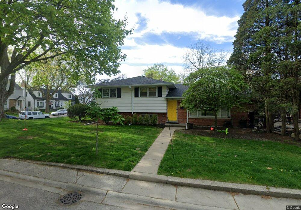
4135 Crain St Skokie, IL 60076
North Skokie NeighborhoodEstimated Value: $424,000 - $447,000
3
Beds
2
Baths
1,363
Sq Ft
$321/Sq Ft
Est. Value
About This Home
This home is located at 4135 Crain St, Skokie, IL 60076 and is currently estimated at $437,665, approximately $321 per square foot. 4135 Crain St is a home located in Cook County with nearby schools including Elizabeth Meyer School, John Middleton Elementary School, and Oliver Mccracken Middle School.
Ownership History
Date
Name
Owned For
Owner Type
Purchase Details
Closed on
Oct 21, 2014
Sold by
Lutfallah George and Zipprich Ellen
Bought by
Lutfallah George and Zipprich Ellen
Current Estimated Value
Purchase Details
Closed on
Jan 17, 2014
Sold by
Consortian Development Llc
Bought by
Lutfallah George
Purchase Details
Closed on
Aug 9, 2013
Sold by
Declaratio Mancoff Debra
Bought by
Consortian Development Llc
Create a Home Valuation Report for This Property
The Home Valuation Report is an in-depth analysis detailing your home's value as well as a comparison with similar homes in the area
Home Values in the Area
Average Home Value in this Area
Purchase History
| Date | Buyer | Sale Price | Title Company |
|---|---|---|---|
| Lutfallah George | -- | None Available | |
| Lutfallah George | $275,000 | Nat | |
| Consortian Development Llc | $160,000 | Ct |
Source: Public Records
Tax History Compared to Growth
Tax History
| Year | Tax Paid | Tax Assessment Tax Assessment Total Assessment is a certain percentage of the fair market value that is determined by local assessors to be the total taxable value of land and additions on the property. | Land | Improvement |
|---|---|---|---|---|
| 2024 | $6,745 | $27,992 | $6,188 | $21,804 |
| 2023 | $6,544 | $29,648 | $6,188 | $23,460 |
| 2022 | $6,544 | $29,648 | $6,188 | $23,460 |
| 2021 | $5,652 | $23,314 | $4,354 | $18,960 |
| 2020 | $5,645 | $23,314 | $4,354 | $18,960 |
| 2019 | $5,717 | $25,948 | $4,354 | $21,594 |
| 2018 | $6,218 | $23,081 | $3,781 | $19,300 |
| 2017 | $6,263 | $23,081 | $3,781 | $19,300 |
| 2016 | $5,988 | $23,081 | $3,781 | $19,300 |
| 2015 | $5,382 | $19,281 | $3,208 | $16,073 |
| 2014 | $5,256 | $19,281 | $3,208 | $16,073 |
| 2013 | $5,699 | $20,952 | $3,208 | $17,744 |
Source: Public Records
Map
Nearby Homes
- 8720 Karlov Ave
- 3615 Oakton St
- 8449 Kedvale Ave
- 3358 Dempster St
- 4218 Main St
- 8451 Harding Ave
- 8417 Harding Ave
- 4410 Bobolink Terrace
- 9010 Keeler Ave
- 8301 Karlov Ave
- 8600 E Prairie Rd
- 8330 Springfield Ave
- 8228 Kedvale Ave
- 4343 Davis St
- 8240 Lowell Ave
- 40 Williamsburg Rd
- 8231 Harding Ave
- 7825 Kolmar Ave
- 8219 Lowell Ave
- 3639 Crain St
- 4135 Crain St
- 8652 Kedvale Ave
- 8646 Kedvale Ave
- 8642 Kedvale Ave
- 4140 Crain St
- 8659 Keeler Ave
- 8653 Keeler Ave
- 8640 Kedvale Ave
- 8653 Kedvale Ave
- 8649 Keeler Ave
- 8651 Kedvale Ave
- 8636 Kedvale Ave
- 8641 Keeler Ave
- 8701 Keeler Ave
- 8645 Kedvale Ave
- 8706 Kedvale Ave
- 8706 Kedvale Ave
- 8701 Kedvale Ave
- 8635 Kedvale Ave
- 8711 Keeler Ave