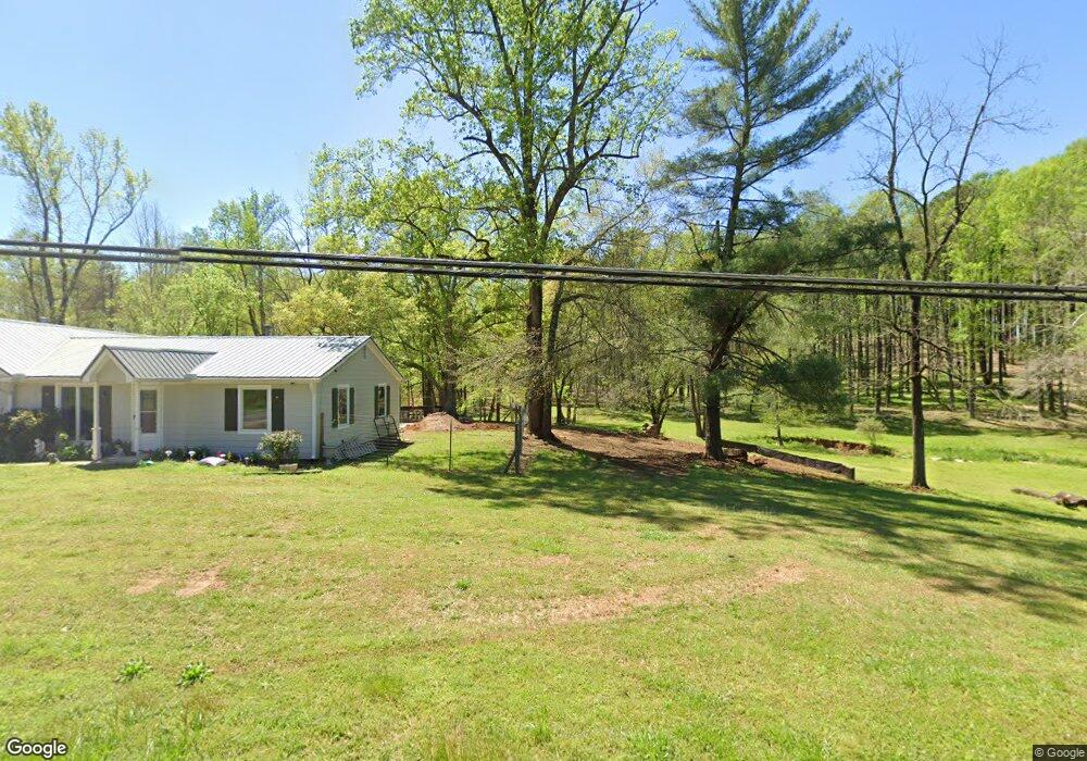
4135 Dahlonega Hwy Cumming, GA 30028
Estimated Value: $565,000 - $1,244,392
3
Beds
2
Baths
2,254
Sq Ft
$401/Sq Ft
Est. Value
About This Home
This home is located at 4135 Dahlonega Hwy, Cumming, GA 30028 and is currently estimated at $904,696, approximately $401 per square foot. 4135 Dahlonega Hwy is a home located in Forsyth County with nearby schools including Coal Mountain Elementary School, North Forsyth Middle School, and North Forsyth High School.
Ownership History
Date
Name
Owned For
Owner Type
Purchase Details
Closed on
Jan 25, 2024
Sold by
Brooks Lora Anne Townsend and Brooks Christopher S
Bought by
Dahlonega One Llc
Current Estimated Value
Purchase Details
Closed on
Mar 7, 2017
Sold by
Brooks Lora Anne Townsend
Bought by
Brooks Lora Anne Townsend and Brooks Christopher S
Purchase Details
Closed on
Jul 27, 2016
Sold by
Grogan Carolyn
Bought by
Brooks Lora Anne Townsend
Purchase Details
Closed on
Mar 7, 2013
Sold by
Townsend Carolyn
Bought by
Townsend Lawrence D
Home Financials for this Owner
Home Financials are based on the most recent Mortgage that was taken out on this home.
Original Mortgage
$257,200
Interest Rate
3.56%
Mortgage Type
New Conventional
Create a Home Valuation Report for This Property
The Home Valuation Report is an in-depth analysis detailing your home's value as well as a comparison with similar homes in the area
Home Values in the Area
Average Home Value in this Area
Purchase History
| Date | Buyer | Sale Price | Title Company |
|---|---|---|---|
| Dahlonega One Llc | -- | None Listed On Document | |
| Brooks Lora Anne Townsend | -- | -- | |
| Brooks Lora Anne Townsend | -- | -- | |
| Townsend Lawrence D | -- | -- |
Source: Public Records
Mortgage History
| Date | Status | Borrower | Loan Amount |
|---|---|---|---|
| Previous Owner | Townsend Lawrence D | $257,200 |
Source: Public Records
Tax History Compared to Growth
Tax History
| Year | Tax Paid | Tax Assessment Tax Assessment Total Assessment is a certain percentage of the fair market value that is determined by local assessors to be the total taxable value of land and additions on the property. | Land | Improvement |
|---|---|---|---|---|
| 2025 | $12,293 | $558,684 | $318,864 | $239,820 |
| 2024 | $12,293 | $501,316 | $267,788 | $233,528 |
| 2023 | $11,643 | $473,012 | $258,552 | $214,460 |
| 2022 | $10,155 | $285,180 | $162,888 | $122,292 |
| 2021 | $7,875 | $285,180 | $162,888 | $122,292 |
| 2020 | $7,727 | $279,836 | $162,888 | $116,948 |
| 2019 | $6,378 | $230,628 | $114,624 | $116,004 |
| 2018 | $6,094 | $220,364 | $114,624 | $105,740 |
| 2017 | $5,270 | $189,900 | $90,492 | $99,408 |
| 2016 | $1,328 | $162,004 | $72,396 | $99,408 |
| 2015 | $1,249 | $162,004 | $62,596 | $99,408 |
| 2014 | $1,121 | $153,420 | $62,596 | $90,824 |
Source: Public Records
Map
Nearby Homes
- 4740 Alford Commons
- 4580 Orchard Ridge Ct
- 3925 Mark Lake Rd
- 4540 Bluffton Ct
- 4685 Orchard View Way
- 4455 Orchard Lake Dr
- 4660 Trailwinds Run
- 5540 Bucknell Trace
- 5345 Bucknell Trace
- 3530 Dahlonega Hwy
- 3534 Dahlonega Hwy
- 4620 Oak Grove Cir
- 4775 Baldwin Dr
- 5160 Bucknell Trace
- 4425 Huron Dr
- 4750 Beechnut Cir
- 4250 Pembia Dr
- 4095 Dahlonega Hwy
- 4080 Mark Lake Rd
- 4090 Mark Lake Rd
- 4175 Dahlonega Hwy
- 4310 Deerfield Rd Unit III
- 4290 Deerfield Rd
- 4215 Dahlonega Hwy
- 4780 Alford Common
- 4780 Alford Commons
- 3996 Mark Lake Rd
- 4060 Mark Lake Rd
- 4070 Mark Lake Rd
- 4790 Alford Common
- 4770 Alford Commons
- 4330 Deerfield Rd
- 4760 Alford Common Unit 203
- 4785 Alford Common
- 4240 Deerfield Rd
- 4085 Dahlonega Hwy
- 4020 Mark Lake Rd