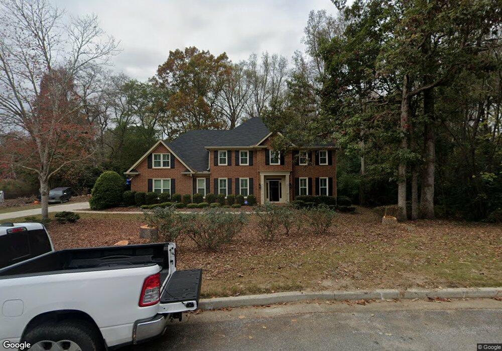
4136 Knollcrest Cir N Augusta, GA 30907
Estimated Value: $484,569 - $508,000
5
Beds
4
Baths
3,400
Sq Ft
$146/Sq Ft
Est. Value
About This Home
This home is located at 4136 Knollcrest Cir N, Augusta, GA 30907 and is currently estimated at $495,892, approximately $145 per square foot. 4136 Knollcrest Cir N is a home located in Columbia County with nearby schools including Jupiter Elementary School, Martinez Elementary School, and Evans Middle School.
Ownership History
Date
Name
Owned For
Owner Type
Purchase Details
Closed on
Nov 4, 2022
Sold by
Holloway Hale J
Bought by
Harris Robert S and Harris Deborah V
Current Estimated Value
Purchase Details
Closed on
Mar 2, 2016
Sold by
Holloway Heather G
Bought by
Holloway Hale J
Purchase Details
Closed on
Aug 2, 2006
Sold by
Cyran Frederick A
Bought by
Holloway Hale J
Home Financials for this Owner
Home Financials are based on the most recent Mortgage that was taken out on this home.
Original Mortgage
$246,000
Interest Rate
6.71%
Create a Home Valuation Report for This Property
The Home Valuation Report is an in-depth analysis detailing your home's value as well as a comparison with similar homes in the area
Home Values in the Area
Average Home Value in this Area
Purchase History
| Date | Buyer | Sale Price | Title Company |
|---|---|---|---|
| Harris Robert S | $450,000 | -- | |
| Holloway Hale J | -- | -- | |
| Holloway Hale J | $321,000 | -- |
Source: Public Records
Mortgage History
| Date | Status | Borrower | Loan Amount |
|---|---|---|---|
| Previous Owner | Holloway Hale J | $246,000 |
Source: Public Records
Tax History Compared to Growth
Tax History
| Year | Tax Paid | Tax Assessment Tax Assessment Total Assessment is a certain percentage of the fair market value that is determined by local assessors to be the total taxable value of land and additions on the property. | Land | Improvement |
|---|---|---|---|---|
| 2025 | $4,841 | $202,546 | $29,647 | $172,899 |
| 2024 | $4,984 | $199,130 | $23,842 | $175,288 |
| 2023 | $4,984 | $171,597 | $27,620 | $143,977 |
| 2022 | $3,803 | $144,124 | $24,394 | $119,730 |
| 2021 | $3,783 | $137,017 | $22,367 | $114,650 |
| 2020 | $3,338 | $118,142 | $20,340 | $97,802 |
| 2019 | $3,332 | $117,941 | $20,985 | $96,956 |
| 2018 | $3,176 | $111,946 | $19,694 | $92,252 |
| 2017 | $3,307 | $116,222 | $22,183 | $94,039 |
| 2016 | $3,216 | $117,174 | $20,316 | $96,858 |
| 2015 | $3,208 | $116,629 | $19,578 | $97,051 |
| 2014 | $3,343 | $120,149 | $21,053 | $99,096 |
Source: Public Records
Map
Nearby Homes
- 4130 Knollcrest Cir N
- 168 Cofield Rd
- 4123 Knollcrest Cir N
- 245 Kestwick Dr W
- 522 Gray Dr
- 4222 Green Ivy Cir
- 4350 Quail Creek Rd
- 4182 Knollcrest Cir N Unit N.
- 4129 Allison Rd
- 110 Redbud Ln
- 4134 Allison Rd
- 4366 Quail Creek Rd
- 4373 Quail Creek Rd
- 4127 Meriden Dr
- 4212 Knollcrest Cir S
- 126 Wood Creek Dr
- 302 Summer Place
- 361 Paces Ferry Rd
- 373 Forest Ct
- 4355 Columbia Rd
- 4136 N Knollcrest Circle Cir N
- 4138 Knollcrest Cir N
- 4134 Knollcrest Cir N
- 186 Stone Mill Dr
- 184 Stone Mill Dr
- 4141 Knollcrest Cir N
- 4140 Knollcrest Cir N
- 171 Kestwick Dr W
- 188 Stone Mill Dr
- 182 Stone Mill Dr
- 177 Kestwick Dr W
- 4143 Knollcrest Cir N
- 4142 Knollcrest Cir N
- 169 Kestwick Dr E
- 176 Springlakes Ct
- 0 W Kestwick Dr Unit 520879
- 0 W Kestwick Dr Unit 504248
- 179 Kestwick Dr W
- 4135 Knollcrest Cir N
- 4145 Knollcrest Cir N