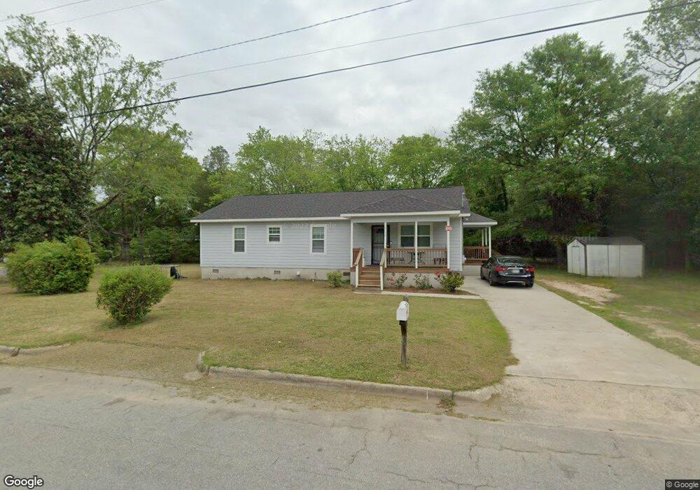
4136 Roy Ave Macon, GA 31206
Estimated Value: $129,000 - $203,000
4
Beds
2
Baths
1,500
Sq Ft
$108/Sq Ft
Est. Value
About This Home
This home is located at 4136 Roy Ave, Macon, GA 31206 and is currently estimated at $161,344, approximately $107 per square foot. 4136 Roy Ave is a home with nearby schools including Bruce Elementary School, Rutland Middle School, and Rutland High School.
Ownership History
Date
Name
Owned For
Owner Type
Purchase Details
Closed on
Apr 12, 2012
Sold by
Macon Area Habitat For Humanity Inc
Bought by
Parks Kristy Rochelle
Current Estimated Value
Home Financials for this Owner
Home Financials are based on the most recent Mortgage that was taken out on this home.
Original Mortgage
$85,000
Outstanding Balance
$35,131
Interest Rate
3.9%
Mortgage Type
Seller Take Back
Estimated Equity
$126,213
Purchase Details
Closed on
Nov 16, 2009
Sold by
Pankow Christopher
Bought by
Macon Area Habitat For Humanity Inc
Purchase Details
Closed on
Jan 24, 2000
Bought by
Pankow Christopher
Create a Home Valuation Report for This Property
The Home Valuation Report is an in-depth analysis detailing your home's value as well as a comparison with similar homes in the area
Purchase History
| Date | Buyer | Sale Price | Title Company |
|---|---|---|---|
| Parks Kristy Rochelle | $95,080 | None Available | |
| Macon Area Habitat For Humanity Inc | $6,500 | None Available | |
| Pankow Christopher | $40,000 | -- |
Source: Public Records
Mortgage History
| Date | Status | Borrower | Loan Amount |
|---|---|---|---|
| Open | Parks Kristy Rochelle | $85,000 |
Source: Public Records
Tax History
| Year | Tax Paid | Tax Assessment Tax Assessment Total Assessment is a certain percentage of the fair market value that is determined by local assessors to be the total taxable value of land and additions on the property. | Land | Improvement |
|---|---|---|---|---|
| 2025 | $1,642 | $73,826 | $3,650 | $70,176 |
| 2024 | $1,697 | $73,826 | $3,650 | $70,176 |
| 2023 | $797 | $56,373 | $3,650 | $52,723 |
| 2022 | $1,420 | $48,010 | $4,081 | $43,929 |
| 2021 | $1,001 | $33,347 | $2,597 | $30,750 |
| 2020 | $861 | $29,182 | $2,782 | $26,400 |
| 2019 | $761 | $26,450 | $2,226 | $24,224 |
| 2018 | $588 | $13,812 | $2,226 | $11,586 |
| 2017 | $799 | $28,336 | $2,226 | $26,110 |
| 2016 | $738 | $28,336 | $2,226 | $26,110 |
| 2015 | $1,031 | $28,039 | $2,226 | $25,813 |
| 2014 | $1,410 | $31,126 | $3,204 | $27,922 |
Source: Public Records
Map
Nearby Homes
- 4124 Worsham Ave
- 4030 Marion Ave
- 4319 Worsham Ave
- 4189 Marion Ave
- 4062 Broadway
- 4268 Marion Ave
- 563 Carmen Place
- 4054 Marion Ave
- 4255 Worsham Ave
- 4283 Irving Ave
- 708 Richmond St Unit 1
- 4301 Marion Ave
- 4305 Marion Ave
- 823 Fulton St
- 3861 Desoto Dr
- 579 Lynmore Ave
- 3897 Tela Place
- 4195 Mikado Ave
- 925 Troupe St
- 863 Richmond St
- 4070 Marion Ave
- 4076 Marion Ave
- 4087 Marion Ave
- 4144 Roy Ave
- 4137 Roy Ave
- 4072 Marion Ave
- 4097 Marion Ave
- 4101 Marion Ave
- 4077 Marion Ave
- 4151 Roy Ave
- 4071 Marion Ave
- 4109 Marion Ave
- 4143 Dorothy Ave
- 4159 Roy Ave Unit 102-A5
- 4159 Roy Ave
- 4149 Dorothy Ave
- 4114 Marion Ave
- 4088 Worsham Ave
- 4092 Worsham Ave
- 4084 Worsham Ave
Your Personal Tour Guide
Ask me questions while you tour the home.