Estimated Value: $204,000 - $274,000
3
Beds
2
Baths
1,452
Sq Ft
$163/Sq Ft
Est. Value
About This Home
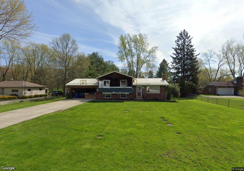
This home is located at 4136 Sherman Rd, Kent, OH 44240 and is currently estimated at $236,272, approximately $162 per square foot. 4136 Sherman Rd is a home located in Portage County with nearby schools including Brimfield Elementary School, Field Middle School, and Field High School.
Ownership History
Date
Name
Owned For
Owner Type
Purchase Details
Closed on
Dec 6, 2018
Sold by
Davis Chester M
Bought by
Davis Douglas and Davis Dawn
Current Estimated Value
Home Financials for this Owner
Home Financials are based on the most recent Mortgage that was taken out on this home.
Original Mortgage
$103,900
Outstanding Balance
$66,178
Interest Rate
4.8%
Mortgage Type
New Conventional
Estimated Equity
$170,094
Purchase Details
Closed on
Apr 21, 2005
Sold by
Matteson Charles J and Matteson Dorcas M
Bought by
Davis Chester M
Home Financials for this Owner
Home Financials are based on the most recent Mortgage that was taken out on this home.
Original Mortgage
$112,800
Interest Rate
5.89%
Mortgage Type
Fannie Mae Freddie Mac
Purchase Details
Closed on
Jan 1, 1990
Bought by
Matteson Charles J
Create a Home Valuation Report for This Property
The Home Valuation Report is an in-depth analysis detailing your home's value as well as a comparison with similar homes in the area
Home Values in the Area
Average Home Value in this Area
Purchase History
| Date | Buyer | Sale Price | Title Company |
|---|---|---|---|
| Davis Douglas | $115,900 | Titleco Title Agency | |
| Davis Chester M | $141,000 | Cardinal First Title Inc | |
| Matteson Charles J | -- | -- |
Source: Public Records
Mortgage History
| Date | Status | Borrower | Loan Amount |
|---|---|---|---|
| Open | Davis Douglas | $103,900 | |
| Previous Owner | Davis Chester M | $112,800 | |
| Closed | Davis Chester M | $14,100 |
Source: Public Records
Tax History Compared to Growth
Tax History
| Year | Tax Paid | Tax Assessment Tax Assessment Total Assessment is a certain percentage of the fair market value that is determined by local assessors to be the total taxable value of land and additions on the property. | Land | Improvement |
|---|---|---|---|---|
| 2024 | $3,090 | $64,510 | $15,750 | $48,760 |
| 2023 | $2,779 | $46,590 | $9,870 | $36,720 |
| 2022 | $2,787 | $46,590 | $9,870 | $36,720 |
| 2021 | $2,712 | $46,590 | $9,870 | $36,720 |
| 2020 | $2,399 | $37,280 | $9,870 | $27,410 |
| 2019 | $2,371 | $37,280 | $9,870 | $27,410 |
| 2018 | $1,922 | $37,100 | $9,870 | $27,230 |
| 2017 | $2,164 | $37,100 | $9,870 | $27,230 |
| 2016 | $1,986 | $37,100 | $9,870 | $27,230 |
| 2015 | $1,944 | $37,100 | $9,870 | $27,230 |
| 2014 | $1,885 | $37,100 | $9,870 | $27,230 |
| 2013 | $1,842 | $37,100 | $9,870 | $27,230 |
Source: Public Records
Map
Nearby Homes
- 4088 Lynwood Dr
- 3868 Willow Way
- 3793 Ranfield Rd
- 1523 Queenstown Rd
- 3672 Elmhurst Ct
- 3658 Elmhurst Ct
- 3579 Elmhurst Ct
- 1418 Arcadia Rd
- 1354 Brimfield Dr
- 3517 Jameson Dr
- 3434 Lawndale Dr
- 4891 Edson Rd
- 1489 Old Forge Rd
- 1330 Highpoint St
- 2092 Sugar Maple Dr
- 1088 Irish Rd
- 3946 Mctaggart Blvd
- 4682 State Route 43
- 3924 Homestead Rd
- 3914 Homestead Rd
- 4148 Sherman Rd
- 4124 Sherman Rd
- 4156 Sherman Rd
- 4114 Sherman Rd
- 4133 Sherman Rd
- 4143 Sherman Rd
- 4166 Sherman Rd
- 4102 Sherman Rd
- 4151 Sherman Rd
- 4121 Sherman Rd
- 4167 Sherman Rd
- 4178 Sherman Rd
- 4103 Sherman Rd
- 4187 Lynwood Dr
- 4157 Lynwood Dr
- 4091 Sherman Rd
- 4137 Lynwood Dr
- 4107 Lynwood Dr
- 4177 Sherman Rd
- 4187 Sherman Rd