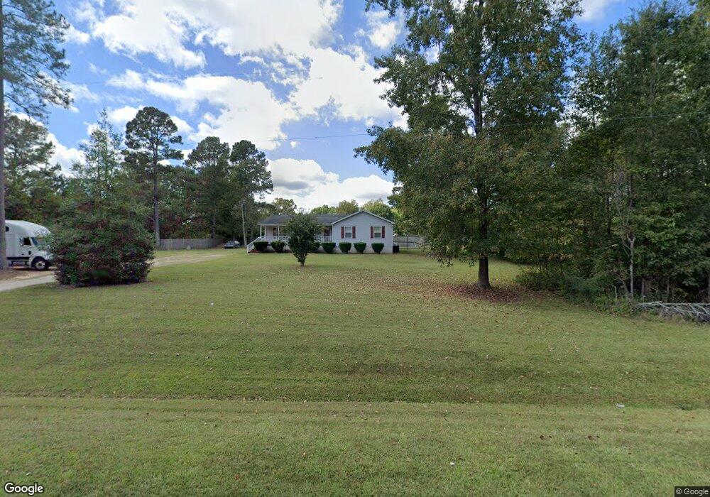
4137 Nc 39 Hwy N Louisburg, NC 27549
Estimated Value: $200,000 - $279,000
3
Beds
3
Baths
1,511
Sq Ft
$161/Sq Ft
Est. Value
About This Home
This home is located at 4137 Nc 39 Hwy N, Louisburg, NC 27549 and is currently estimated at $242,540, approximately $160 per square foot. 4137 Nc 39 Hwy N is a home located in Franklin County with nearby schools including Laurel Mill Elementary School, Terrell Lane Middle School, and Louisburg High School.
Ownership History
Date
Name
Owned For
Owner Type
Purchase Details
Closed on
Mar 7, 2023
Sold by
Jones William
Bought by
Jones William
Current Estimated Value
Home Financials for this Owner
Home Financials are based on the most recent Mortgage that was taken out on this home.
Original Mortgage
$123,000
Interest Rate
6.28%
Mortgage Type
New Conventional
Purchase Details
Closed on
Dec 31, 2008
Sold by
Thurston Randy L and Thurston Elizabeth D
Bought by
Jones William and Jones Shirley
Home Financials for this Owner
Home Financials are based on the most recent Mortgage that was taken out on this home.
Original Mortgage
$113,502
Interest Rate
5.96%
Mortgage Type
FHA
Purchase Details
Closed on
May 21, 2007
Sold by
Emc Mortgage Copr
Bought by
Thurston Randy L and Thurston Elizabeth
Home Financials for this Owner
Home Financials are based on the most recent Mortgage that was taken out on this home.
Original Mortgage
$60,300
Interest Rate
6.16%
Mortgage Type
New Conventional
Create a Home Valuation Report for This Property
The Home Valuation Report is an in-depth analysis detailing your home's value as well as a comparison with similar homes in the area
Home Values in the Area
Average Home Value in this Area
Purchase History
| Date | Buyer | Sale Price | Title Company |
|---|---|---|---|
| Jones William | -- | None Listed On Document | |
| Jones William | -- | None Listed On Document | |
| Jones William | $115,000 | None Available | |
| Thurston Randy L | $67,000 | None Available |
Source: Public Records
Mortgage History
| Date | Status | Borrower | Loan Amount |
|---|---|---|---|
| Previous Owner | Jones William | $123,000 | |
| Previous Owner | Jones William | $113,502 | |
| Previous Owner | Thurston Randy L | $60,300 |
Source: Public Records
Tax History Compared to Growth
Tax History
| Year | Tax Paid | Tax Assessment Tax Assessment Total Assessment is a certain percentage of the fair market value that is determined by local assessors to be the total taxable value of land and additions on the property. | Land | Improvement |
|---|---|---|---|---|
| 2025 | $1,265 | $198,480 | $42,000 | $156,480 |
| 2024 | $1,265 | $198,480 | $42,000 | $156,480 |
| 2023 | $952 | $95,950 | $13,750 | $82,200 |
| 2022 | $942 | $95,950 | $13,750 | $82,200 |
| 2021 | $952 | $95,950 | $13,750 | $82,200 |
| 2020 | $958 | $95,950 | $13,750 | $82,200 |
| 2019 | $937 | $95,950 | $13,750 | $82,200 |
| 2018 | $932 | $95,950 | $13,750 | $82,200 |
| 2017 | $1,025 | $98,400 | $12,500 | $85,900 |
| 2016 | $1,059 | $98,400 | $12,500 | $85,900 |
| 2015 | $1,059 | $98,400 | $12,500 | $85,900 |
| 2014 | $982 | $98,400 | $12,500 | $85,900 |
Source: Public Records
Map
Nearby Homes
- 35 Jonesville Ln
- 307 Wilson-Fuller Rd
- 4224 Us 401 Hwy N
- 641 Rocky Ford Rd
- 76 Sutton Rd
- 0 Sutton Rd
- 70 Acres Sutton Rd
- 1302 Rocky Ford Rd
- 0 Breedlove Rd Unit 10076336
- 642 Breedlove Rd
- 0 Beasley Rd Unit 10130664
- 1734 Rocky Ford Rd
- 20.37 Acre Opie Frazier Rd
- 00 Opie Frazier Rd
- 0 Krafft Corner Unit 10130210
- 0 Zinnia Ct Unit 10129898
- 06 Tillery Dr
- 11 Tillery Dr
- 08 Tillery Dr
- 09 Tillery Dr
- 4137 N Carolina 39
- 15 Hbar
- 4123 Nc 39 Hwy N
- 4123 Nc 39 Hwy N
- 4081 Nc 39 Hwy N
- 20 Jonesville Ln
- 4197 Nc 39 Hwy N
- 30 Jonesville Ln
- 40 Jonesville Ln
- 00 Jones Ln
- 0 Jonesville Ln Unit 1632203
- 0 Jonesville Ln Unit 1632196
- 0 Jonesville Ln Unit 10 1632203
- 0 Jonesville Ln Unit 1 1632196
- 15 Jones Ln
- 4025 Nc 39 Hwy N
- 4025 Nc 39 Hwy N
- None N Carolina 39 Hwy N
- 2104 N Carolina 39 Hwy N
- 0 N Carolina 39 Hwy N