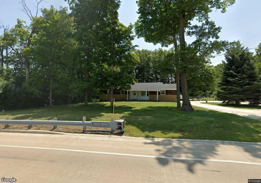
4137 State Road 60 Slinger, WI 53086
Estimated Value: $400,000 - $506,690
4
Beds
1
Bath
1,800
Sq Ft
$246/Sq Ft
Est. Value
About This Home
This home is located at 4137 State Road 60, Slinger, WI 53086 and is currently estimated at $443,173, approximately $246 per square foot. 4137 State Road 60 is a home located in Washington County with nearby schools including Slinger High School and St Peter Elementary School.
Ownership History
Date
Name
Owned For
Owner Type
Purchase Details
Closed on
Mar 14, 2011
Sold by
Federal National Mortgage Association
Bought by
Salkowski David J
Current Estimated Value
Home Financials for this Owner
Home Financials are based on the most recent Mortgage that was taken out on this home.
Original Mortgage
$104,000
Outstanding Balance
$70,625
Interest Rate
4.93%
Mortgage Type
New Conventional
Estimated Equity
$372,548
Purchase Details
Closed on
Mar 20, 2007
Sold by
Aker Jewel O
Bought by
Aker Jewel O
Create a Home Valuation Report for This Property
The Home Valuation Report is an in-depth analysis detailing your home's value as well as a comparison with similar homes in the area
Home Values in the Area
Average Home Value in this Area
Purchase History
| Date | Buyer | Sale Price | Title Company |
|---|---|---|---|
| Salkowski David J | -- | None Available | |
| Aker Jewel O | $225,000 | -- |
Source: Public Records
Mortgage History
| Date | Status | Borrower | Loan Amount |
|---|---|---|---|
| Open | Salkowski David J | $104,000 |
Source: Public Records
Tax History
| Year | Tax Paid | Tax Assessment Tax Assessment Total Assessment is a certain percentage of the fair market value that is determined by local assessors to be the total taxable value of land and additions on the property. | Land | Improvement |
|---|---|---|---|---|
| 2025 | $2,877 | $350,200 | $85,700 | $264,500 |
| 2024 | $2,834 | $350,200 | $85,700 | $264,500 |
| 2023 | $2,603 | $350,200 | $85,700 | $264,500 |
| 2022 | $2,602 | $251,600 | $68,500 | $183,100 |
| 2021 | $2,603 | $251,600 | $68,500 | $183,100 |
| 2020 | $2,599 | $251,600 | $68,500 | $183,100 |
| 2019 | $2,565 | $251,600 | $68,500 | $183,100 |
| 2018 | $2,515 | $229,900 | $65,200 | $164,700 |
| 2017 | $2,562 | $229,900 | $65,200 | $164,700 |
| 2016 | $2,557 | $229,900 | $65,200 | $164,700 |
| 2015 | $2,644 | $221,000 | $63,400 | $157,600 |
| 2014 | $2,644 | $241,400 | $83,200 | $158,200 |
| 2013 | $2,958 | $256,400 | $92,400 | $164,000 |
Source: Public Records
Map
Nearby Homes
- 1874 Woodland Way Unit 433-3
- 1844 Woodland Way Unit 431-1
- 1830 Woodland Way Unit 430-4
- 1820 Horseshoe Ln Unit 423-1
- 1822 Horseshoe Ln Unit 423-2
- 2456 Boulder Dr
- 2470 Boulder Dr
- 1793 Cedar Ridge Dr Unit 215-1
- 1795 Woodland Way
- 420 Cobblestone Ct
- 1709 Woodland Way
- 2491 Boulder Dr
- 2497 Boulder Dr
- 2484 Boulder Dr
- Lt62 Boulder Dr
- Lt84 Boulder Dr
- Lt60 Boulder Dr
- Lt86 Boulder Dr
- Lt58 Boulder Dr
- Lt92 Boulder Dr
- 1345 Hillside Rd
- 1365 Hillside Rd Unit Lt3
- 3670 Hillside Rd Unit A4
- 4069 State Road 60
- 4063 State Road 60
- 4094 Lexington Rd
- 710 Cedar Bluffs Way
- 635 Cedar Bluffs Way
- 4083 Lexington Rd
- 4080 Lexington Rd
- 625 Cedar Bluffs Way Unit 7921529-11834587
- 4225 Stoney Ln
- 4066 Springfield Ln
- 1850 Stoney Ln
- 1848 Stoney Ln
- 1844 Stoney Ln
- 1840 Stoney Ln
- 4084 Springfield Ln
- 4065 Springfield Ln
- 1830 Stoney Ln
Your Personal Tour Guide
Ask me questions while you tour the home.