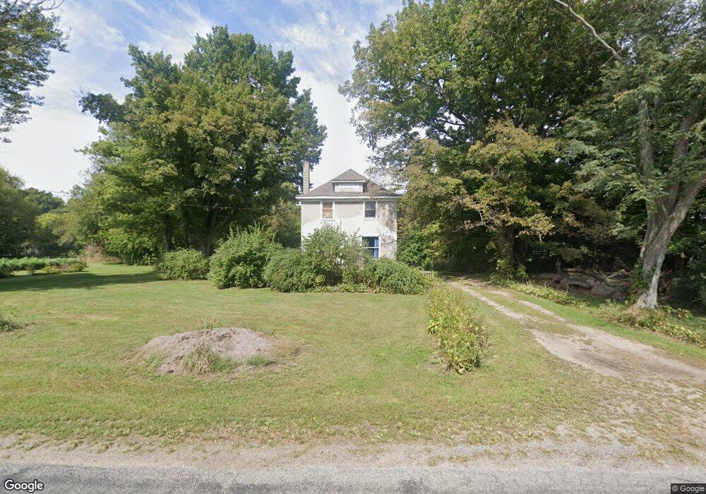
41382 Paw Paw Rd Paw Paw, MI 49079
Estimated Value: $118,000 - $293,000
--
Bed
--
Bath
1,232
Sq Ft
$169/Sq Ft
Est. Value
About This Home
This home is located at 41382 Paw Paw Rd, Paw Paw, MI 49079 and is currently estimated at $208,104, approximately $168 per square foot. 41382 Paw Paw Rd is a home located in Van Buren County with nearby schools including Paw Paw Early Elementary School, Paw Paw Later Elementary School, and Paw Paw Middle School.
Ownership History
Date
Name
Owned For
Owner Type
Purchase Details
Closed on
Sep 25, 2006
Sold by
Ketchersid Mary Hood and Ketchersid Burrell David
Bought by
Weaver Tom and Weaver Ii Tom Alan
Current Estimated Value
Purchase Details
Closed on
Sep 19, 2006
Sold by
Bailey Ann K and Bailey Mark
Bought by
Weaver Tom and Weaver Ii Tom Alan
Purchase Details
Closed on
Sep 18, 2006
Sold by
Hood James A and Hood Mary M
Bought by
Weaver Tom and Weaver Tommy Allen
Purchase Details
Closed on
Sep 13, 2006
Sold by
Hood Thomas C and Hood Virginia J
Bought by
Weaver Tom and Weaver Ii Tom Alan
Create a Home Valuation Report for This Property
The Home Valuation Report is an in-depth analysis detailing your home's value as well as a comparison with similar homes in the area
Home Values in the Area
Average Home Value in this Area
Purchase History
| Date | Buyer | Sale Price | Title Company |
|---|---|---|---|
| Weaver Tom | $7,500 | None Available | |
| Weaver Tom | $7,500 | None Available | |
| Weaver Tom | $7,500 | None Available | |
| Weaver Tom | $7,500 | None Available |
Source: Public Records
Tax History Compared to Growth
Tax History
| Year | Tax Paid | Tax Assessment Tax Assessment Total Assessment is a certain percentage of the fair market value that is determined by local assessors to be the total taxable value of land and additions on the property. | Land | Improvement |
|---|---|---|---|---|
| 2025 | $1,119 | $62,500 | $0 | $0 |
| 2024 | $338 | $55,700 | $0 | $0 |
| 2023 | $322 | $48,900 | $0 | $0 |
| 2022 | $1,026 | $43,000 | $0 | $0 |
| 2021 | $995 | $44,000 | $12,000 | $32,000 |
| 2020 | $934 | $43,700 | $12,000 | $31,700 |
| 2019 | $877 | $40,500 | $40,500 | $0 |
| 2018 | $856 | $36,100 | $36,100 | $0 |
| 2017 | $832 | $28,700 | $0 | $0 |
| 2016 | $827 | $38,200 | $0 | $0 |
| 2015 | $761 | $38,200 | $0 | $0 |
| 2014 | $747 | $34,157 | $0 | $0 |
| 2013 | -- | $35,300 | $35,300 | $0 |
Source: Public Records
Map
Nearby Homes
- 59388 41st St
- 0 70th Ave
- 58356 Cr 671
- 40421 W Red Arrow Hwy
- 45717 64th Ave
- 38126 72nd Ave
- 38126 72nd Ave Unit b
- 57653 W Red Arrow Hwy
- 73541 39th St
- 1 Kasper Dr
- 44702 B 56th Ave
- 38347 County Road 374
- 58797 Territorial Rd
- 0 Ampey Rd Unit 3
- 0 Ampey Rd Unit 1
- 0 Ampey Rd Unit 2
- V/L Glenview Dr
- 109 N Harris St
- 1 Cr 665
- Parcel A Territorial Rd
- 65098 41st St
- 65204 41st St
- 65000 41st St
- 41482 Paw Paw Rd
- 41482 Paw Paw Rd
- 64924 41st St
- 41550 E Bayshore Dr
- 64858 41st St
- 64858 41st St
- 41540 E Bayshore Dr
- 64878 41st St
- 41560 E Bayshore Dr
- 41267 Paw Paw Rd
- 41267 Paw Paw Rd
- 41497 Paw Paw Rd
- 41602 E Bayshore Dr
- 41630 E Bayshore Dr
- 41662 E Bayshore Dr
- 41463 E Bayshore Dr
- 32 E Bayshore Dr