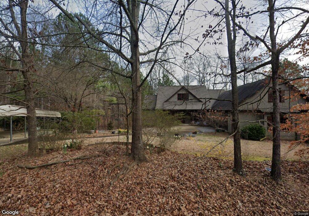
414 Adams Rd Canton, GA 30115
Union Hill NeighborhoodEstimated Value: $634,000 - $788,000
4
Beds
5
Baths
2,871
Sq Ft
$251/Sq Ft
Est. Value
About This Home
This home is located at 414 Adams Rd, Canton, GA 30115 and is currently estimated at $721,902, approximately $251 per square foot. 414 Adams Rd is a home located in Cherokee County with nearby schools including Avery Elementary School, Creekland Middle School, and Creekview High School.
Ownership History
Date
Name
Owned For
Owner Type
Purchase Details
Closed on
May 18, 1999
Sold by
Koch Jay J and Koch Marilyn E
Bought by
Vines Timothy W and Vines Tricia L
Current Estimated Value
Home Financials for this Owner
Home Financials are based on the most recent Mortgage that was taken out on this home.
Original Mortgage
$183,000
Outstanding Balance
$45,568
Interest Rate
6.84%
Mortgage Type
New Conventional
Estimated Equity
$676,334
Create a Home Valuation Report for This Property
The Home Valuation Report is an in-depth analysis detailing your home's value as well as a comparison with similar homes in the area
Home Values in the Area
Average Home Value in this Area
Purchase History
| Date | Buyer | Sale Price | Title Company |
|---|---|---|---|
| Vines Timothy W | $193,000 | -- |
Source: Public Records
Mortgage History
| Date | Status | Borrower | Loan Amount |
|---|---|---|---|
| Open | Vines Timothy W | $183,000 |
Source: Public Records
Tax History
| Year | Tax Paid | Tax Assessment Tax Assessment Total Assessment is a certain percentage of the fair market value that is determined by local assessors to be the total taxable value of land and additions on the property. | Land | Improvement |
|---|---|---|---|---|
| 2025 | $6,002 | $259,852 | $58,640 | $201,212 |
| 2024 | $5,574 | $238,652 | $47,320 | $191,332 |
| 2023 | $4,632 | $214,572 | $38,160 | $176,412 |
| 2022 | $4,434 | $182,012 | $36,640 | $145,372 |
| 2021 | $4,077 | $150,852 | $30,520 | $120,332 |
| 2020 | $3,748 | $136,492 | $30,520 | $105,972 |
| 2019 | $3,677 | $133,440 | $30,520 | $102,920 |
| 2018 | $2,308 | $83,000 | $30,520 | $52,480 |
| 2017 | $2,353 | $209,800 | $30,520 | $53,400 |
| 2016 | $2,157 | $191,000 | $25,880 | $50,520 |
| 2015 | $2,176 | $190,800 | $24,960 | $51,360 |
| 2014 | $2,024 | $177,500 | $20,360 | $50,640 |
Source: Public Records
Map
Nearby Homes
- 1205 Sterlington Dr
- 1209 Sterlington Dr
- 1216 Sterlington Dr
- 1217 Sterlington Dr
- 580 Evans Cook Rd
- 1281 Sterlington Dr
- 1107 Forest Creek Dr
- 105 Widgeon Ct
- 278 Evans Cook Rd
- 304 Meadowcrest Cir
- 220 Forest Creek Ln
- 119 Wood Grove Ln
- 115 Wood Grove Ln
- 4972 Cumming Hwy
- 2001 Epperson Rd
- Everett Plan at Woodberry - Masterpiece Collection
- Leland Plan at Woodberry - Masterpiece Collection
- Pearson Plan at Woodberry - Masterpiece Collection
- Paxton Plan at Woodberry - Masterpiece Collection
- Winslow Plan at Woodberry - Masterpiece Collection
- 938 Evans Cook Rd
- 535 Adams Rd
- 390 Adams Rd
- 844 Evans Cook Rd
- 153 Bessie Lusk Dr
- 1112 Evans Cook Rd
- 491 Adams Rd
- 377 Adams Rd
- 221 Evans Cook Ct
- 1013 Evans Cook Rd
- 465 Adams Rd
- 163 Bessie Lusk Dr
- 0 Adams Rd Unit 6095609
- 0 Adams Rd Unit 8479159
- 1119 Evans Cook Rd
- 209 Evans Cook Ct
- 214 Evans Cook Ct
- 184 Bessie Lusk Dr
- 200 Evans Cook Ct
- 1157 Evans Cook Rd